Circular route in the Mercantour starting from Castérino

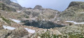
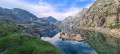
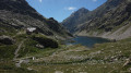
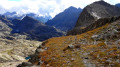
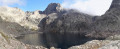
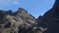
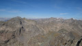
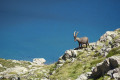
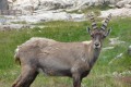
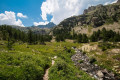
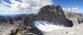
This challenging route will take you from the Roya Valley in the east to the Gordolasque Valley in the west. Over the course of these five days, you’ll have the chance to pass close to the highest peak in the Alpes-Maritimes, the Gélas. You’ll climb a legendary summit, Mont Bégo. You’ll make your way from valley to valley, crossing a series of mountain passes: the Pas de Pagari, the Pas du Mont Colomb, the Pas du Trem and the Baisse de Valmasque. Every day, chamois, ibex and marmots will keep you company.

Details

1620182
Creation:
Last update:
Last review:
  • Walking
    Activity: Walking
  • ↔
    Distance: 34.52 mi
  • ◔
    Average duration: 5 days 
  • ▲
    Difficulty: Difficult

  • ⚐
    Back to start: Yes
  • ↗
    Ascent: + 16,145 ft
  • ↘
    Descent: - 16,165 ft

  • ▲
    Highest point: 9,646 ft
  • ▼
    Lowest point: 5,135 ft

Photos

Stages of the route

This route needs several days, find the details below:

  1. S
  2. 2
  3. 3
  4. 4
  5. E

Notes

This route passes through a protected area, which may be subject to special regulations:

Worth a visit

- The Pagari mountain hut for a break: a warm welcome. The warden, Aladar, will offer you his craft beer called Pagarina, brewed in a small brewery next to the reception area. It’s the highest microbrewery in Europe!
- The Pas de Pagari.
- Mont Clapier.
- The Cime de la Malédie.
- The Cime du Gelas.
- The Balcon du Gélas.
- Mont Saint Robert.
- Lac Blanc, which is the source of the Vésubie.
- Fenestre Lake and Pass.
- Pas des Ladres.
- Pas du Trem.
- Cime du Diable.
- Devil’s Lake.
- Lake de la Muta.
- Trem Lake.
- Fourca Lake.
- Mount Bégo.
- Valmasque Pass.
- Baisse du Basto.
- Fontanalbe Pass.
- Mount Sainte-Marie.

Always be cautious and plan ahead when you're outdoors. Visorando and the author of this route cannot be held responsible for any accidents occurring on this route.

Reviews and comments

4.7 / 5
Based on 2 reviews

Reliability of the description
5 / 5
Ease of following the route
4 / 5
Route interest
5 / 5
boubbou.com
boubbou.com
• Edited:

Overall rating : 4.7 / 5

Date of your route : Jul 05, 2026
Reliability of the description : ★★★★★ Very good
Ease of following the route : ★★★★☆ Good
Route interest : ★★★★★ Very good
Very busy route : Yes

My wife and I set off on Sunday 5 July to tackle this magnificent 55-kilometre circular route. On the first day, we’d advise you to drive up or hitch a lift to start from the car park a good 2 kilometres higher up, as the first day is very tough! With almost 1,500 metres of elevation gain and 15 km of steady but fairly easy climbing up to the Pas de l’Agnel, that’s where things get tricky, as the descent on the Italian side towards the Lac Blanc de l’Agnel is difficult, with large boulders to navigate and not many signposts or cairns. From there, there’s a long climb up to the Pas de Pagari, we tackled this climb in the middle of the afternoon in sweltering heat; the descent to the Refuge de Nice is tricky too. It took us 9 hours instead of the 7 hours estimated by Visorando, and we’re no novices. On the second day, we took an alternative route on the advice of the warden at the Refuge de Nice after telling him about our first day. This second day takes you past the Cime Gélas, Cime St Robert and Cime de Fenestre. Between points 2 and 7, there is no marked trail and, according to the warden, it is signposted only by cairns. We followed his advice to head to the Madone de Fenestre refuge via the GR 52 and the Pas du Mont Colomb, to avoid retracing this route the following day to reach the Relais des Merveilles, we took the walk via the Vallon du Ponset and the Baisse des 5 Lacs; it was magnificent and saved us the 4 km road stretch from the Pont du Countet to the Relais des Merveilles, On the fourth day, we followed the Visorando route, hiking up to the Cime du Diable and back – the view is well worth it. Be warned: from the Pas du Trem onwards, plastic tips on walking poles are compulsory, although this isn’t signposted. On the fifth day, we tackled the ascent of Mont Bégo!! A fairly easy, steady climb, with a technical section at the summit – be careful on the descent!!! We found it particularly dangerous and completely unsecured; if you’re prone to vertigo, don’t attempt it. It’s a long descent of over 9 km back to the car. It’s important to have left the car at the upper car park, as this avoids having to walk the last 2 km along the road, which must be gruelling at the end of the trek. We were lucky enough to see the ibex and chamois in the Mercantour up close – very close indeed. This circular route is magnificent – thanks to the author.
Remember to download the GPX tracks before you set off, as there isn’t much mobile coverage.

Machine-translated

kikicobra65
kikicobra65

Overall rating : 4.7 / 5

Date of your route : Sep 04, 2025
Reliability of the description : ★★★★★ Very good
Ease of following the route : ★★★★☆ Good
Route interest : ★★★★★ Very good
Very busy route : No

Hello
Based on your analysis of the route, it is difficult to give a general opinion as each stage is so different.
However, I will try to give my impressions of the route I did with my nephew (aged 26, and me aged 60).
I saw that some people were asking whether a certain level of fitness was required to complete this magnificent loop in the Mercantour.
We completed this hike in four days instead of five. We left on 31 August 2025 and returned yesterday (3 September)
As for the difficulty, I'm quite athletic myself. I completed the GR 20 in early July, and I must say that for those who want to do it, this loop is good preparation because the landscape and trails on the first two stages are very similar, with lots of rocks, scree, etc.
On the first stage (Castérino, Nice refuge), there is a short technical uphill section, but if you take care, it's manageable.
Be careful, however, as the weather conditions can quickly turn the hike into a nightmare.
But all this is indicated in the Visorando 5 information sheet (thanks again for all the information).
On the second stage, which connects the Nice refuge to the Madone des Fenêtres refuge, there are sections where you do need a bit of experience to climb up to the Balcon du Gelas, especially as we had bad weather and did it in the rain. The descent is also very technical.
What's more, during the descent we got lost because there was a red cross and an arrow of the same colour that led us off the path and onto a very dangerous descent. We should have turned back, but we wanted to continue. This was a serious mistake, as the descent became very dangerous, especially as it was raining and therefore very slippery. We found ourselves completely off-trail and wasted time finding the trail again once we reached the bottom.
In short, be sure to look out for the cairns that mark the descent to avoid this kind of mishap, which could have cost us dearly.
stage 3 from the Madone des Fenêtres refuge to the Merveilles refuge (we doubled the stage because we ran out of food and cash, as credit cards are not accepted at the refuges, as mentioned in the Visorando description)
No notable difficulties, even though we climbed a total of 1,600 metres and descended 1,200 metres. Very beautiful hike with magnificent views. The weather was not ideal due to rain.
the fourth stage from the Refuge des Merveilles to Castérino was easy.

A few bits of information: for those travelling independently, it is possible to camp at all stages, but sometimes you have to wait until 7 p.m. to pitch your tent. At other stages, this is not necessary.
If you want to have dinner at a refuge, it is possible but you must book in advance; depending on the time of year, it can be very busy (no credit cards accepted. Around €22 for dinner, €10 for picnics and breakfast).
As for equipment, at this time of year, you don't need crampons, ice axes, etc. Remember to bring technical clothing (it was very cold for us), as the tent was frozen in the morning at the Refuge des Merveilles.

That's it, I don't think I've forgotten anything.
Thanks again to VISORANDO (I downloaded the tracks because there was no network coverage in some places), which was very useful.
A very beautiful loop to be enjoyed without moderation.

Machine-translated

Murielalsace
Murielalsace

Hello,
I’m organising a trek with some friends and we’d like to do the circular route you suggested in the Mercantour.
However, I see several days marked as ‘Very difficult’. As the walking times per day are rather limited, I imagine there must be some very difficult sections – but are they technical? Do we need specific knowledge or equipment? Or is it simply the ‘elevation gain’ we’ll have to tackle?

We’ve all done week-long treks before; we’re relatively young (around 40) and all quite fit (running, cycling, etc.), but we’re not mountain experts, let alone mountaineers.

If you could give me your opinion on whether this route is suitable for our level, that would be really kind and brilliant.
Even though I realise you won’t be able to make any firm commitments, as you don’t know us, it would still be reassuring to have an opinion...
Thanks in advance,
Muriel

Machine-translated

Other walks in the area

For more walks, use our search engine .

The GPS track and description are the property of this route's author. Please do not copy them without permission.