


- No water sources along the route.
⚠ This magnificent route includes at least one section graded T3 every day.
A quick reminder about route grades: see this page.
⚠ Route reserved for experienced walkers.
Recommended time of year: August, September


This route, deliberately named “Around Mont Clapier”, will take you to discover this magnificent peak, rising to 3,045 m. Situated in the north of the Alpes-Maritimes, on the French-Italian border, it offers a magnificent panorama of the main peaks of the Mercantour and Argentera ranges. Over the course of these three days, you’ll be able to admire it from various angles. You’ll also have the opportunity to climb it.
Before setting off, please see the ‘Practical information’ section .


 Country:
France
Country:
France

 City:
Tende (06430)
City:
Tende (06430) 


This route needs several days, find the details below:
⚠ This magnificent route includes at least one section graded T3 every day.
A quick reminder about route grades: see this page.
⚠ Route reserved for experienced walkers.
Recommended time of year: August, September
Hello Ran54,
I think a pointless debate has just started. I’d like to point out, as I did to Gérard, that we’re talking about hiking here, not mountaineering. On the page I’m referring to, you should only take into account the section entitled ‘Hike Grading’.
I agree that the website draws on information from the CAS, and that mountaineering grades undoubtedly vary from country to country.
To bring this discussion to a close, here is a link to a CAF source on hiking difficulty ratings in France that I’ve just found
http://cafcannes.ffcam.fr/cotations-rando.html
What does this page say about the T3 grade? It is exactly the same, word for word and comma for comma, as the page I had been referring to until now. Unfortunately, I wasn’t aware of this page when I first started writing about hikes, so I couldn’t have drawn attention to the T3 grade.
One might now criticise me for the fact that this page is from the CAF Côte d’Azur – what about the other CAF branches?
Furthermore, for a section in Italy, such as the Refuge de Pagari to Castérino stage, should we refer to the CAF page or the CAI page?
In conclusion, from now on I’ll include a link to the CAF page.
I’ll make the necessary corrections on the relevant pages for this trek.
For my part, I think that if Visorando were to create a page on this subject, all the walks covered by these descriptions would be standardised.
As far as I’m concerned, the debate is closed.
Kind regards,
Dominique
Machine-translated


Hello,
Let’s acknowledge that VR’s automatic recommendations are imperfect:
The author must therefore maintain a critical perspective on any automatic recommendation and take into account distance, elevation gain and terrain conditions simultaneously. And, as you do, Dominique, it is necessary to provide a qualitative description of the difficulties the walker may encounter
.
Machine-translated
Hello, Gérard.
It’s quite difficult to express the classification of walks on Visorando.
A hike covering 20 km with no elevation gain is classified as ‘difficult’.
The third stage of this trek, ‘Refuge de Pagari – Castérino’, is rated as ‘medium difficulty’ according to Visorando’s criteria.
I can assure you that this has nothing to do with that assessment.
The page I’ve linked to is from a French hiking website, ‘www.rando-marche.fr/’.
I’m referring to the difficulty ratings for walking routes
T3 applies only to this paragraph; you just need to read the following text:
T3: Demanding mountain hike
The path is not necessarily visible throughout. Exposed sections may be equipped with ropes or chains. You may need to use your hands for balance. A few exposed sections with a risk of falling, scree slopes and rocky slopes with no clear path.
Requirements: Very sure-footed. Good trekking boots. Average navigational skills. Basic mountaineering experience desirable.
The other ratings do not specifically apply to walking routes.
It is true that the source is Swiss, but it is internationally recognised, including in France.
The text I have copied above corresponds perfectly to the requirements of the stages on this trek.
It seems to me that it is necessary to inform potential hikers about the nature of the hike’s difficulties before they commit to it. The Visorando classification, on the other hand, may be misleading.
Kind regards,
Dominique
Machine-translated
Circular of Valmasque and Fontanalbe  13.60 mi
+3,586 ft
-3,586 ft
9h 25
13.60 mi
+3,586 ft
-3,586 ft
9h 25
 Difficult
 Departure from Tende (Alpes-Maritimes)
Cime Viglino from Castérino
Departure from Tende (Alpes-Maritimes)
Cime Viglino from Castérino  10.73 mi
+4,049 ft
-4,068 ft
7 hrs
Very difficult
Departure from Tende (Alpes-Maritimes)
Le Grand Capelet
10.73 mi
+4,049 ft
-4,068 ft
7 hrs
Very difficult
Departure from Tende (Alpes-Maritimes)
Le Grand Capelet  14.01 mi
+4,370 ft
-4,390 ft
8 hrs
Very difficult
Departure from Tende (Alpes-Maritimes)
Lac Vert de Fontanalba and Voie Sacrée
14.01 mi
+4,370 ft
-4,390 ft
8 hrs
Very difficult
Departure from Tende (Alpes-Maritimes)
Lac Vert de Fontanalba and Voie Sacrée 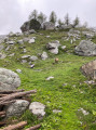 8.58 mi
+2,290 ft
-2,313 ft
5h 55
8.58 mi
+2,290 ft
-2,313 ft
5h 55
 Moderate
Departure from Tende (Alpes-Maritimes)
From Castérino to the Refuge des Merveilles
Moderate
Departure from Tende (Alpes-Maritimes)
From Castérino to the Refuge des Merveilles 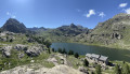 8.31 mi
+3,058 ft
-1,736 ft
6h 30
Difficult
Departure from Tende (Alpes-Maritimes)
From Valmasque to Lac des Mesches via Mont Bégo
8.31 mi
+3,058 ft
-1,736 ft
6h 30
Difficult
Departure from Tende (Alpes-Maritimes)
From Valmasque to Lac des Mesches via Mont Bégo  13.66 mi
+4,006 ft
-5,118 ft
10 hrs
Very difficult
Departure from Tende (Alpes-Maritimes)
Lac de l'Agnel
13.66 mi
+4,006 ft
-5,118 ft
10 hrs
Very difficult
Departure from Tende (Alpes-Maritimes)
Lac de l'Agnel 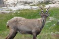 6.75 mi
+2,408 ft
-2,392 ft
5h 10
Moderate
Departure from Tende (Alpes-Maritimes)
Circular route in the Mercantour starting from Castérino
6.75 mi
+2,408 ft
-2,392 ft
5h 10
Moderate
Departure from Tende (Alpes-Maritimes)
Circular route in the Mercantour starting from Castérino 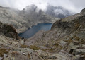 34.52 mi
+16,145 ft
-16,165 ft
5 days
Difficult
Departure from Tende (Alpes-Maritimes)
34.52 mi
+16,145 ft
-16,165 ft
5 days
Difficult
Departure from Tende (Alpes-Maritimes)
For more walks, use our search engine .
The GPS track and description are the property of this route's author. Please do not copy them without permission.
Scan this QR code with your smartphone's camera.
To open this route on your smartphone, you must have the Visorando app installed. If not, got to the Apple Store (iPhone) or Google Play Store (Android) to download the app.
 Visorando Member
