Castérino – Nice Mountain Hut

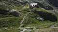
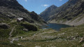
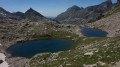
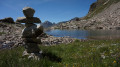
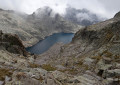
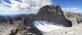
This first stage takes you from the bottom of the Roya Valley to the Nice Refuge. The proposed route is longer and more difficult than the one via the Baisse du Basto, but much less busy. On this demanding detour, you’ll enjoy the passage over the Pas de l’Agnel, the stretch into Italy as far as the Pas de Pagari, stopping off at the Rifugio Pagari, nestled against the summit of the Malédie. During the descent to the Refuge de Nice, you’ll enjoy the tranquillity of the Lacs Clapier.

This walk is part of a multi-day hike: Circular route in the Mercantour starting from Castérino

Details

1621786
Creation:
Last update:
Last review:
  • Walking
    Activity: Walking
  • ↔
    Distance: 8.98 mi
  • ◔
    Duration according to the author: 7 hrs 
  • ▲
    Difficulty: Very difficult

  • ⚐
    Back to start: No
  • ↗
    Ascent: + 4,928 ft
  • ↘
    Descent: - 3,258 ft

  • ▲
    Highest point: 9,173 ft
  • ▼
    Lowest point: 5,607 ft
  • ⚐ Country: France
  • ⚐
    Areas: Alps, Mercantour
  • ⚐ City: Tende (06430)
  • ⚑
    Start: N 44.11417° / E 7.494839°
  • ⚑
    End: N 44.104494° / E 7.400522°
  • ❏
    IGN map(s): Ref. 3741OT, 3841OT
  • Hour-by-hour weather

Photos

Description of the walk

From Saint-Dalmas de Tende (06), take the D91 road towards Castérino. From Castérino, head to the upper car park.

(S/E) Go through the “Entrée parc du Mercantour” barrier near marker 394, then follow the track on the left which runs alongside the Valmasque stream to marker 393.

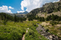
(1) At the sign indicating “Lac de l’Agnel 2h”, turn right and cross the torrent via a small bridge. The path continues through a small meadow, then winds its way up to the Pointe de Valmasque.

(2) Follow the path, which becomes rockier, to Lac de l’Agnel.

(3) Above the dam, heading west, continue along the path towards the Pas de l’Agnel.

(4) A tricky section (very short).

(5) Tricky section (a few dozen metres). Then follow the path to reach the Pas de l’Agnel, which marks the French-Italian border.

(6) Start by following a narrow track, then quickly move onto large scree, keeping a close eye on the red markings. The route is very well signposted. (Grade T3)

(7) Continue over a fairly steep scree slope to the end of Lac Blanc.

(8) From Lac Blanc, head west along a good path until you reach the junction with a track coming from the eastern pass of Mont Clapier.

(9) Leave the track to your left and continue straight on until you reach the junction with the Pagari path coming from San Giacomo.
Turn left onto the series of hairpin bends leading to the Pagari refuge. Head to the refuge for a well-deserved break.

(10) From the refuge, return to the path junction and take the steep climb to the right towards the Pas de Pagari. (Grade T3)

(11) At the Pas de Pagari, the path is clear. Begin the descent to the two small lakes of Mont Clapier.

(12) The path passes between the two lakes. Continue towards the Refuge de Nice until you reach the junction with theGR®52.
Carry on to the steps to reach the Refuge de Nice (E).

Waypoints

  1. S : mi 0 - alt. 5,623 ft - Upper Castérino car park (marker 395)
  2. 1 : mi 1.1 - alt. 5,997 ft - Sign for Lac de l’Agnel
  3. 2 : mi 2.17 - alt. 7,146 ft - Valmasque Point
  4. 3 : mi 3.51 - alt. 7,986 ft - Lac de l'Agnel
  5. 4 : mi 3.83 - alt. 8,084 ft - Tricky section (use of hands recommended) - Lac de l'Agnel
  6. 5 : mi 3.95 - alt. 8,038 ft - Tricky section (use of hands recommended)
  7. 6 : mi 4.43 - alt. 8,406 ft - Pas de l’Agnel (French-Italian border)
  8. 7 : mi 4.89 - alt. 7,851 ft - Scree slope
  9. 8 : mi 5.21 - alt. 7,513 ft - Lago Bianco – Lac Blanc
  10. 9 : mi 5.56 - alt. 7,579 ft - Junction with the eastern path up Mont Clapier
  11. 10 : mi 6.79 - alt. 8,556 ft - Refuge de Pagari - Refuge CAI FEDERICI MARCHESINI AL PAGARI (2650 m)
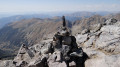
  12. 11 : mi 7.39 - alt. 9,173 ft - Pagari Pass
  13. 12 : mi 8.01 - alt. 8,330 ft - Lacs du Mont Clapier
  14. E : mi 8.97 - alt. 7,290 ft - Refuge de Nice

Notes

  • This route includes two sections graded T3.
  • Tricky sections (4) and (5).
  • A quick reminder about route grades: see this page.

This route passes through a protected area, which may be subject to special regulations:

Worth a visit

  • The Pagari mountain hut is a great place to stop for a break: you’ll receive a warm welcome. The warden, ‘Aladar’, will offer you his craft beer, ‘Pagarina’, brewed in a small brewery next to the reception area. It’s the highest microbrewery in Europe.
  • The Pas de Pagari.
  • Mont Clapier.
  • The Cime de la Malédie.
  • The Cime du Gelas.
  • The Cime de Pagari.

Always be cautious and plan ahead when you're outdoors. Visorando and the author of this route cannot be held responsible for any accidents occurring on this route.

The GR® and PR® markings are the intellectual property of the Fédération Française de Randonnée Pédestre.

Other walks in the area

For more walks, use our search engine .

The GPS track and description are the property of this route's author. Please do not copy them without permission.