Refine your search for walks in Botsorhel
Botsorhel walks
 Around Guerlesquin
 Visorando Member
 10.74 mi
 +781 ft
 -774 ft
 5h 35
5h 35
 Moderate
 Departure from Guerlesquin (Finistère)
Guerlesquin, a small town full of character, was known in the 11th century for its fairs. From the 17th century, beautiful buildings remain in the town centre: the Présidial, the Market Halls and the Church. The town is close to the Étang du Guic, where two fine sandy beaches await walkers.After walking around the lake, we explore the nearby forest, moving in turn from Finistère into Côtes-d’Armor before returning to Finistère. Indeed, it is the river ‘Le Guic’ that forms the departmental boundary.
From Plougonven to the two menhirs via the Bois de Gaspern
9.48 mi
+732 ft
-735 ft
5h 00
Moderate
Departure from Plougonven (Finistère)
A gateway into Finistère via the Monts d’Arrée: the small medieval town of Plougonven, with its parish enclosure, lies close to the Gaspern forest. At the southern end of this route, two menhirs stand alone in a field.
Walk around the Moulin Neuf Pond (Vilin Nevez)
 1.88 mi
+10 ft
-7 ft
0h 50
1.88 mi
+10 ft
-7 ft
0h 50
 Easy
Departure from Plounérin (Côtes-d'Armor)
Easy
Departure from Plounérin (Côtes-d'Armor)
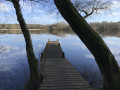
A short walk along the Étang du Moulin Neuf, with opportunities to spot birds and, if you’re lucky, otters.
Walk in Plouégat-Guérand
0.72 mi
+13 ft
-13 ft
0h 20
Easy
Departure from Plouégat-Guérand (Finistère)
A walk to discover the beautiful Saint-Agapit Church in Plouégat-Guérand, with its rich collection of polychrome sculptures, as well as a pretty fountain. The main street, Place du Bourg, is lined with traditional village houses.
Kerhalon Route
3.29 mi
+289 ft
-269 ft
1h 45
Easy
Departure from Plouégat-Guérand (Finistère)
A short route through the countryside around Plouégat-Guérand that takes you close to the Douron before returning to the village, where you can admire its beautiful, fully renovated church.
Porz Meur Tumulus Route
3.31 mi
+213 ft
-194 ft
1h 40
Easy
Departure from Plouégat-Guérand (Finistère)
This is a short, easy route that takes you through the village and allows you to discover the fully restored Saint-Agapit Church, the Porz Meur Tumulus, which probably dates back to the Bronze Age, and the surrounding countryside.
Garlan circular route
3.18 mi
+259 ft
-279 ft
1h 40
Easy
Departure from Garlan (Finistère)
This walk was created for guests at the Ferme de Croaz Men (Croaz Men on maps). However, part of the route described here, which bypasses the farm, is accessible to everyone starting from Garlan. It is a short circular route that takes you past a wash house, a few pretty houses with their hydrangeas, and crosses the River Dourduff. Guests at Croas Men, see this link.
Walk in the Beffrou Forest
6.52 mi
+692 ft
-702 ft
3h 35
Moderate
Departure from Loguivy-Plougras (Côtes-d'Armor)
The Beffrou Departmental Forest is a beautiful 611-hectare area! During this hike, which includes a few challenging climbs, you will only see tarmac when crossing roads. A pond, a covered walkway, a high point offering a view of the Monts d'Arrée and a chance to discover the local flora and fauna: here, everything grows in peace and tranquillity.
Route to discover Morlaix
7.13 mi
+699 ft
-682 ft
3h 55
Moderate
Departure from Plougonven (Finistère)
A walk to discover Morlaix. Along this route, you’ll find a few churches and chapels, including the beautiful Saint-Mélaine Church, some stunning murals, the viaduct, a lovely wash house and a few fountains, numerous medieval half-timbered houses, picturesque narrow streets, alleyways and stairways (which involve quite a bit of climbing), the former tobacco factory, the former monastic quarters on the town’s hillside, but also plenty of car parks and traffic – even right in the town centre – and the regrettable absence of the River Morlaix, which has been covered over by a car park upstream of the harbour.
The Beurc’hoat route in Scrignac
 Local authority
 4.63 mi
+387 ft
-390 ft
2h 30
Easy
Departure from Scrignac (Finistère)
4.63 mi
+387 ft
-390 ft
2h 30
Easy
Departure from Scrignac (Finistère)
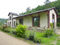
On this walk, you’ll follow a short section of the Voie Verte No. 7 (La Vélodyssée ) before heading into the northern part of the Huelgoat Forest and passing through several hamlets in the Monts d’Arrée.
Trinivel to Scrignac route
 5.61 mi
+367 ft
-351 ft
2h 55
Easy
Departure from Scrignac (Finistère)
5.61 mi
+367 ft
-351 ft
2h 55
Easy
Departure from Scrignac (Finistère)
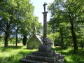
This route allows you to explore the Lestrézec Wood, the Saint-Corentin Chapel and to cycle along Greenway No. 7, ‘La Vélodyssée’, a former railway line that runs alongside the River Squiriou.
The lower Douron valley
8.71 mi
+361 ft
-348 ft
4h 20
Moderate
Departure from Plouégat-Guérand (Finistère)
Starting from the village of Pont Menou, follow the River Douron to its estuary between the headlands of Locquirec and l’Armorique. After enjoying a few views of the open sea, you’ll return via the higher ground of the valley. The route passes through numerous hamlets, some with beautiful houses, chapels and fountains, as well as ancient Roman baths. You’ll also enjoy stunning views of the Tour d’Argent and Île Blanche manor houses.
Pont Menou Route
 3.23 mi
+197 ft
-226 ft
1h 40
Easy
Departure from Plouégat-Guérand (Finistère)
3.23 mi
+197 ft
-226 ft
1h 40
Easy
Departure from Plouégat-Guérand (Finistère)
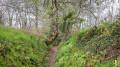
An easy short route starting from the foot of the Douron at Pont Menou, taking you through the Plouégat countryside via Kelumec and Kerforn, just a few metres from the Cozmezou cider house.
The circular routes of the Chapelles route south of Plestin-les-Grèves
7.68 mi
+384 ft
-413 ft
3h 50
Moderate
Departure from Plestin-les-Grèves (Côtes-d'Armor)
This is an easy walk, except for the distance, which combines sunken paths and wide forest lanes, as well as chapels and castles, not to mention streams and brooks, with the English Channel as a backdrop.
The Corniche de l'Armorique starting from Plestin-les-Grèves
 6.80 mi
+407 ft
-410 ft
3h 30
Moderate
Departure from Plestin-les-Grèves (Côtes-d'Armor)
6.80 mi
+407 ft
-410 ft
3h 30
Moderate
Departure from Plestin-les-Grèves (Côtes-d'Armor)
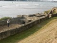
Setting off from Plestin-les-Grèves, you very quickly catch sight of Grève Saint-Michel, where, at low tide, the English Channel recedes into the horizon, creating a vast expanse for all kinds of wind sports: sand yachting, windsurfing, kite flying, etc...
Then, following theGR®34, you walk along the Corniche de l’Armorique, discovering Lannion Bay and the mouth of the Douron. Opposite lies Locquirec and Finistère.
History is also present in the form of the Gallo-Roman thermal baths.
Rosanbo Castle
7.46 mi
+449 ft
-423 ft
3h 50
Moderate
Departure from Tréduder (Côtes-d'Armor)
Winding through the Trégor countryside, this route will take you past the most imposing castle in Brittany. Built between the 14th and 18th centuries, it has belonged to the same family for several generations. It is furnished with period pieces and open to the public.
Tréduder and its streams
 6.15 mi
+673 ft
-643 ft
3h 25
Moderate
Departure from Tréduder (Côtes-d'Armor)
6.15 mi
+673 ft
-643 ft
3h 25
Moderate
Departure from Tréduder (Côtes-d'Armor)
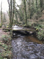
The commune of Tréduder is bounded by three streams: to the west, the Roscoat; to the south, the Dour Plat, which flows into the Yar, marking the commune’s eastern boundary. This walk takes you along these streams, but numerous small streams feed into them, making certain sections very wet in spring.
From Plouaret to Lannion along the Léguer
 16.39 mi
+994 ft
-1,375 ft
8h 25
16.39 mi
+994 ft
-1,375 ft
8h 25
 Difficult
Departure from Plouaret (Côtes-d'Armor)
Difficult
Departure from Plouaret (Côtes-d'Armor)
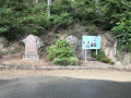
The aim is to follow the course of the Saint-Éturien stream and then the Léguer river from Plouaret-Trégor station to Lannion station. Plan to return by train.
Route from Lestrézec to Berrien
 7.67 mi
+574 ft
-591 ft
4h 00
Moderate
Departure from Berrien (Finistère)
7.67 mi
+574 ft
-591 ft
4h 00
Moderate
Departure from Berrien (Finistère)
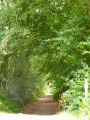
A picturesque heritage route that passes through the Huelgoat State Forest and the Lestrézec woods.
Saint-Haran circular
 4.78 mi
+135 ft
-135 ft
2h 20
Easy
Departure from Plestin-les-Grèves (Côtes-d'Armor)
4.78 mi
+135 ft
-135 ft
2h 20
Easy
Departure from Plestin-les-Grèves (Côtes-d'Armor)
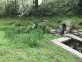
Hike along the banks of the Douron: nature, birds, tranquillity. The Saint-Haran circular route is part of the chapel route.
The Douron Valley
6.64 mi
+381 ft
-361 ft
3h 25
Moderate
Departure from Plestin-les-Grèves (Côtes-d'Armor)
Discover the banks of the Douron, the coastal river that separates the Côtes d'Armor and Finistère departments. Right from the start, you will have to cross a pass: the Col de Saint-Haran (24 metres!), as indicated on the sign at the top. You will cross into a different department when you cross the bridge next to the Moulin de Moualhic, and again at Pont Menou.
Pointe de l’Armorique from Saint-Efflam
5.25 mi
+344 ft
-341 ft
2h 45
Easy
Departure from Plestin-les-Grèves (Côtes-d'Armor)
A circular walk starting from Saint-Efflam, initially through the countryside, dotted with fountains and a few pretty houses, before reaching the Douron estuary and continuing along the coastal path beside the Douron cove, then along the Pointe de l’Armorique cliff-top path, between the headlands of Plestin and Beg Douar. You’ll pass by the ancient Roman baths at Hogolo and have the option of heading down to some small beaches.
Circular route in Plestin-les-Grèves from Saint-Efflam to Sainte-Barbe and the Grand Rocher.
8.21 mi
+830 ft
-814 ft
4h 30
Moderate
Departure from Plestin-les-Grèves (Côtes-d'Armor)
This beautiful circular walk is divided into two parts.
The first part follows the customs officers' path and runs along the seafront, passing numerous viewpoints, headlands and beaches until it reaches the banks of the Douron estuary.
The second part winds through the countryside of valleys and hamlets, revealing pretty manor houses before reaching its climax at the seaside, at an altitude of 84 metres, at the top of the Grand Rocher, which offers an exceptional view of almost the entire bay of Lannion and the Plestinaise countryside.
The Grand Rocher of Saint-Efflam
3.69 mi
+469 ft
-476 ft
2h 05
Moderate
Departure from Plestin-les-Grèves (Côtes-d'Armor)
The Grand Rocher towers 84 m above the Lieue de Grève and offers stunning views in all directions. You’ll climb to the top during this walk, which also takes you along the beach and through the countryside, past beautiful country houses and the Saint-Efflam Fountain.
The Grand Rocher and the Pointe de l'Armorique
 8.90 mi
+823 ft
-810 ft
4h 50
Moderate
Departure from Plestin-les-Grèves (Côtes-d'Armor)
8.90 mi
+823 ft
-810 ft
4h 50
Moderate
Departure from Plestin-les-Grèves (Côtes-d'Armor)
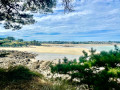
Discovering Grève Saint-Michel: a bay where the sea recedes more than 2 km; first by climbing the Grand Rocher for a breathtaking panorama, then, up close, by walking along the beach, and finally, by admiring it from across the bay on the famousGR®®34. You’ll continue to admire Lannion Bay as you round the Pointe de l’Armorique and, in particular, the Pointe de Plestin, before following the Douron estuary, admiring the chapel and fountain, and returning to Saint-Efflam.
The tip of Armorique
 4.43 mi
+328 ft
-318 ft
2h 20
Moderate
Departure from Plestin-les-Grèves (Côtes-d'Armor)
4.43 mi
+328 ft
-318 ft
2h 20
Moderate
Departure from Plestin-les-Grèves (Côtes-d'Armor)
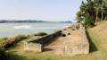
A beautiful hike, much of it taking place along the seafront corniche. Along the way, you can add a visit to a Gallo-Roman site and take a refreshing dip!
Discovering Locquirec
7.40 mi
+325 ft
-312 ft
3h 40
Moderate
Departure from Locquirec (Finistère)
The Pointe de Locquirec offers wonderful landscapes! From Pointe Blanche, the whole bay of Locquirec opens up to walkers, with a different landscape depending on the sea level, followed by the beauty of Kerboulic and its second homes, bursting with sunshine on the Plage des Sables Blancs and Pointe du Corbeau, and finally ending with Pointe du Château and the small port of Locquirec.