Refine your search for walks in Ayguesvives
 Across the hillsides of Lauragais

This circuit winds its way through the gently rolling hills of the Lauragais, with views of the plain, the Montagne Noire and, on a clear day, the entire Pyrenees mountain range, from Canigou to the Pic du Midi.
 The hillsides of Lauragais - The hills of Autan

Circuit in the suburbs of Toulouse on routes mapped out by Sicoaval. It will take you through fields and woods to discover the colourful, rolling landscapes of the Lauragais region via well-maintained paths and trails.
ClearPR® signposting.
The route includes muddy sections in winter (this is the Lauragais region) and a few steep climbs.
 The ridges around Espanès
A route starting from Corronsac in the 'long' version, with magnificent landscapes on ridge paths and some beautiful trails in the Lauragais.
 A challenging circuit on the outskirts of Toulouse.

Just outside Toulouse, this is a short, invigorating circuit. There is a bit of tarmac when crossing Castanet (1.3 km), but the rest is made up of paths and beautiful trails. The countryside is just a few kilometres from Toulouse. Avoid this circuit after heavy rain as some sections will be difficult to navigate.
 The Ariège from bottom to top

A very varied hike, combining bucolic trails along the Ariège and aerial passages on the cliffs. Very little tarmac, lots of trails, beautiful views of the plains and the Pyrenees.
The hike ends with a visit to the charming village of Clermont-le-Fort.
 From Notre-Dame des Bois to Clermont-le-Fort

This hike is based on the route published by SICOVAL "Circular walk from Notre-Dame des Bois", which I modified at the end.
 Panorama and oak forest between Lacroix-Falgarde and Goyrans

On the outskirts of Toulouse, climb up to admire the Pyrenees and the hillsides, then return to the cool shade of the Goyrans forest along the Ariège river.
 Pech David and the Gallic oppidum

Starting from the peaceful village of Pouvourville, this easy walk can be enjoyed in all seasons.
The signs are everywhere, guiding us along the tree-lined path to the Oppidum de Cluzet, where the first inhabitants of Toulouse lived in the Neolithic period.
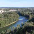
From the Gallic oppidum, and all along the cliff-top path on the heights of Pech David, you can enjoy magnificent views of the Garonne River flowing through the Toulouse plain.
 They're not quite the châteaux of the Loire, but they're close in the Lauragais region.

A very pretty little circuit, without any difficulty, offering superb views of the Lac de la Ganguise, the hillsides and the Pyrenees.
There is very little tarmac, with most of the route following wide, clean paths.
The starting point offers a chance to discover the magnificent little castle of Belflou.
 In the footsteps of the Roman ramparts of Tolosa

This very easy urban walk will take you to the 10 remains of the Roman ramparts of Toulouse fromthe 1st and 3rd centuries AD that are still visible today in public spaces. The duration of this walk will depend on how much time you spend observing the sites.
 Lamartine Lake
In a small corner near Toulouse is a lake where many birds live and where you can enjoy the peace and quiet of nature. Why not spend an afternoon discovering it?
 Toulouse left bank: Jardins du Barry, Cartoucherie and Saint-Cyprien
Stroll along the left bank of Toulouse and discover the city's new developments on a former industrial site. Green spaces have been created to provide shade and coolness in summer. The route is safe and away from traffic. The walk continues towards the historic district and ends at Saint-Cyprien.
 The Bois de Monturon in Colomiers
This walk close to the city remains mostly rural and allows you to discover the pretty Pont Saint Jean bridge and the small Bois de Monturon forest. An ideal family walk with no difficulty.
 A loop in the woods at Montberon

A few kilometres north of Toulouse, you can enjoy a lovely route through the woods, perfect for jogging, trail running or hiking.
 Les Coteaux, the Garonne and Arize rivers from Carbonne

This beautiful hike takes you to the heights of Carbonne and the meeting point of the Garonne and Arize rivers.
 The Revéloise roundabout
This walk, which is flat and easy, takes you around the bastide town of Revéloise and allows you to discover some historical sites. The starting point is right next to the municipal swimming pool.
 Saint-Ferreol

Section of the "sentier des sommets" trail, cut off from the link with Revel, reducing the total distance to 14 km.
No technical difficulties, with beautiful views of the Lauragais. The route ends with a shaded walk around the lake, where you can swim in season.
 The Chemin des Amoureux

The Chemin des Amoureux (Lovers' Path) takes you up the Laudot valley toward Cammazes. You return on the GR7.
 The hillsides of Pamiers via the Abbaye de Cailloup

A short hike that starts on the banks of the Ariège before climbing the hills. There are breathtaking views of Pamiers, the Pyrenees and the Plantaurel hills.
 Panorama around Montjoire

This walk offers beautiful 360° views from the Chemin de Ronde de Montjoire. Explore this town, a stronghold of the Cathar resistance, as you walk through fields and along ridge paths.
 Fields and woods around Cépet
A country walk through the fields and woods around Cépet (31 ). There are a few short stretches on roads open to traffic, but this does not detract from the charm of this walk on the outskirts of Toulouse.
 Oppidum of Berniquaut

Circuit to Gallic ruins offering a 360° view of the Sorèze plain.
 Walk around the Aussonnelle

Come and escape to the bucolic surroundings of Bonrepos-sur-Aussonnelle, on the border between Haute-Garonne and Gers.
 Oppidum of Berniquaut and Saint-Jammes Chapel

On the western edge of the Montagne Noire, this hike harmoniously combines historical remains and beautiful views. The Oppidum de Berniquaut, the excavations of medieval dwellings on the same site, a large standing stone with cup marks and the ruins of the Chapelle Saint-Jammes de Besauceles will delight history enthusiasts. Lovers of beautiful landscapes will also find something to satisfy them on this route, which overlooks the Sorèze plain from a height of over 300 metres.
 Among the vines: heart-shaped serapias

A bucolic walk in the heart of the Fronton AOP. You will go from valley to valley through vineyards and forests. You will enjoy magnificent views of the Girou valley with the Pyrenees as a backdrop and a panoramic view of the Tarn valley from Rabastens to Montauban.
The circuit is marked by 13 scent markers featuring the aromas of Fronton wines. Can you recognise them all?
 The butterfly trail

Along the trail, you will follow rural paths and discover remarkable landscapes, cultivated plains and shady valleys. You will have an unobstructed view of the Girou plain and the hillsides.
You will be accompanied by numerous butterflies, and the diverse wildlife and flora along the trail will brighten up your hike, including a private park populated by deer.
 Tabariane loop
A short family walk to the Merovingian cemetery in Tabariane from the church square in Teilhet. You will discover magnificent views of the Hers valley and the Ariège Pyrenees.
 Menville loop
Menville is a pleasant little village on the left bank of the Save. The river meanders lazily through green meadows. Pretty houses with carefully tended gardens are grouped around the bell tower. The residents of Menville enjoy the peace and quiet and proximity to nature. Country roads lead to beautiful old farms, which everyone takes pride in maintaining and improving.
 The Mas-d'Azil dolmens trail

Le Mas-d'Azil is a site rich in prehistoric remains. This trail takes in three very well-preserved dolmens, while offering a fine view of the Ariège Pyrenees and surrounding hills.
 Brogne loop

Between the Tarn and Dadou valleys, this is a beautiful hike in the hills of Parisot. On a clear day, there is a beautiful view of the Pyrenees at the end of Chemin de la Brogne. The hike is marked in yellow and maintained by the Association du Patrimoine de la commune de Parisot (Parisot Heritage Association).
 On the way to Dame Fines

A lovely walk in the Tarn countryside with a Tuscan feel. Beautiful views and two chapels to see along the way. Yellow signposts.
Please note that changes are pending.
Moderator's note 10 May 2024
Official modification of the route between point (12) and point (13) with new signage. Do not take the path towards the Bruguière farm.
From point (12), follow the Sainte-Cécile road, pass the path leading to the farm but continue on the Sainte-Cécile road until you return to point (9).
From the point (9), turn right onto the Pébrines road.
When you reach the fork, take the right-hand branch.
Continue until you reach the point (13).

