


Refine your search for walks in Arquian
Arquian walks


 The Chemin des Bois, starting from Arquian
 Tourist office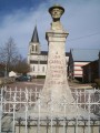
 6.03 mi
 +351 ft
 -361 ft
 3h 05
3h 05
 Easy
Easy
 Departure from Arquian (Nièvre)
This route is no longer passable. Trees are blocking the paths, and some of these paths are in very poor condition. The signposting put in place a few years ago is no longer up to date. Work will soon be carried out, including a new site survey and new signposting
Arquian is situated in Puisaye Nivernaise; the river Vrille, a tributary of the Loire, flows through the area.
In the village square, the bust of Jean Carriès, sculpted by Charles Gaudry, pays tribute to the famous ceramicist.
Les Gallons
 Visorando Member12.10 mi
+246 ft
-276 ft
5h 45
Visorando Member12.10 mi
+246 ft
-276 ft
5h 45
 Moderate
Departure from Lavau (Yonne) (Yonne)
Moderate
Departure from Lavau (Yonne) (Yonne)
Marked route No. 36.
A route south of Lavau featuring frequent fords, all of which have been improved, and numerous isolated farms or those grouped into small hamlets. The wooded sections are dominated by deciduous trees such as oak, slender hornbeam or pollarded hornbeam, and trees typical of wetland habitats such as birch, aspen, alder and willow...
P'ti Jean
6.96 mi
+174 ft
-180 ft
3h 20
Moderate
Departure from Lavau (Yonne) (Yonne)
Marked route No. 81.Wooded sections, rural and sunken paths, and small roads in the heart of the countryside make up the charm of this walk through the lands of the former Grand Treasurer of the Kingdom of France, Jacques Cœur.
Fortified House
5.54 mi
+223 ft
-210 ft
2h 45
Easy
Departure from Saint-Amand-en-Puisaye (Nièvre)
Marked walk No. 39From the16th-century castle at the very start of the route to the ruins of Maison Fort Castle, the route takes you past the ponds—the largest of which is the Étang de la Forge—and the Chemin du Tacot.
Les Méandres de la Vrille
 Association / Club / Walk leader4.35 mi
+308 ft
-282 ft
2h 15
Easy
Departure from Saint-Amand-en-Puisaye (Nièvre)
Association / Club / Walk leader4.35 mi
+308 ft
-282 ft
2h 15
Easy
Departure from Saint-Amand-en-Puisaye (Nièvre)
Waymarked walk N° 38
In the land of the potters, there is first and foremost the clay that serves as the raw material for the craftsmen, then the water that gushes out of the clay-silica or clay-limestone soils, depending on the geology of the subsoil in this area. But there's also the beauty of nature, with its landscapes, paths framed and even marked by these hedges and their sometimes mysterious, sometimes mischievous tadpoles. They are the source of some of the legends that live in the area.
The Chemin Carriès
5.15 mi
+167 ft
-144 ft
2h 30
Easy
Departure from Saint-Amand-en-Puisaye (Nièvre)
Marked trail No. 40
Taking this path is to step into the life and work of Jean-Joseph Carriès. This trail begins with the history of pottery and ends with a sunken path lined with works by ceramicists and the potters’ quarters in the village of Saint-Amand-en-Puisaye.
The Vérinoise Circular
 2.99 mi
+213 ft
-184 ft
1h 35
Easy
Departure from Saint-Vérain (Nièvre)
2.99 mi
+213 ft
-184 ft
1h 35
Easy
Departure from Saint-Vérain (Nièvre)
Marked route No. 34.
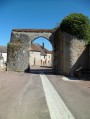
The village of Saint-Vérain, built on a hillside, was surrounded by fortified walls in the Middle Ages, making it one of the most powerful feudal cities in the region. Numerous remains bear witness to the city's importance, including ramparts, towers, gates, wells, a keep, etc.
Medieval Walk in Saint-Vérain
 0.67 mi
+75 ft
-75 ft
0h 25
Easy
Departure from Saint-Vérain (Nièvre)
0.67 mi
+75 ft
-75 ft
0h 25
Easy
Departure from Saint-Vérain (Nièvre)
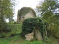
Follow the castle path to discover the keep and the remains of the13th-century feudal town.
Circuit de La Chapelle aux Rois
 8.91 mi
+771 ft
-771 ft
4h 45
Moderate
Departure from Bitry (Nièvre)
8.91 mi
+771 ft
-771 ft
4h 45
Moderate
Departure from Bitry (Nièvre)
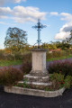
Marked trail No. 35.The commune of Bitry covers 1,746 hectares. The Ramois boundary marker is at an altitude of 326 metres, while the La Maloise river flows at the lowest point, 189 metres above sea level.Between the village and the hamlet of Les Beauchats, you can visit a chapel dedicated to Saint Marc and Saint Roc, which was restored in the 20th century.
La Villéon discovery trail in Puisaye
 5.35 mi
+299 ft
-308 ft
2h 45
Easy
Departure from Bitry (Nièvre)
5.35 mi
+299 ft
-308 ft
2h 45
Easy
Departure from Bitry (Nièvre)
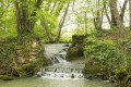
Marked trail No. 61.Emmanuel de La Villéon (1848-1944) was a painter of Breton origin (Fougères, where he has his museum) who lived from 1900 to 1936 in a mansion in the hamlet of Salvard. An admirer of Monet, he adopted most of the characteristics of Impressionism.This route, now enhanced with panels featuring reproductions and commentary, allows visitors to rediscover some of the places painted by the artist, including certain characteristics of the Poyaudin bocage.
Let's go for a walk in the woods
 4.97 mi
+285 ft
-272 ft
2h 30
Easy
Departure from Saint-Loup (Nièvre) (Nièvre)
4.97 mi
+285 ft
-272 ft
2h 30
Easy
Departure from Saint-Loup (Nièvre) (Nièvre)
Discover the village of Saint-Loup-des-Bois, its inhabitants, the Saints-Lupéens, and the forests that surround it. You will pass by the Museum of Agricultural Machinery and Rural Life, which traces the history of agricultural machinery. In addition to these major collections in Europe, there is an astonishing and impressive collection of irons and a collection dedicated to woodworking trades (clog makers, coopers, wheelwrights, etc.).
The spillways of Lac du Bourdon
1.10 mi
+79 ft
-82 ft
0h 35
Easy
Departure from Saint-Fargeau (Yonne)
A short walk to explore the spillways of Lac du Bourdon, behind the dam commissioned in 1905. There are two spillways: the Rigole du Bourdon for the cold water at the bottom of the lake, and the Ruisseau du Bourdon for the surface water. The latter is laid out in “terraces”, creating waterfalls when the water is released. You’ll be lucky enough to see them if you visit at the right time. Otherwise, it’s still a very pretty spot! Read the safety information in the Practical Information section.
 Circular route starting from Batilly-en-Puisaye via Maillebois
10.03 mi
+105 ft
-105 ft
2 hrs
Easy
Departure from Batilly-en-Puisaye (Loiret)
A cycle route exploring the landscapes of the Loiret. From Batilly-en-Puisaye to Dammarie-en-Puisaye, you’ll discover the beautiful countryside of Puisaye. On this route, you’ll also come across the Maillebois goat farm, where you can buy their goat’s cheese.
Family Ecolodge - Attrape Rêve
3.42 mi
+30 ft
-13 ft
45 mins
Easy
Departure from Batilly-en-Puisaye (Loiret)
A route to the Attrape Rêve equestrian centre in Dammarie-en-Puisaye
Murals in Puisaye – Sainte-Anne, Saint-Pierre and Saint-Fiacre
18.23 mi
+640 ft
-633 ft
6 hrs
Moderate
Departure from Saint-Fargeau (Yonne)
La Puisaye: not just blue and green in the landscape, but also ochre in the subsoil. It is from this natural pigment that artists since the 12th century have adorned many of the region’s religious buildings. This walk allows you to discover three of the fifteen or so listed to date.A route along charming country lanes...
Le Moulin Fleury
 4.30 mi
+315 ft
-292 ft
2h 15
Easy
Departure from Saint-Fargeau (Yonne)
4.30 mi
+315 ft
-292 ft
2h 15
Easy
Departure from Saint-Fargeau (Yonne)
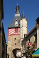
Marked route No. 113.The historic centre of Saint-Fargeau and a nature walk are the main attractions of this outing.From the red-brick castle to the murals of the Sainte-Anne Chapel, via the Loing river, this is a bucolic walk.
Walk in Saint-Fargeau
1.38 mi
+39 ft
-33 ft
0h 40
Easy
Departure from Saint-Fargeau (Yonne)
A walk to perhaps round off the day with a visit to the castle and/or the museum. As you wander through the streets, you’ll see medieval houses, wash houses, the old market hall, and you’ll often cross the Ruisseau du Bourdon.