Refine your search for walks in Amigny
Amigny walks
 Circular walk through the hamlets starting from Saint-Georges-Montcoq
 Visorando Member
 9.53 mi
 +686 ft
 -669 ft
 5h 00
5h 00
 Moderate
 Departure from Saint-Georges-Montcocq (Manche)
Quite steep terrain on certain sections. Plenty of places to get water if you’re walking with your dogs.
The sunken paths from Feugères
8.63 mi
+535 ft
-535 ft
4h 25
Moderate
Departure from Feugères (Manche)
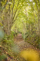
Discover the typical landscape of central Manche on a walk lasting around 4 hours. Numerous sunken paths, also known as ‘chasses’, link the various hamlets and villages, offering the chance to explore the rich architectural heritage that combines granite and mudbrick.
Route des Bonnes Gens from Le Mesnilbus
 Tourist office
 6.93 mi
+384 ft
-381 ft
3h 30
Moderate
Departure from Le Mesnilbus (Manche)
6.93 mi
+384 ft
-381 ft
3h 30
Moderate
Departure from Le Mesnilbus (Manche)
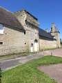
In the Middle Ages, its name meant ‘small farmstead in the middle of the woods’. In 1792, its inhabitants refused to accept the change of regime brought about by the Revolution. Following a dispute with the king’s recruiter (who demanded more soldiers), the population rebelled, and the parish was removed from the register of parishes in France. The church was devastated, and the bells and the lords’ lead coffins were melted down.
Between land and marsh -2-
 8.63 mi
+108 ft
-105 ft
4h 05
Moderate
Departure from Montmartin-en-Graignes (Manche)
8.63 mi
+108 ft
-105 ft
4h 05
Moderate
Departure from Montmartin-en-Graignes (Manche)
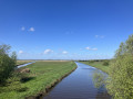
This route is an addition to the route entitled: Between Land and Marsh -1-.
On the edge of the marsh
6.04 mi
+207 ft
-213 ft
3h 00
 Easy
Departure from Montmartin-en-Graignes (Manche)
Easy
Departure from Montmartin-en-Graignes (Manche)
Taking the new paths created by the land consolidation in Montmartin-en-Graignes, this route allows you to explore the countryside on the edge of the marshes. It offers some beautiful views.
On the Stork Trail
4.82 mi
+69 ft
-154 ft
2h 15
Easy
Departure from Montmartin-en-Graignes (Manche)
This short walk takes us from the village of Montmartin-en-Graignes to the Château de la Rivière in Saint-Fromond, a nesting site for many storks.
Between land and marsh -1-
5.33 mi
+108 ft
-108 ft
2h 35
Easy
Departure from Montmartin-en-Graignes (Manche)
This route allows us to experience a walk along a towpath and reach the land overlooking the marsh.
 Condé-sur-Vire - Pont-Farcy via the greenway
 23.78 mi
+417 ft
-394 ft
4 hrs
Easy
Departure from Condé-sur-Vire (Manche)
23.78 mi
+417 ft
-394 ft
4 hrs
Easy
Departure from Condé-sur-Vire (Manche)
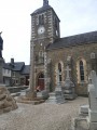
A beautiful route in the heart of nature, along the Vire river, very quiet and very pleasant.
Around the port of Carentan
4.12 mi
+30 ft
-30 ft
1h 55
Easy
Departure from Saint-Hilaire-Petitville (Manche)
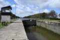
Marina tower. Passage through the lock and the two bell towers.
From the church to the Carentan lock
 3.49 mi
+36 ft
-36 ft
1h 40
Easy
Departure from Carentan (Manche)
3.49 mi
+36 ft
-36 ft
1h 40
Easy
Departure from Carentan (Manche)
During this walk, you will discover Carentan, a town with architectural heritage dating from the Middle Ages to the 19th century.
Les Romains et les Calvaires au départ de Saint-Sauveur-Lendelin
11.49 mi
+240 ft
-243 ft
5h 30
Moderate
Departure from Saint-Sauveur-Lendelin (Manche)
Ce territoire, facilement accessible de la côte et de l'intérieur du Cotentin par des chemins de grande randonnée constitue un trait d'union géographique entre Saint-Lô, la capitale du cheval et Coutances, Pays d'art et d'Histoire. C'est un territoire vallonné qui comprend de nombreuses zones humides (marais). Il est traversé par la voie romaine (D 535) qui reliait Abrincae, nom romain d'Avranches et Alauna, Valognes.
Brectouville route
 5.47 mi
+328 ft
-325 ft
2h 50
Easy
Departure from Condé-sur-Vire (Manche)
5.47 mi
+328 ft
-325 ft
2h 50
Easy
Departure from Condé-sur-Vire (Manche)
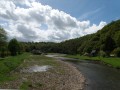
The hike is accessible to a wide range of people as there are no difficult sections.
La vallée de la Soulles à Montpinchon
7.34 mi
+620 ft
-620 ft
3h 55
Moderate
Departure from Montpinchon (Manche)
De cet endroit, nommé le Mont, vous apprécierez la vue imprenable sur la commune et ses environs, dominés par la cathédrale gothique de Coutances. Le sentier vous mènera derrière le Château de Cerisy-la-Salle, devenu Centre Culturel International. Toutes les cultures s'y rencontrent chaque année lors de colloques très prisés.
The Old Sea Wall at Brévands
 4.91 mi
+75 ft
-82 ft
2h 20
Easy
Departure from Brévands (Manche)
4.91 mi
+75 ft
-82 ft
2h 20
Easy
Departure from Brévands (Manche)
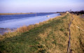
Set off to explore Brévands, a picturesque little village in the Baie des Veys at the heart of the polders, rich in built and natural heritage. Walk along the dirt tracks, follow the Douve river and admire the typical buildings of the area.
The Chapelle des Costils in Roncey
 6.89 mi
+427 ft
-440 ft
3h 35
Moderate
Departure from Roncey (Manche)
6.89 mi
+427 ft
-440 ft
3h 35
Moderate
Departure from Roncey (Manche)
This village, with a population of over 800, is a typical example of post-war reconstruction and was largely destroyed during the Second World War. On 29 July 1944, the day the village was liberated during Operation Cobra, several thousand German soldiers were surrounded in this pocket, with the village of Roncey at its centre.
La Jacre Route
 Local authority3.60 mi
+282 ft
-272 ft
1h 55
Easy
Departure from Domjean (Manche)
Local authority3.60 mi
+282 ft
-272 ft
1h 55
Easy
Departure from Domjean (Manche)
A easy route along very pleasant sunken paths.
Les Champs Boullot from Domjean
4.64 mi
+217 ft
-233 ft
2h 20
Easy
Departure from Domjean (Manche)
A easy route with lovely views, sunken paths and plenty of shade.