On the Stork Trail

This short walk takes us from the village of Montmartin-en-Graignes to the Château de la Rivière in Saint-Fromond, a nesting site for many storks.

Details

n°67331
Creation:
Last update:
Last review:
  • Walking
    Activity: Walking
  • ↔
    Distance: 4.82 mi
  • ◔
    Average duration: 2h 15 
  • ▲
    Difficulty: Easy

  • ⚐
    Back to start: No
  • ↗
    Ascent: + 69 ft
  • ↘
    Descent: - 154 ft

  • ▲
    Highest point: 98 ft
  • ▼
    Lowest point: 7 ft

Description of the walk

Moderator update on 4 August 2020: Please note! Changes on the ground near the go-kart track. See the notices dated 4 July 2020 and 3 August 2020

The walk starts at the car park of Montmartin-en-Graignes Town Hall.

(S) We head towards Rue de l’Abbé Bihel and stock up on a few walking essentials at the grocery shop.
We then take the Chemin du Roi (named in memory of Louis XVI’s visit to the village) until we reach the newly cut path. We carry on straight ahead until we reach the crossroads at Clos du Mont.

(1) We turn left and head towards the hamlet known as “La Raye”.

(2) We turn right onto the departmental road leading towards Neuilly-la-Forêt, until we reach the D974 road leading from Saint-Jean-de-Daye to Carentan.

(3) We follow the verge on the left and reach, on the left, the road leading to the hamlet of Rouge Fossé (there’s a sign advertising honey for sale at the crossroads).

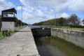
(4) At the hamlet, we turn right and reach the banks of the Vire and Taute Canal, which we follow to the left until we come to a bridge crossing the canal.

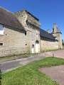
(5) At this point, we turn left and continue to the Château de la Rivière, a nesting site for many storks (E).

Waypoints

  1. S : mi 0 - alt. 98 ft - Car park at Montmartin-en-Graignes Town Hall
  2. 1 : mi 0.77 - alt. 95 ft - Crossroads, turn left
  3. 2 : mi 1.63 - alt. 16 ft - La Raye - Vire (fleuve)
  4. 3 : mi 2.73 - alt. 30 ft - D974, on the left
  5. 4 : mi 3.52 - alt. 20 ft - Rouge Fossé
  6. 5 : mi 4.62 - alt. 16 ft - Bridge, on the left
  7. E : mi 4.82 - alt. 10 ft - Château de la Rivière

Reviews and comments

3.4 / 5
Based on 3 reviews

Reliability of the description
3.3 / 5
Ease of following the route
3 / 5
Route interest
4 / 5
das
das

Hello,
I’m planning a week-long holiday in September 2025 with some friends, heading to Isigny-sur-Mer. So nothing’s been finalised yet.
Thank you for your help.

Machine-translated

bernard Le Prieur
bernard Le Prieur

Overall rating : 2 / 5

Date of your route : Aug 03, 2020
Reliability of the description : ★★★☆☆ Average
Ease of following the route : ★☆☆☆☆ Very disappointing
Route interest : Not used / Not applicable
Very busy route : No

This route is no longer in use; it would be a good idea to remove it. After the path leading to the go-kart track, the passage (path) between the two fields is completely blocked by vegetation. It is possible to take the road, but it is a very busy county road.

Machine-translated

larayevire
larayevire

I’m sorry. I’m going to take another look at this route by driving round the go-kart track. I’m also going to raise the issue with local councillors to ensure the towpath is cleared.

Machine-translated

MinaViso
MinaViso

Overall rating : 3.3 / 5

Date of your route : Jul 04, 2019
Reliability of the description : ★★★☆☆ Average
Ease of following the route : ★★★☆☆ Average
Route interest : ★★★★☆ Good

The aim of the walk is interesting, but the route has been altered due to the privatisation of parts of the path (near the go-kart track and the access point to the towpath)
When we did the walk, the towpath hadn’t been maintained (nettles and grass 50 cm high), but for the return journey we were easily able to find an alternative route: the towpath on the other bank, although this meant a longer stretch along the road!

Machine-translated

jaunet richard
jaunet richard

Overall rating : 4.3 / 5

Date of your route : Feb 25, 2018
Reliability of the description : ★★★★☆ Good
Ease of following the route : ★★★★★ Very good
Route interest : ★★★★☆ Good

Very pleasant.

Machine-translated

Marie - Cécile
Marie - Cécile
• Edited:

I wasn’t able to go on this walk because the marshes are currently flooded, so do check before you set off. The four-lane road – ‘scheduled to open in 2012’ – has now been completed, which has significantly altered the landscape.

Machine-translated

Other walks in the area

For more walks, use our search engine .

The GPS track and description are the property of this route's author. Please do not copy them without permission.