Country:
 City:
City:


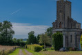
Starting point: the church square in Roncey.
Yellow signposting
(S/E) From the square, with your back to it, turn right towards Coutances along the D59 until you reach the second road on the right at Les Cardronnets.
(1) At this junction, turn right towards La Davière.
(2) At the hamlet, turn right onto a track to join the D102.
(3) Turn left onto the departmental road towards Les Brières. At the entrance to the hamlet, take the track branching off to the right. Continue straight on at the junction with the Route du Paradis, pass behind the cemetery and join the D58.
(4) Turn left towards La Barberie and ignore two roads on the right.
(5) Take the track on the right towards La Clémenterie and follow it as far as La Lévrerie.
(6) Turn right to join the D236. On this road, turn left before taking the first path on the right.
(7) At the fork in the road, carry on straight on towards the D102, cross it, and continue along the path until you reach the next fork in the road.
(8) Turn left and follow the track as it approaches La Vanne and then runs alongside it at a distance. You’ll arrive near the D438.
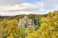
(9) At this junction, turn right and head towards the Chapelle des Costils.
(10) After taking in the view, walk past the chapel and carry on straight ahead to return to the Fork in the road you passed earlier.
(8) Carry on straight ahead, cross the D102 again and continue to the next junction.
(7) Turn left towards La Rousserie. At the road, where the path ends, take the first left for about 200 m, then turn onto a path branching off to the right towards La Planche Barbou. You’ll reach the D349.
(11) Follow the road to the right, continuing straight on until you reach Roncey. At the roundabout, carry on straight ahead to the church square (S/E).

 Tourist office
 Visorando Member
 Easy
Easy