Circular walk through the hamlets starting from Saint-Georges-Montcoq

Quite steep terrain on certain sections. Plenty of places to get water if you’re walking with your dogs.

Details

21603351
Creation:
Last update:
Last review:
  • Walking
    Activity: Walking
  • ↔
    Distance: 9.53 mi
  • ◔
    Average duration: 5h 00 
  • ▲
    Difficulty: Moderate

  • ⚐
    Back to start: Yes
  • ↗
    Ascent: + 686 ft
  • ↘
    Descent: - 669 ft

  • ▲
    Highest point: 390 ft
  • ▼
    Lowest point: 23 ft

Description of the walk

Park in the car park at the Saint-Georges-Montcoq town hall.

(S/E) Take the path between the garage and the playground, then go round the back of the school across the lawn and rejoin the road. Follow it to the right, towards Rampan; at the fork, continue straight on along the D447, Rue des Fontenelles. Reach thefirst junction just at the entrance to the hamlet known as La Petellerie.

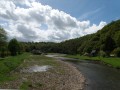
(1) Turn left (following the yellowPR® signposts) and head downhill, passing a house on your left, until you reach the River Vire, behind the buildings opposite you, at the junction with Rue Valvire on the left and the Port Cavelande promenade on the right.

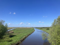
(2) Turn right and follow the River Vire (the old sewage treatment works are still visible, followed by an archery range). Follow the path which branches off from the River Vire at the T-junction with the Chemin de Cresme.

(3) Continue along the road, turning left then right, then follow the yellowPR® path straight on to reach Le Mézeray. In the hamlet, at the Fork in the road, take the left-hand path, go round the wayside cross to take the street that descends towards the railway line, and walk alongside it at a distance. Follow the road and turn right to reach the hamlet of Le Grand Hamel.

(4) Turn left, then left again to pass under the railway line, and then follow it at a distance to reach a crossroads near the hamlet of Rampan, just after the cemetery.

(5) From here, you can take a detour to the left to visit the picnic area at the red bridge over the Vire.

(6) Turn back and return to the crossroads.

(5) Turn left to cross the railway line, then take a first turn left then right to continue along the yellowPR® trail. Stay on the path on the left, which eventually runs alongside the ditch in the hamlet of Rampan. When you reach the hamlet of La Capelle, turn left and join the D447.

(7) Leave thePR® and turn right onto this road, passing La Nicollerie. At the Chasse Neuve junction, continue straight ahead. You’ll reach the hamlet of La Roserie and carry on to the end of the road.

(8) Take the path that branches off to the left of the farm, then cross the Ruisseau de l’Écalhan and rejoin aPR® path at Cour Talvas.

(9) Turn right onto it and follow the yellow markings to the hamlet of Les Anges.

(10) Leave thePR® and turn left, crossing the D974 (Voie de la Liberté) with care. You’ll come to another right-angled junction.

(11) Take the path on the right, walking some distance alongside the Ruisseau Saint-Martin. Then leave the stream behind and head towards the hamlet of Clos Binet. Turn right for a few metres to reach the D974 (Voie de la Liberté) once more.

(12) Please take care here, as this road is very busy and requires your full attention.
However, there are two options:
- follow the route shown on the map by turning left until you reach the roundabout. Take the left-hand exit and, at the pumping station, turn right. You’ll reach the housing estate; go through it and carefully cross the D974 again to reach the car park at Saint-Georges-Montcoq Town Hall (S/E).

- Cross the D974 with care, reach the hamlet of La Houssaye, then turn left into Rue du Monchoix. At the T-junction, head straight ahead to return to the junction you passed on the way out.
Turn left and follow the route in the opposite direction to the one taken on the way there to return to the car park at the town hall in Saint-Georges-Montcoq (S/E).

Waypoints

  1. S/E : mi 0 - alt. 348 ft - Town hall car park
  2. 1 : mi 0.38 - alt. 322 ft - Turn left towards La Vire
  3. 2 : mi 0.86 - alt. 46 ft - Turn right – along the River Vire and the railway line
  4. 3 : mi 2.36 - alt. 262 ft - The Mézeray Calvary
  5. 4 : mi 3.92 - alt. 128 ft - The village of Le Grand Hamel
  6. 5 : mi 4.84 - alt. 69 ft - Junction for a return trip to La Vire
  7. 6 : mi 4.96 - alt. 33 ft - Picnic area. Bridge over the - Vire (fleuve)
  8. 7 : mi 5.8 - alt. 125 ft - D447 – Towards Pont-Hébert
  9. 8 : mi 6.82 - alt. 167 ft
  10. 9 : mi 6.92 - alt. 171 ft - Turn right onto the dirt track
  11. 10 : mi 7.49 - alt. 223 ft - Les Anges
  12. 11 : mi 7.75 - alt. 226 ft - Crossroads. Dirt track
  13. 12 : mi 8.57 - alt. 338 ft - Optional junction
  14. S/E : mi 9.53 - alt. 348 ft - Town hall car park

Worth a visit

Always be cautious and plan ahead when you're outdoors. Visorando and the author of this route cannot be held responsible for any accidents occurring on this route.

The GR® and PR® markings are the intellectual property of the Fédération Française de Randonnée Pédestre.

Reviews and comments

3.3 / 5
Based on 5 reviews

Reliability of the description
3.2 / 5
Ease of following the route
3.2 / 5
Route interest
3.4 / 5
jourdanpatrick1951
jourdanpatrick1951

Overall rating : 4.7 / 5

Date of your route : Sep 22, 2025
Reliability of the description : ★★★★★ Very good
Ease of following the route : ★★★★★ Very good
Route interest : ★★★★☆ Good
Very busy route : No

A lovely walk, almost entirely on footpaths, mostly shaded with beautiful views of the Vire valley. It's a shame that at the end there are 500 metres along a very busy road; it would be better to join the parallel PR footpath

Machine-translated

Fabibi14
Fabibi14

Overall rating : 4 / 5

Date of your route : Apr 28, 2025
Reliability of the description : ★★★★☆ Good
Ease of following the route : ★★★★☆ Good
Route interest : ★★★★☆ Good
Very busy route : No

A lovely walk in the countryside.
A few lovely views.
To finish off this walk, at point 12 we decided to take the second option to avoid the main road.

Machine-translated

Marion VR
Marion VR ★

Hello Zumba, thank you for your clarifications, which we have added to the walk description in consultation with the author.

Machine-translated

zumba
zumba

Overall rating : 4 / 5

Date of your route : Aug 09, 2023
Reliability of the description : ★★★★☆ Good
Ease of following the route : ★★★★☆ Good
Route interest : ★★★★☆ Good
Very busy route : No

Having decided to take on the challenge after reading the two previous reviews, I found this route fairly well explained and easy to follow. A few comments, however:
- At the start of the walk, it should be made clear that you need to cross the lawn behind the school to get back onto the road.
- At point 2, at the Cresme fork in the road, I chose to carry on straight ahead along the yellow PR path to reach Le Mézeray, thereby avoiding having to cross the D447.
- Point 5: after crossing the railway line, turn left, then take the path on the right. On this path, follow the yellow PR sign to the left to reach the hamlet of La Capelle.
Point 7: to cross the Ecalhan stream, take the path to the left of the farm.
The countryside is lovely, and the paths are easy, except at point 2, which has a fairly steep climb on soggy ground. You’ll need good, waterproof shoes for this route. I spotted some wild animals – it’s magical!
To finish, I chose the Hameau de la Houssaye route, which was delightful and full of beautiful flowers.

Machine-translated

paskal61
paskal61

Overall rating : 1 / 5

Date of your route : Jun 27, 2023
Reliability of the description : ★☆☆☆☆ Very disappointing
Ease of following the route : ★☆☆☆☆ Very disappointing
Route interest : ★☆☆☆☆ Very disappointing
Very busy route : No

The route is completely out of date and poorly signposted… You end up in people’s backyards… Rubbish – needs a proper review…

Machine-translated

seullines
seullines

Overall rating : 2.7 / 5

Date of your route : Feb 14, 2023
Reliability of the description : ★★☆☆☆ Disappointing
Ease of following the route : ★★☆☆☆ Disappointing
Route interest : ★★★★☆ Good
Very busy route : No

Poor route description, especially at the start of the walk.
Lack of signposting

Machine-translated

Other walks in the area

For more walks, use our search engine .

The GPS track and description are the property of this route's author. Please do not copy them without permission.