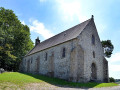
The Vanne Valley in Saint-Denis-le-Vêtu

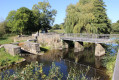
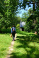
This village, with its traditional houses, holds some lovely surprises. The sunken lanes, typical of the hedgerow landscape, lead towards the Vanne valley, offering views of beautiful countryside.

Details

n°15868720
Creation:
Last update:
Last review:
  • Walking
    Activity: Walking
  • ↔
    Distance: 7.83 mi
  • ◔
    Average duration: 3h 55 
  • ▲
    Difficulty: Moderate

  • ⚐
    Back to start: Yes
  • ↗
    Ascent: + 351 ft
  • ↘
    Descent: - 381 ft

  • ▲
    Highest point: 259 ft
  • ▼
    Lowest point: 89 ft

Photos

Description of the walk

Park in the small car park by the cemetery.

Yellow signposts

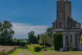
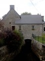
(S/E) Walk alongside the cemetery and the church on your left, then turn right towards Clos de la Grange. Walk past Le Grand Fontenay along a long path until you reach the mill.

(2) Turn left and walk straight on. Pass in front of Petit Fontenay and continue along the road to reach La Normanderie. Once you reach this hamlet, turn left and continue along the path to La Campagne de Bas.

(3) Head straight on along the road until you reach a junction.

(4) Take the path branching off to the right, towards La Violetterie.

(5) Walk straight on until you reach the D438e.

(6) At the junction, turn right and continue until you come to a small path branching off to the left just before the Ruisseau du Pont Cée. Turn left.

(7) At the Fork in the road, keep left to reach La Croix and the junction on the D76.

(8) Turn right, ignore the D438 on your right and continue for about 350 metres.

(9) About fifty metres before the house, follow the path on the right until you rejoin the D438, then turn left, ignoring the Chemin de la Scellerie which branches off opposite. Carry on to the next junction and turn right onto the path running alongside the Ruisseau du Pont Cée.

(7) Keep to the left, rejoin the road you took on the way there and follow it to the right.

(6) Go straight on, then take the path on the left.

(4) Ignore the route you’ve already taken and turn right. Cross the road at a place called Campagne and continue straight ahead along the path.

(10) Cross the D76 and head straight ahead to reach La Pennerie.

(11) Turn left and follow the D276 until you come to a road branching off to the right. Follow this road to reach Bois Roger.

(12) Turn left to reach Le Mesnage au Comte, then take the road on the left; after that, turn right onto the footpath towards La Martinerie. At this point, take the road set back on the right, which very quickly becomes a footpath leading you to the hamlet known as Les Mottinières.

(13) Turn right to reach the village of Saint-Denis-le-Vêtu. You’ll come to the cemetery car park and the church (S/E).

Waypoints

  1. S/E : mi 0 - alt. 213 ft - Cemetery car park - Église Saint-Denis (Saint-Denis-le-Vêtu)
  2. 1 : mi 0.73 - alt. 102 ft - Mill - La Vanne (rivière)
  3. 2 : mi 1.73 - alt. 194 ft - La Campagne de Bas
  4. 3 : mi 1.89 - alt. 217 ft - Junction with the A/R road
  5. 4 : mi 2.07 - alt. 115 ft - La Violetterie
  6. 5 : mi 2.37 - alt. 177 ft - D438e
  7. 6 : mi 2.57 - alt. 135 ft - Junction of the Croix circular loop
  8. 7 : mi 3.15 - alt. 230 ft - La Croix
  9. 8 : mi 3.47 - alt. 243 ft - Path on the right towards the D438
  10. 9 : mi 5.53 - alt. 223 ft - D76
  11. 10 : mi 5.97 - alt. 207 ft - La Pennerie
  12. 11 : mi 6.65 - alt. 259 ft - Bois Roger
  13. 12 : mi 7.46 - alt. 200 ft - Les Mottinières
  14. S/E : mi 7.83 - alt. 213 ft - Cemetery car park

Notes

Difficulty: none

Public toilets behind the town hall.
Water point in the cemetery.
Bakery.
La Baratte, restaurant and local produce.
Organic market gardener, Gonzague Brionne.

Worth a visit

Places of interest

Saint-Denis-le-Vêtu still has many bread ovens, some of which have been restored, and numerous grain barns characterised by large openings allowing heavily laden carts to pass through on their return from the harvest. Take a good look at them as you walk along the route.

Did you know? “Hay” is the name of a hamlet in Saint-Denis; it is the masculine form of “haie”, referring to the inhabitant of an estate surrounded by hedgerows.

On the council’s website (www.saintdenislevetu.fr), a local resident has taken on the role of historian, explaining no fewer than 55 hamlet names, as well as how a shrub out of place in a meadow or on a slope (boxwood, privet, a degenerate apple or pear tree, laurel), the remains of an enclosed garden, the hollow of a filled-in well, a few cut stones, broken slates or tiles … bear witness to a vanished village.

The village centre: characterful houses and the church

No fewer than three hypotheses have been put forward to explain the etymology of the village’s name:

- ‘Le Vêtu’ is said to derive from ‘vadum’ (ford, a Latin word), the etymology of ‘Vêtu’ being given by Marcel Proust in *Sodom and Gomorrah*.

- ‘Vêtu’ could also mean ‘whose fields are covered with crops’, in contrast to Saint-Denis-le-Gast, as a ‘gâtine’ was, in Old French, a ‘bad land’ – a region consisting of poor, infertile, impermeable soil with a predominantly siliceous composition.

- Another and final hypothesis put forward on the town’s website: the name ‘Vêtu’ is a corruption of the Latin word ‘vetus’, meaning ‘old’, as opposed to ‘Gast’ or ‘young’. Choose whichever explanation you prefer…

In this charming village with its stone and rubble-built houses, you can also admire the chancel and tower of its church, which date from the 13th century, whilst the baptismal font dates from the 16th century. The first recorded mention of the church’s existence is its donation to Blanchelande Abbey in 1199 by Guillaume de Rollos and his wife Isabelle. The bell tower features a stone bearing seven mysterious letters, the meaning of which no one has yet discovered. Inside, you’ll find a lovely little organ dating from 1946, decorated with vine motifs carved by a local cabinetmaker.

Charming village “La Normanderie”__

This small hamlet consists of buildings typical of the region, constructed using locally sourced materials: earth and stone. Before the Second World War, the inhabitants made use of the resources available to them. The clay soil, sometimes mixed with straw to lighten it, provides ideal insulation against damp. The weathered buildings are thus given a new lease of life. The stones used came from nearby quarries.

Reviews and comments

4.7 / 5
Based on 1 review

Reliability of the description
5 / 5
Ease of following the route
4 / 5
Route interest
5 / 5
Karsenti
Karsenti

Overall rating : 4.7 / 5

Date of your route : May 13, 2022
Reliability of the description : ★★★★★ Very good
Ease of following the route : ★★★★☆ Good
Route interest : ★★★★★ Very good
Very busy route : No

There are many sections of the path with very tall grass. Some sections are clear. Between 5 and 6, a spring makes the left-hand path, just before the bridge, impassable. Turn back to the Aumesnil crossroads to complete the route.

Machine-translated

Other walks in the area

For more walks, use our search engine .

The GPS track and description are the property of this route's author. Please do not copy them without permission.