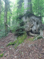
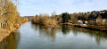
Woodland and the hills of the Forest from Montcy-Notre-Dame

A pleasant circular route starting from the car park in front of the church at Montcy-Notre-Dame. The route climbs gradually up to the higher parts of the village, offering a lovely mix of open stretches and shaded sections through the woodland in the Forest area – ideal for a cool outing on hot days.

Details

103206839
Creation:
Last update:
Last review:
  • Walking
    Activity: Walking
  • ↔
    Distance: 3.65 mi
  • ◔
    Average duration: 1h 50 
  • ▲
    Difficulty: Easy

  • ⚐
    Back to start: Yes
  • ↗
    Ascent: + 187 ft
  • ↘
    Descent: - 190 ft

  • ▲
    Highest point: 705 ft
  • ▼
    Lowest point: 518 ft

Description of the walk

Park in the car park in front of Montcy-Notre-Dame church.

(S/E) With your back to the church, head down the main street, pass the town hall and make your way up towards the centre of the village.

(1) Continue uphill to the right and through the village along Rue Ambroise Roynette, gradually leaving the built-up area behind. The street turns into a narrow track and joins Rue des Cloutiers.

(2) Continue uphill along Rue des Cloutiers to join Chemin d’Entre les Voies.

(3) Turn right along a small park. The path climbs gently through open countryside through the Champeaux area and joins Rue de la Forêt.

(4) The path enters the forest and has a few open sections. Continue towards the Auberge du Laminak. Pass a junction.

(5) Carry on straight ahead due north to reach the Auberge du Laminak. At this point, the path beyond is fenced off and inaccessible.

(6) Turn round and retrace your steps back to the junction.

(5) Take the path that branches off to the left, easily recognisable by a wooden cross. The path then leads into the forest, ideal for enjoying the shade of the undergrowth.

(7) At the top of the circular path (at the hamlet of Sous les Isles, south-east of the hamlet of La Forest), the path begins to curve back towards the start. Follow the path as it descends towards the south-east along the edge of the woods.

(8) At the junction of the paths, take thesecond path on the left (do not take thefirst path, which descends steeply towards the east, but the one above it) to begin the steeper descent back up to the upper part of the village.

(9) Back in the village, walk through the upper part of Montcy-Notre-Dame along the small residential streets (Rue des Prêtres then Rue Victor Hugo), then head back down towards the village centre to reach the car park at Notre-Dame Church (S/E).

Waypoints

  1. S/E : mi 0 - alt. 525 ft - Notre-Dame Church car park - Église Notre-Dame
  2. 1 : mi 0.1 - alt. 531 ft - Rue Ambroise Roynette
  3. 2 : mi 0.37 - alt. 574 ft - Rue des Cloutiers
  4. 3 : mi 0.5 - alt. 610 ft - Chemin d’Entre les Voies
  5. 4 : mi 1 - alt. 696 ft - Rue de la Forêt – Champeaux
  6. 5 : mi 1.4 - alt. 669 ft - Junction
  7. 6 : mi 1.78 - alt. 702 ft - Auberge du Laminak
  8. 7 : mi 2.28 - alt. 630 ft - Top of the hill at Sous Les Isles
  9. 8 : mi 2.4 - alt. 669 ft - Crossroads in the woodland
  10. 9 : mi 3.22 - alt. 571 ft - Ruelle des Prêtres
  11. S/E : mi 3.65 - alt. 525 ft - Notre-Dame Church car park - Meuse (fleuve)

Notes

Water points: there are no water points along the route. Please ensure you bring enough water with you.

Equipment / Refreshments: remember to bring some snacks – the route really works up an appetite!

Worth a visit

Local heritage and nature:
- Montcy-Notre-Dame Church: the village’s traditional parish church, notable for its pale limestone construction and slate roof.
- Trans-Ardennes Greenway: running alongside the meandering Meuse, it offers an idyllic setting for extending your walk or cycle ride.
- Montcy-Notre-Dame Dam: a pleasant spot along the Meuse offering a lovely view of the river and the surrounding countryside.


In the immediate vicinity (Charleville-Mézières):
- Place Ducale: a 17th-century architectural gem just a few minutes away, perfect for a break on a terrace after your walk.
- Arthur Rimbaud Museum: housed in the Vieux Moulin on the banks of the Meuse, dedicated to the illustrious poet born in Charleville.

Other walks in the area

For more walks, use our search engine .

The GPS track and description are the property of this route's author. Please do not copy them without permission.