A circular route along the River Sormonne and the Warcq footpaths

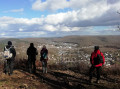
A very easy walk on perfectly flat terrain, ideal for Nordic walking or a walk in the fresh air on the outskirts of Charleville-Mézières. A pleasant route accessible to all, following well-maintained paths through meadows and along the banks of the Sormonne.

The terrain is ideal for maintaining a steady walking pace without any obstacles. Simple trainers or lightweight walking shoes are perfectly suitable.

Details

104901785
Creation:
Last update:
Last review:
  • Walking
    Activity: Walking
  • ↔
    Distance: 3.09 mi
  • ◔
    Average duration: 1h 35 
  • ▲
    Difficulty: Easy

  • ⚐
    Back to start: Yes
  • ↗
    Ascent: + 148 ft
  • ↘
    Descent: - 148 ft

  • ▲
    Highest point: 614 ft
  • ▼
    Lowest point: 466 ft
  • ⚐ Country: France
  • ⚐ City: Warcq (08000)
  • ⚑
    Start/End: N 49.783039° / E 4.683601°
  • ❏
    IGN map(s): Ref. 2909SB, 3009SB
  • Hour-by-hour weather

Description of the walk

Parking is available in the small, newly built housing estate on Chemin du Château d’eau, accessed from Boulevard Lucien Pierquier

(S/E) At the bend in the road, opposite the water tower, turn right onto a small tarmac road heading south-west, running alongside the meadows, known as La Hachette. This continues as a path to the left of a property. Follow the edge of the meadow until you reach the trees.

(1) Keep to the left onto a grassy path which joins a well-marked stony track (Chemin de Pisselotte). On your right, there is a fitness trail (useful for doing a few exercises as you go).
Carry on straight ahead and, when you reach the railway line, turn right, heading due west along the “La Chapellerie” path, running alongside the railway line. You will come to a level crossing.

(2) Turn left and cross the railway line (Caution: level crossing without barriers; take care when crossing, as trains run regularly. Hold children’s hands). Take the Route de Tourne to the right, heading west for about a hundred metres, until you reach the start of a path on the left.
Cross the road carefully to take this path and head straight down towards the River Sormonne (past the grey metal railing).

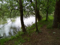
(3) Turn 90° to the left onto the path that joins the river and runs alongside it, enjoying the coolness of the water and the riverside vegetation. You’ll reach the junction with the D9 (Rue de la République)

(4) Cross carefully ( pedestrian crossing on the left) and take the wide path leading to the area known as La Grand Pâquis, following the Meuse on your right. You’ll come to a left-hand bend near the Amicale Canine grounds.

(5) Turn sharply left, then, at the next Fork in the road, take the left-hand branch of the path to reach the Promenade des Bertholet. Walk along it and cross at the first pedestrian crossing to follow the pavement on the right. After about 350 m, you’ll reach No. 21.

(6) Turn right onto the Chemin de la Pisselotte, leaving the Phinelec electricity company on your left. Keep to the right and begin a steep climb towards the level crossing.
Cross the railway line with care (level crossing without barriers). Continue along the track heading north-north-west until you reach a junction of tracks.

(7) Turn right onto the Chemin de la Pisselotte to reach the final stretch leading to the village and the N43.

(8) Turn left onto the pavement and walk for about 300 m along Boulevard Lucien Pierquin to reach Chemin du Château d’eau and the finish line in front of the water tower (S/E).

Waypoints

  1. S/E : mi 0 - alt. 614 ft - Water tower
  2. 1 : mi 0.19 - alt. 604 ft - Grassy path
  3. 2 : mi 0.74 - alt. 512 ft - Level crossing
  4. 3 : mi 1.06 - alt. 472 ft - Metal railing - Sormonne (rivière) - Affluent de la Meuse
  5. 4 : mi 1.45 - alt. 469 ft - D9 – Pedestrian crossing
  6. 5 : mi 2.07 - alt. 479 ft - Chemins junction - Meuse (fleuve)
  7. 6 : mi 2.39 - alt. 476 ft - Track junction
  8. 7 : mi 2.58 - alt. 551 ft - Track junction
  9. 8 : mi 2.86 - alt. 591 ft - N43 junction – Warcq entrance
  10. S/E : mi 3.09 - alt. 614 ft - Water tower

Notes

- There are no water sources along the route: make sure you bring enough water with you.
- Bring walking poles: even though the route is easy, ruts may have formed.
- Level crossings: our route crosses two level crossings on the section passing through Warcq (Charleville-Mézières–Hirson/Lille line); traffic is relatively light compared to major TGV or commuter lines. The average number of trains passing through is around 15 to 25 per day, all types combined: Passenger trains (TER): 10 to 14 TER services per day; and Freight trains: an average of 5 to 10 freight trains pass through each day.
Please take care when crossing the tracks

Worth a visit

Saint-Paul Church in Warcq
Saint Paul’s Church , designed by the architect Pierre Villière, was built in 1965. It stands in the Bellevue du Nord neighbourhood , within the municipality of Warcq, on the outskirts of Charleville-Mézières. Its overall shape resembles that of a tent, with a base that flares out slightly towards the rear. The walls are built of dark stone cut into elongated blocks , with light-colouredjoints . The church has a pitched roof covered in slate and is flanked at the rear by a bell tower with a square base and a three-sided pyramid roof, also covered in slate. One of these sides features several sound-absorbing panels and ispartially glazed. The front façade , which projects slightly out wards from the square, is covered only by the overhangingroof . It is entirely adorned with abstract , tinted stained-glass windows , designed by D. Dalia and crafted by Malherbe, which also feature at the junction of the wall and the ceiling. The laminated timber structure with curved rafters is visible inside; it harmonises with the panelled ceiling and the furnishings ,which consist of logbenches .
Address: Rue de Warcq

According to Pop Culture Heritage Platform


Gallo-Roman Baths These Gallo-Roman baths , remarkable for their opulence and impeccable condition, discovered on the outskirts of Charleville-Mézières, bear witness to a prestigious past buried beneath the soil of the Ardennes. This virtual tour offers you the chance to travel back to the 4th century and see what the baths were like in ancienttimes .
The preventive excavation at Warcq, ‘Simonelle, Sous le chemin de Tournes’, carried out in 2017, revealed what appears to be a section of a Roman villa with a centralcourtyard . The complete bath complex was discovered during field excavations carried out by the Ardennesarchaeological team .
This architectural complex , whose foundations and walls remain visible , houses several rooms intended for bathing, an ingenious heating system and various decorative features in white and colouredmarble . The layout of the bathing areas reflects a regressive design , where the apodyterium (changing room) opens directly onto the three bathing cubicles in succession. The praefurnium, where the fire is lit, lies in the extension of the hot room in the southernmost section of the structure (approximately 80 m²).
The state of preservation of the bathhouse is remarkable, as evidenced by the presence of some still-intact paving stones in the bathingrooms . The floor decoration is characterised by the presence of at least two ‘opus sectile’ patterns .The tepidarium features geometric figures , whilst the frigidarium is characterised by a chequerboard pattern , with these decorative elements comprising alternating shades of stone (bluish and white). The three bathing rooms also show traces of marble cladding at the base of the walls
, and it is likely that the upper part was painted in lightcolours .
Analysis of the structure has revealed four distinct periods of occupation dating from the 1st to the 4th century AD, each of which shows numerous signs of refurbishment. The scale of the preserved ruins , the presence of the original floors , and the richness of these thermal baths (area, cladding, ornate floors , etc.) make this site a unique testament to life in Warcq during Antiquity, as well as throughout the Ardennesregion .

According to the ‘Ardennes Culture and Heritage’ CD

Other walks in the area

For more walks, use our search engine .

The GPS track and description are the property of this route's author. Please do not copy them without permission.