Around Montcy-Notre-Dame

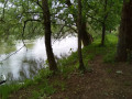
Hiking between the river and the forest. Observe the beaver lodges on the two islands of Montcy, on the Meuse, and their tracks along the river. Opportunity to visit the linen museum. In the past, many houses had a wash house and the inhabitants washed the laundry of the bourgeoisie of Charleville. Montcy-Notre-Dame was nicknamed Montcy-les-Linges.

Details

1805191
Creation:
Last update:
Last review:
  • Walking
    Activity: Walking
  • ↔
    Distance: 5.00 mi
  • ◔
    Average duration: 2h 35 
  • ▲
    Difficulty: Easy

  • ⚐
    Back to start: Yes
  • ↗
    Ascent: + 305 ft
  • ↘
    Descent: - 295 ft

  • ▲
    Highest point: 696 ft
  • ▼
    Lowest point: 456 ft

Photos

Description of the walk

Park in the car park to the left of the bridge when coming from Charleville-Mézières.

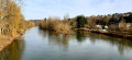
(S/E) Head left and walk along the island. Continue along the Meuse to the dam, go past it and reach the road. Turn right towards Montcy Notre Dame. After about 100 metres,

(1) Take the small road, Chemin de Chaumont, which climbs to the foot of a small tower. The route runs alongside a medical-educational institute. Take the path on the left, into the woods, which joins a road. Follow it to the right and you will reach a departmental road (D69). Turn right, taking care with the traffic, until you reach the crossroads at the waste collection centre.

(2) Just before the waste collection centre, turn right again and go down the path that leads to the Yame equestrian centre.

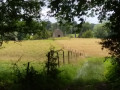
(3) After passing it, turn left onto a path in the woods that runs alongside a pasture. There is a short steep climb along this pasture. Continue to a farm building and climb up to the right.

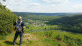
(4) At the top, turn left and follow the wide stony path through the forest, passing a building that used to house a sawmill. On the left, there is a viewpoint over part of Charleville and part of the route.

(5) After the sawmill, take the first path on the right (there is a barrier blocking the path, go around it). Descend through the woods to reach a path that heads to the right, quickly passing meadows where trees cut down by beavers are visible. Further on, the path joins another path that descends the hill.

(6) Turn left and join the tarmac Greenway. On the other bank, you can see the village of Aiglemont spread out across the hill. Pass in front of a World War II blockhouse, then in front of the second island of Montcy-Notre-Dame. You may be able to spot a beaver lodge here.

(7) After the island, leave the Voie Verte by taking a path on the right. You will arrive at the entrance to Montcy-Notre-Dame.

(8) Pass in front of the cemetery, remembering to read the maxim addressed to passers-by on a pillar at the main entrance. Reach the village square. The linen museum is located next to the town hall. Pass to the right of the church and look at the old tower overlooking the Meuse (beautiful view of the Montcy-Saint-Pierre district). Continue down Rue du Tarne on the right, then turn left onto Rue Principale to reach the car park on the right of the bridge (S/E).


Waypoints

  1. S/E : mi 0 - alt. 463 ft - Car park next to the bridge. - Meuse (fleuve)
  2. 1 : mi 0.93 - alt. 479 ft - Chaumont road
  3. 2 : mi 1.76 - alt. 610 ft - Crossroads at the waste collection centre.
  4. 3 : mi 2.24 - alt. 604 ft - La Yame equestrian centre
  5. 4 : mi 2.74 - alt. 692 ft - Large crossroads
  6. 5 : mi 3.14 - alt. 669 ft - After the old sawmill.
  7. 6 : mi 3.9 - alt. 459 ft - Greenway
  8. 7 : mi 4.27 - alt. 463 ft - Second island
  9. 8 : mi 4.69 - alt. 525 ft - Cemetery
  10. S/E : mi 5 - alt. 463 ft - Car park next to the bridge.

Notes

On the square in Montcy-Notre-Dame: newsagent selling local produce.
Bakery and butcher's shop.
Drinking water in the cemetery.
Before the Montcy-Notre-Dame bridge: Drinks.

Worth a visit

(Between S/E and 1) At the first third of the island, you can see a pile of branches, some of which have been stripped of their bark (the beavers' lodge). In winter, many great cormorants perch on the island and a few Canada geese and mute swans nest there in spring. See also the old Montcy baths where locals came to bathe in the Meuse until the late 1960s.

(1) Alternative: You can make a return trip (500 m) to the Abri Sainte-Thérèse in Waridon, where a grotto similar to the one in Lourdes has been built. The Way of the Cross on the hill consists of remarkable bronze statues. As you rejoin the trail, note the remains of the Château des Fées (or ruined castle), which were uncovered at the end ofthe 20th century. In the Middle Ages, the lord who occupied it used to ransom boats passing on the Meuse.
Places to visit in Waridon: Abri Sainte-Thérèse and its Way of the Cross.
Château Défait.
In Montcy Notre Dame: Linen Museum next to the town hall.

Reviews and comments

4.3 / 5
Based on 7 reviews

Reliability of the description
4.4 / 5
Ease of following the route
4.3 / 5
Route interest
4.3 / 5
User 22250407

Overall rating : 4 / 5

Date of your route : Sep 22, 2025
Reliability of the description : ★★★★☆ Good
Ease of following the route : ★★★★☆ Good
Route interest : ★★★★☆ Good
Very busy route : No

A lovely walk, very enjoyable to follow. At first, I wasn't keen on doing the Montcy Notre Dame walk, but honestly, I don't regret it. It's really good, with lots of woods 👍

Machine-translated

User 21461767

Overall rating : 4.7 / 5

Date of your route : Jul 26, 2025
Reliability of the description : ★★★★★ Very good
Ease of following the route : ★★★★☆ Good
Route interest : ★★★★★ Very good
Very busy route : No

A beautiful and very varied walk. I agree with one hiker's comment about the difficulty of finding the right path at point 3. At the same time, it's very relative because with the map we can easily find our way. Apart from that, we had a lot of fun.

Machine-translated

JFB-ARDENNES
JFB-ARDENNES

Overall rating : 5 / 5

Date of your route : Jul 30, 2023
Reliability of the description : ★★★★★ Very good
Ease of following the route : ★★★★★ Very good
Route interest : ★★★★★ Very good
Very busy route : No

Thank you for this hike dedicated to the Montcy Notre Dame forest. For anyone who may have doubts about following this route, I recommend using GPS guidance via the GPX file. For me, it was a wonderful discovery of an unknown trail.

Machine-translated

Philippe PAILLA
Philippe PAILLA

Overall rating : 4.7 / 5

Date of your route : Oct 22, 2022
Reliability of the description : ★★★★★ Very good
Ease of following the route : ★★★★★ Very good
Route interest : ★★★★☆ Good
Very busy route : No

At point 3, you must turn left immediately after passing the Yame equestrian centre. The path that branches off to the left into the woods is not very visible. One or two steps with wooden risers, which are also not very visible, mark the start of the climb.

Machine-translated

bozierbruno
bozierbruno

Overall rating : 4 / 5

Date of your route : Sep 01, 2019
Reliability of the description : ★★★★☆ Good
Ease of following the route : ★★★★☆ Good
Route interest : ★★★★☆ Good

A very pleasant walk on the outskirts of Charleville.

Three points to note

  • Shortly before the (1), a recently installed fence means you have to go past the lock to reach the road, then turn right to find the Chaumont path.
  • A private property sign at the entrance to the woods just past the equestrian centre raised a few questions.
  • After the (5), carried away by momentum, we descended to the altitude of 163 m.

Thank you for sharing this.
Bozier Bruno and Co.

Machine-translated

leflon08
leflon08

Overall rating : 3.3 / 5

Date of your route : Sep 02, 2019
Reliability of the description : ★★★☆☆ Average
Ease of following the route : ★★★☆☆ Average
Route interest : ★★★★☆ Good

Not easy when it comes to points 4 and 5.
What's more, I had forgotten my smartphone (so no Google Maps)!

Machine-translated

Martial Rando Geca
Martial Rando Geca

Overall rating : 4.7 / 5

Date of your route : Mar 21, 2019
Reliability of the description : ★★★★★ Very good
Ease of following the route : ★★★★★ Very good
Route interest : ★★★★☆ Good

A lovely walk, with one small downside: the Meuse was high, so one section was flooded.

Machine-translated

Other walks in the area

For more walks, use our search engine .

The GPS track and description are the property of this route's author. Please do not copy them without permission.