


picotel

 Visorando Member
 Premium user
 - Location: Araules (43200)
- Gender: man
Sign up:
Published route(s)
 Le Puy du Rocher as seen from Chambeuil
 13.58 mi
 +3,720 ft
 -3,704 ft
 7 hrs
7 hrs
 Very difficult
 Departure from Laveissière (Cantal)
To stay largely off the marked and well-trodden paths, the route to the summit starts from a fairly low point, following the very gentle ridge south of the Alagnon. This hike requires a good sense of direction due to the lack of signposting and sections through ‘summer pastures’ without a defined path; a GPS is a great help.
The return journey along the lower section follows a fairly long stretch of road, though it is very pleasant and has very little traffic.
Route on the Desaignes plateau
 11.37 mi
+1,939 ft
-1,936 ft
6h 55
11.37 mi
+1,939 ft
-1,936 ft
6h 55
 Moderate
Departure from Désaignes (Ardèche)
Moderate
Departure from Désaignes (Ardèche)
Walk along the slopes of the Sialle stream valley.
Paths rather than tracks, due to the lack of visitors to this isolated valley.
The route starts at the highest point, but the starting point in Desaignes is obvious when approaching from below.
Circular route to Rochepaule from Lac de Devesset.
 8.91 mi
+1,890 ft
-1,886 ft
5h 45
Moderate
Departure from Devesset (Ardèche)
8.91 mi
+1,890 ft
-1,886 ft
5h 45
Moderate
Departure from Devesset (Ardèche)
A route that is mostly shaded, following a wide variety of paths. Access to the lake, which has been developed, is 300m from the starting point. Route revised in September 2026 to correct sections that had become impassable!
I also suggest a circular route starting from Rochepaule.See practical information.
Circular in the Agueneyre valley starting from Rochepaule
 8.38 mi
+1,358 ft
-1,352 ft
5h 00
Moderate
Departure from Rochepaule (Ardèche)
8.38 mi
+1,358 ft
-1,352 ft
5h 00
Moderate
Departure from Rochepaule (Ardèche)
Up on the heights to the north of the Agueneyre valley and back along the river to the south, in the shade.On the way back, you’ll need to take a private track – not shown on maps – with a makeshift footbridge over the river.
The Pic du Lizieux via the "chemin des écoliers"
 6.41 mi
+1,325 ft
-1,312 ft
4h 05
Moderate
Departure from Araules (Haute-Loire)
6.41 mi
+1,325 ft
-1,312 ft
4h 05
Moderate
Departure from Araules (Haute-Loire)
A route exploring little-used paths and points of interest, an alternative to the marked trails.
Between Eyrieux and Saint-Julien-Labrousse
 6.12 mi
+1,440 ft
-1,467 ft
4h 05
Moderate
Departure from Saint-Julien-Labrousse (Ardèche)
6.12 mi
+1,440 ft
-1,467 ft
4h 05
Moderate
Departure from Saint-Julien-Labrousse (Ardèche)
A circular loop above the Eyrieux at the start, then a climb up the slopes of the Glo.Difficulty rating: Caution – navigation difficulties and paths may have disappeared on this route. See reviews
The Pic du Lizieux via the Mounier
7.83 mi
+1,243 ft
-1,257 ft
4h 40
Moderate
Departure from Saint-Jeures (Haute-Loire)
A variation on the climb up Lizieux that takes you to Mounier, a little-known peak overlooking Freycenet and the menhir above Monbuzat-La Chieze.
Walk along the Auze river in Araules-Saint-Jeures
 3.79 mi
+656 ft
-663 ft
2h 20
Moderate
Departure from Araules (Haute-Loire)
3.79 mi
+656 ft
-663 ft
2h 20
Moderate
Departure from Araules (Haute-Loire)
A short route to include as an alternative on your local walks that pass through Vareille and then the road, providing access to the Auze up to a little-known waterfall at the bottom of almost impassable gorges.
The paths not shown on the IGN map are nevertheless passable; the Auze is crossed via two large steps (requiring a bit of a jump) at one of the only possible points, regardless of the river’s level.
Route from Goudet via Camp d'Antoune
 7.27 mi
+1,391 ft
-1,381 ft
4h 35
Moderate
Departure from Goudet (Haute-Loire)
7.27 mi
+1,391 ft
-1,381 ft
4h 35
Moderate
Departure from Goudet (Haute-Loire)
Goudet is a crossing point on the Stevenson Trail (GR®70), which intersects with theGR®40, which we took for our departure.
Two notable points of interest: the Moulin du Rocher mill and its organ pipes, and the Camp d'Antoune with its bird's eye view of the Loire.
Above Rieutord
 8.37 mi
+1,132 ft
-1,125 ft
4h 50
Moderate
Departure from Usclades-et-Rieutord (Ardèche)
8.37 mi
+1,132 ft
-1,125 ft
4h 50
Moderate
Departure from Usclades-et-Rieutord (Ardèche)
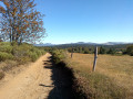
A walk that does not descend into deep valleys and offers lovely views in all directions, both of the Mezenc and, in the distance, of the Ventoux.
Circular route from Le Monastier-sur-Gazeille starting from Feycenet-la-Tour
 12.57 mi
+1,621 ft
-1,621 ft
7h 10
12.57 mi
+1,621 ft
-1,621 ft
7h 10
 Difficult
Departure from Freycenet-la-Tour (Haute-Loire)
Difficult
Departure from Freycenet-la-Tour (Haute-Loire)
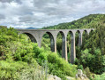
Descent to Le Monastier via little-used paths from the curious alluvial plain pond, less original return via the GR®. With an optional final circular loop offering views of the Mine stream valley.
Cross the famous Recoumène Viaduct and visit Le Monastier.
Le Testavoyre via La Roche de Carle
 9.95 mi
+1,860 ft
-1,854 ft
6h 10
Moderate
Departure from Araules (Haute-Loire)
9.95 mi
+1,860 ft
-1,854 ft
6h 10
Moderate
Departure from Araules (Haute-Loire)
A route offering the chance to explore the Roche de Carle, a little-visited rock formation situated above the Auze at the headwaters of the river. Starts from Araules, returns via the Testavoyre.
Gorges de l'Auze depuis Araules
 2.64 mi
+541 ft
-568 ft
1h 40
Moderate
Departure from Araules (Haute-Loire)
2.64 mi
+541 ft
-568 ft
1h 40
Moderate
Departure from Araules (Haute-Loire)
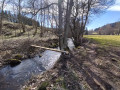
New section through the deep gorges of the Auze downstream from Araules, inaccessible in places if the stream is too high. Obstacles remain following the mini-tornado a few years ago, but they can still be crossed. The path is poorly marked in places; ribbons tied to branches and blue markers are there to help with navigation!