Le Testavoyre via La Roche de Carle

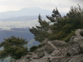
A route offering the chance to explore the Roche de Carle, a little-visited rock formation situated above the Auze at the headwaters of the river. Starts from Araules, returns via the Testavoyre.

Details

4347353
Creation:
Last update:
Last review:
  • Walking
    Activity: Walking
  • ↔
    Distance: 9.95 mi
  • ◔
    Average duration: 6h 10 
  • ▲
    Difficulty: Moderate

  • ⚐
    Back to start: Yes
  • ↗
    Ascent: + 1,860 ft
  • ↘
    Descent: - 1,854 ft

  • ▲
    Highest point: 4,678 ft
  • ▼
    Lowest point: 3,241 ft

Photos

Description of the walk

Car park at the bottom of Araules towards Saint-Jeures, before the bridge over the Auze.

(S/E) Head south towards the hamlet of La Salce and arrive at the Auze.

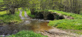
(1) Leave the path and cross the ‘Roman Bridge’ over the Auze, then climb steadily through the Lizieux forest along a very damp, somewhat difficult path until you reach a more clearly marked and signposted track.

(2) Turn right towards the south and then right again three times at each junction until you reach the hamlet of Mirandes. Head uphill to join the Tour du Lizieux road by taking a short cut to the right.

(3) Leave the road – which is now unpaved – and follow a small track running through a meadow until you reach a road leading to Arnissac. You’ll need to cross a few electric wires. Leave the hamlet via the southern exit.

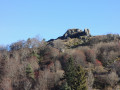
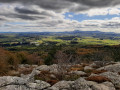
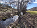
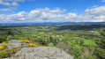
(4) Head down to the right, towards the west, to reach the foot of the Roche de Carle via a very little-used path, with more electric fences to cross as well as the small stream (the source of the Auze) via a small footbridge made of three pieces of wood, then climb straight up to the top of the very steep beech forest. An ideal spot for a picnic at the summit.
Unfortunately, this rock is on private land; however, you can continue along the path westwards, which remains on public land, and find yourself at point 5.

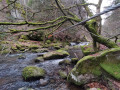
(5) Then head down between the rocks on the western side, cross the Auze and follow the pretty path back up to the departmental road.

(6) After 50 m along the D42 heading north-west, head up to the left until you reach the entrance to the hamlet of Les Sagnes, where you’ll join a signposted path on the right. Head up to the left along this path, which leads onto a wide track through the state-owned forest.

(7) First turn right then left, then right twice, each time for about 50 metres, to join theGR®40, which climbs to the summit of Testavoyre, crossing a small road.

(8) From the summit, head downwards, staying on theGR®, until you reach the D18. Cross the main road carefully and continue for about twenty metres.

(9) Turn right onto theGR® 65 –GR® 430, cross the D42 and continue to the foot of Araules, just before the stream.

(10) Leave theGR® route before the stream and continue to the right along a path that leads back to the car park where you started (S/E).

Waypoints

  1. S/E : mi 0 - alt. 3,251 ft - Car park at the foot of Araules. D18
  2. 1 : mi 0.41 - alt. 3,287 ft - The Roman Bridge - Auze (rivière)
  3. 2 : mi 0.94 - alt. 3,684 ft - PR junction
  4. 3 : mi 2.4 - alt. 3,944 ft - Exit from the forest road
  5. 4 : mi 2.97 - alt. 3,763 ft - Descent towards the Rocher de Carle
  6. 5 : mi 3.4 - alt. 3,917 ft - La Roche de Carle
  7. 6 : mi 3.69 - alt. 3,809 ft - Crossing the departmental road
  8. 7 : mi 4.9 - alt. 4,367 ft - Wide forest track
  9. 8 : mi 5.75 - alt. 4,678 ft - Le Testavoyre
  10. 9 : mi 7.28 - alt. 4,072 ft - GR junction
  11. 10 : mi 9.65 - alt. 3,310 ft - End of the GR
  12. S/E : mi 9.95 - alt. 3,248 ft - Car park at the foot of Araules. D18

Notes

In Araules, there is a bakery and grocery shop, and a cheese shop with a visitor gallery.

Always be cautious and plan ahead when you're outdoors. Visorando and the author of this route cannot be held responsible for any accidents occurring on this route.

The GR® and PR® markings are the intellectual property of the Fédération Française de Randonnée Pédestre.

Reviews and comments

4 / 5
Based on 4 reviews

Reliability of the description
4 / 5
Ease of following the route
4.3 / 5
Route interest
3.8 / 5
SOLIGNAC
SOLIGNAC

Overall rating : 4 / 5

Date of your route : Jan 08, 2024
Reliability of the description : ★★★★☆ Good
Ease of following the route : ★★★★★ Very good
Route interest : ★★★☆☆ Average
Very busy route : No

Nothing special, apart from the testavoyre

Machine-translated

picotel
picotel

The path to the Rocher de Carle has been cleared; the most direct route is the one that’s ‘in plain sight’ through the steeply sloping woodland, but you can follow the path to the right after crossing the stream (do not enter the fir woodland), a path that winds round to the house south of the rock, and from there climb towards the summit, up the gently sloping rock face.
This summit is very rarely visited, which explains the lack of a marked path.

Machine-translated

picotel
picotel

Access to Carle Rock isn’t easy from the north: drive by sight, cross the streams, climb over the fences …

Machine-translated

lucreceneige
lucreceneige

Overall rating : 3.7 / 5

Date of your route : Dec 05, 2022
Reliability of the description : ★★★☆☆ Average
Ease of following the route : ★★★☆☆ Average
Route interest : ★★★★★ Very good
Very busy route : No

It can be difficult to follow as the path disappears; you’ll need a compass to rejoin the GR within the first hour of walking.
Otherwise, a very beautiful route off the beaten track.

Machine-translated

Stephane S.
Stephane S.

Overall rating : 4.7 / 5

Date of your route : Oct 10, 2021
Reliability of the description : ★★★★★ Very good
Ease of following the route : ★★★★★ Very good
Route interest : ★★★★☆ Good
Very busy route : No

A lovely route. A bit muddy at the start (from point 1 to point 2). I couldn’t find the path leading to the top of the Roche de Carle. That said, the woodland is magnificent. A lovely route.

Machine-translated

picotel
picotel

Thank you for your comments. Please note that my routes are always a bit of a hidden gem; for other types of route, there are the tourist office brochures!

Machine-translated

• Edited:

The user account associated with this content has been deleted.

Other walks in the area

For more walks, use our search engine .

The GPS track and description are the property of this route's author. Please do not copy them without permission.