Between Eyrieux and Saint-Julien-Labrousse

A circular loop above the Eyrieux at the start, then a climb up the slopes of the Glo.
Difficulty rating: Caution – navigation difficulties and paths may have disappeared on this route. See reviews

Details

n°1552877
Creation:
Last update:
Last review:
  • Walking
    Activity: Walking
  • ↔
    Distance: 6.12 mi
  • ◔
    Average duration: 4h 05 
  • ▲
    Difficulty: Moderate

  • ⚐
    Back to start: Yes
  • ↗
    Ascent: + 1,440 ft
  • ↘
    Descent: - 1,467 ft

  • ▲
    Highest point: 2,106 ft
  • ▼
    Lowest point: 1,188 ft

Photos

Description of the walk

Start at the small pass at Les Vernets on the D241A between Le Cheylard and Saint-Julien Labrousse.

(S/E) A large part of the first section of the route follows theGR®® 420, marked in red and white; take this straight away, heading slightly downhill towards the south, below the road. Pass through the hamlets of Le Trible and Trouiller-dessus, and reach the point overlooking the Eyrieux.

(1) Turn eastwards towards the hamlet of Le Serre. Here, a lovely winding descent leads to the lowest point of the walk, in the Glo valley.

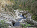
(2) Leave the main path here and take a narrower track that climbs slightly to the left. This is still theGR®®, but the markings are very faded. You’ll reach a small gorge overlooking the Glo, with a chain to hold on to for safety. Pass under a natural dolmen.

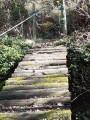
(3) Cross the Glo via a wooden footbridge which is in a rather precarious condition; take care where you step. Walk alongside the hamlet of Péaillères on the overgrown path. You’ll come out onto the road; turn right here heading south for about a hundred metres, then take a path that cuts across the circular loop in the road. Follow this path on to Roissac.

(4) At the crossroads, turn left onto a small, quiet road. Follow it to the bottom of a small valley on the outskirts of the hamlet of Maleval.

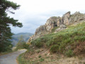
(5) Here, let theGR®® head off to the right; keep left on the road. Pass through the hamlets of Maleval and Bardèche to reach a rocky outcrop marked ‘Ruins of Rochemure Castle’.

(6) Stay on the road and you’ll soon reach the hamlet of Mourier, following the red and yellow markings ofthe VernouxGRP® ®. You’ll come to another crossroads.

(7) Leave the road, keep left on theGRP®® and head down towards Le Glo. You’ll reach a hairpin bend.

(8) Head straight ahead and follow the path as it winds until you reach the small removable wooden footbridge crossing the stream. On the other bank, follow the stream downhill for about fifty metres to admire the small waterfall amongst the smooth rocks and its natural pools. Head back up to the path that crosses the hamlet of Les Granges.

(9) Take the road on the right for a few metres and head left up the granite-gravel path to Les Vernets, then on to L’Albouret to return to the car park (S/E).

Waypoints

  1. S/E : mi 0 - alt. 2,103 ft - Col à l’Albouret on the D241A, overlooking the - Eyrieux (rivière) à finaliser
  2. 1 : mi 0.63 - alt. 1,834 ft - Above the Eyrieux
  3. 2 : mi 1.8 - alt. 1,188 ft - Glo Valley
  4. 3 : mi 1.96 - alt. 1,224 ft - Worn footbridge
  5. 4 : mi 2.48 - alt. 1,785 ft - Roissac
  6. 5 : mi 3.43 - alt. 2,011 ft - Maleval
  7. 6 : mi 4.33 - alt. 2,034 ft - Ruins of Rochemure Castle
  8. 7 : mi 4.58 - alt. 1,988 ft - Path after Mourier
  9. 8 : mi 4.96 - alt. 1,791 ft - Exit from the marked path
  10. 9 : mi 5.31 - alt. 1,719 ft - Les Granges
  11. S/E : mi 6.12 - alt. 2,103 ft - Col à l’Albouret on the D241A

Worth a visit

In autumn, remember to bring a bag and some gloves to collect chestnuts along the way.

Always be cautious and plan ahead when you're outdoors. Visorando and the author of this route cannot be held responsible for any accidents occurring on this route.

The GR® and PR® markings are the intellectual property of the Fédération Française de Randonnée Pédestre.

Reviews and comments

3.1 / 5
Based on 4 reviews

Reliability of the description
2.5 / 5
Ease of following the route
2.3 / 5
Route interest
4.5 / 5
armelle42
armelle42

Overall rating : 3.3 / 5

Date of your route : Oct 02, 2023
Reliability of the description : ★★★☆☆ Average
Ease of following the route : ★★☆☆☆ Disappointing
Route interest : ★★★★★ Very good
Very busy route : No

Like many others, I got lost at n2 – I went too far down – but luckily I met someone who pointed me in the right direction. Actually, the path is between two large rocks with an orange arrow on them
As for the famous bridge, it’s actually quite safe – it’s just the way it looks.
Luckily I had the GPS route, otherwise… …
The scenery is magnificent! I’ll definitely be doing it again now that I’ve got my bearings sorted.

Machine-translated

dorian2000
dorian2000

Overall rating : 3 / 5

Date of your route : Apr 19, 2022
Reliability of the description : ★★☆☆☆ Disappointing
Ease of following the route : ★★☆☆☆ Disappointing
Route interest : ★★★★★ Very good
Very busy route : No

Walk completed on 17 April 2022.
A very scenic walk, but the route is difficult to follow.
At point 2: Do not go down to the stream. The path to take runs above the stream’s gorges.
Between points 7 and 9: The descent takes place amongst the chestnut trees as there is no longer a visible path.

I do not recommend this walk to anyone without experience in navigation.

Machine-translated

Philou 26
Philou 26

Overall rating : 2.7 / 5

Date of your route : Oct 24, 2021
Reliability of the description : ★★☆☆☆ Disappointing
Ease of following the route : ★★☆☆☆ Disappointing
Route interest : ★★★★☆ Good
Very busy route : No

This walk is not recommended for those who are not in good physical condition. Do not attempt it without a GPS and a route marked on a map. We had the Visorando app and still had to turn back several times to find the right route, as the paths to take are not very visible. For example, we didn’t pass point 2 – we didn’t see the path, so we missed the dolmen. Take care at point 3 – there’s a rather daunting footbridge to cross; we crossed it anyway, albeit with some trepidation. Otherwise, it’s a lovely walk with superb views.

Machine-translated

Loelo
Loelo

Overall rating : 3.3 / 5

Date of your route : Jul 06, 2020
Reliability of the description : ★★★☆☆ Average
Ease of following the route : ★★★☆☆ Average
Route interest : ★★★★☆ Good
Very busy route : No

There are too many inaccuracies in the markings and descriptions, which makes it difficult to find your way. At point no. 2 (or 3), when you reach the very bottom at L’Eyrieux, it’s difficult to find the little path on the left that leads back up the Glo. At point no. 9, you have to ‘navigate by sight’ – there’s no path, no markings… It’s tricky once again.

Machine-translated

Thierryb26
Thierryb26

Hello,
Thank you for this route,

I see that the route passes through the hamlet of Péaillères – is there no longer any dispute with the landowner whose property borders the path?

Machine-translated

Other walks in the area

For more walks, use our search engine .

The GPS track and description are the property of this route's author. Please do not copy them without permission.