


manuuher

 Visorando Member
 Premium user
 - Location: Cholet (49280|49300)
- Gender: man
Sign up:
Published route(s)
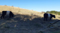
 The battlefield of the Wars of the Vendée around Cholet
 4.65 mi
 +121 ft
 -102 ft
 2h 15
2h 15
 Easy
Easy
 Departure from Cholet (Maine-et-Loire)
This route, created during the land consolidation linked to the construction of the motorway, takes you alongside the many streams of this cattle-rearing plateau, runs alongside the Angers–Cholet–Nantes railway line, then past Cholet-Le Pontreau aerodrome, before returning to the starting point. You’ll pass a viewpoint just before arriving.
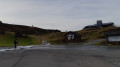
Around Issarbe from the Nordic Centre
 2.20 mi
+331 ft
-322 ft
1h 20
Easy
Departure from Lanne-en-Barétous (Pyrénées-Atlantiques)
2.20 mi
+331 ft
-322 ft
1h 20
Easy
Departure from Lanne-en-Barétous (Pyrénées-Atlantiques)
This path follows a cross-country ski trail in winter (provided there’s snow!). I walked it in the middle of winter as there wasn’t enough snow. It can be done on foot. There’s very little elevation gain, making it an easy, family-friendly walk.
 Around Sèvremoine
 19.92 mi
+407 ft
-427 ft
4 hrs
19.92 mi
+407 ft
-427 ft
4 hrs
 Moderate
Departure from Saint-Macaire-en-Mauges (Maine-et-Loire)
Moderate
Departure from Saint-Macaire-en-Mauges (Maine-et-Loire)
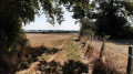
A beautiful loop, passing by two beautiful bodies of water, around Saint-Macaire-en-Mauges and Saint-André-de-la-Marche, forming the commune of Sèvremoine, alternating between main roads (very few), small roads, dirt tracks for tractors, and a few footpaths.
Circular route between Tiffauges and Boussay along the Sèvre river
 9.69 mi
+440 ft
-413 ft
4h 50
Moderate
Departure from Tiffauges (Vendée)
9.69 mi
+440 ft
-413 ft
4h 50
Moderate
Departure from Tiffauges (Vendée)
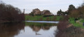
This route offers magnificent views of Tiffauges Castle, especially at the end, or what remains of it, the famous Bluebeard's Castle.
It runs largely along the Sèvre Nantaise stream.
Note that this route can be shortened halfway by taking the Pont de la Grossière bridge. This halves the time and distance for little legs.
On the other hand, the second part is wilder and more bucolic.
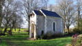
Between Vezins and Saint-Georges-des-Gardes via the Étang des Noues
 22.81 mi
+837 ft
-810 ft
3 hrs
Moderate
Departure from Vezins (Maine-et-Loire)
22.81 mi
+837 ft
-810 ft
3 hrs
Moderate
Departure from Vezins (Maine-et-Loire)
Circular mountain bike route on roads and tracks.
You’ll pass two beautiful buildings: the Chapelle de la Planche Grelet and the Abbaye de Notre-Dame des Gardes.
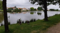
The Three Streams Trail around Saint-Léger-sous-Cholet
 6.88 mi
+79 ft
-79 ft
3h 15
Moderate
Departure from Saint-Léger-sous-Cholet (Maine-et-Loire)
6.88 mi
+79 ft
-79 ft
3h 15
Moderate
Departure from Saint-Léger-sous-Cholet (Maine-et-Loire)
Pleasant circular route around Saint-Léger-sous-Cholet that takes you past three streams.
This route can be done by mountain bike as there are good sections of road and the other paths aren’t too narrow.
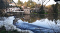
From La Grossière to Rousselin via Boussay
 8.04 mi
+518 ft
-525 ft
4h 10
Moderate
Departure from Boussay (Loire-Atlantique) (Loire-Atlantique)
8.04 mi
+518 ft
-525 ft
4h 10
Moderate
Departure from Boussay (Loire-Atlantique) (Loire-Atlantique)
A lovely walk along the banks of the Sèvre, linking the two walks ‘From La Grossière to Tiffauges ’ and ‘L’Annérie and the Rousselin Mill’.
If you take a short detour, you’ll discover two magnificent viewpoints overlooking the Sèvre Nantaise.
Follow the yellow and red signposts.
Lake Estaens as seen from Les Forges d’Abel
 5.93 mi
+1,998 ft
-1,978 ft
4h 30
Moderate
Departure from Borce (Pyrénées-Atlantiques)
5.93 mi
+1,998 ft
-1,978 ft
4h 30
Moderate
Departure from Borce (Pyrénées-Atlantiques)
This circular route takes you to Lake Estaens from Les Forges d’Abel.
It is also possible to do this hike as a return trip from Sansanet; this route is described on the Lac d’Estaens information sheet
The route suggested here is a circular route offering a variety of scenery.
Please note that this walk is slightly more vertiginous than the other one, in that reaching the lake requires using a small ladder attached to the rock face and a few handrails – though it is completely safe. Alternatively, it can be done as an ascent, which is less vertiginous than a descent.
Although the route is not signposted, it is very well maintained and it is impossible to get lost. However, it is advisable to follow the route on the app to ensure you don’t get lost.
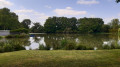
La Glaise and the ponds
 8.48 mi
+1,302 ft
-1,476 ft
5h 00
Moderate
Departure from Vezins (Maine-et-Loire)
8.48 mi
+1,302 ft
-1,476 ft
5h 00
Moderate
Departure from Vezins (Maine-et-Loire)
This loop will take you past countless (private) ponds, mostly through woodland. As its name suggests, the path can be muddy, especially in wet weather.This hike is best done in summer, when the paths are shaded and less muddy.There are many variations that allow you to shorten the loop.
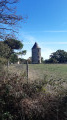
The lake and windmills of Péronne as seen from Chanteloup-les-Bois
 6.41 mi
+66 ft
-72 ft
3h 00
Moderate
Departure from Chanteloup-les-Bois (Maine-et-Loire)
6.41 mi
+66 ft
-72 ft
3h 00
Moderate
Departure from Chanteloup-les-Bois (Maine-et-Loire)
A short, figure-of-eight walk that takes you past two ponds – one public and one private – as well as an old mill. You can walk around the Étang de Péronne, or even have a picnic there on one of the many benches provided. You can also park 200 metres upstream from the point (6) on the other side of the dam. For those with a hearty appetite, the Moulin restaurant is also available. Much of this walk takes place in the forest.