


 Country:
 City:
City:


Start from the Vezins industrial estate, Rue du Chapelet.
(S/E) Head north and leave the industrial estate via Rue du Chapelet. At the junction on the outskirts of Vezins, continue along the path opposite (closed to all motorised vehicles) and then cross the four-lane road.
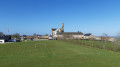
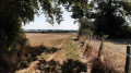
Enjoy the beautiful panoramic view of the region. You’ll notice, in particular, the Abbey of Notre-Dame des Gardes, which you’ll reach later.
Then walk straight on for about 200 metres downhill until you reach a three-way junction.
(1) Continue straight on and rejoin the road after walking past the small pond on your right. Follow the road to La Martinière.
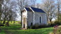
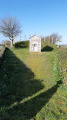
(2) At the Treize Croix crossroads, head straight ahead and walk behind a rather unusual religious monument. Carry on straight ahead along the path, ignoring the turnings leading to the farms. Leave the tarmac behind after the hamlet of La Boutière and, once you’ve crossed the stream, take the path on the left that runs alongside it. You’ll reach the fork at the Chapelle de la Planche Grelet.
A picturesque spot where you can take a break at the tables provided, whilst respecting the site, which is generally well maintained.
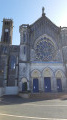
(3) Continue along the path, which keeps climbing until it reaches the road. Carry on uphill to the right, passing through La Basse Sauvagère. Do not take the first left, but continue climbing up to the Abbey of Notre-Dame des Gardes.
You can stop off here and, for example, do a spot of shopping at the shop run by the monks. Another option is to visit the orientation point, which is situated due east in a park. From there, you’ll be treated to a magnificent panoramic view of the surrounding countryside.
(4) Carry on to the right along Rue du Monastère, which winds round the abbey on your left, and head downhill for about 500 metres until you reach the start of thefirst path on the left. Be careful not to miss it.
(5) Follow this track and go round the Haute Garde farm on the left. Then continue to the right along the road to the crossroads where there is a wayside cross.
(6) Turn left and carry on to La Picoulière; at the bend to the right, take the path that climbs up between the villa and the farm.
(7) At the road, turn left onto the dead-end track. The road ends in a track; continue along it. At the end, first turn right then left and take the path at the corner of No. 12. At the end of this, follow the road to the left and, at the four-way junction, carry on straight ahead. Walk alongside the boundary wall of the Château de la Giraudière on your left until you reach the farm in the hamlet of La Giraudière.
(8) Continue along the road to the right and, at the bend just before La Brunetterie, take the path straight ahead. Pass through La Grenauderie and continue along the tarmac road. At the crossroads with a wayside cross, carry on straight ahead along the path which is closed to all motor vehicles except for agricultural access. Ignore a turn-off to the right and reach the next 90° bend to the right, where a path branches off opposite.
(9) Carry on straight ahead, taking the path that passes in front of a small pond and leads to La Barre. At the hamlet, turn left and ignore the access road leading into it. Follow the path straight ahead until you reach the tarmac road.
(10) Take the road on the right. Cross the D960 with care and carry on straight ahead, towards Les Poteries. You’ll reach La Cloterie just after the hamlet known as La Gare.
(11) Take the path on the right, which is reserved for farm traffic. Walk alongside a pond on your right, then another on your left, with a small copse in the centre on your left. At the end of the straight stretch, turn left. At the four-way junction, go straight on, cross a stream and head towards Les Bourneaux. Continue to the right and then right again onto the Allée des Bois. A few metres further on, you’ll reach the first path branching off to the right.
(12) Follow this path as it leads into the woodland and carry on straight ahead to the other end of the wood, before La Gilbertière.
(13) At the edge of the woodland, turn left onto the path and then carry on along the road.
(14) At the T-junction, take the road on the right towards Nuaillé and, at the D148, carry on straight ahead.
(15) At the roundabout, turn left onto the D960. Follow this until you see the D200 on your left, signposted for Mazière-en-Mauges. Follow this road, leave Nuaillé and enter the forest.
You can take the main path, which is suitable for cyclists and pedestrians.
Cross the Ruisseau de chez Blanche, ignore three forest track junctions on the right and join a track on the right.
(16) Follow it straight on until you reach the Étang des Noues. Walk round the pond anti-clockwise, keeping to the left at each fork. Walk past the car park, then head back into the forest after passing the riding centre.
(17) At the three-way junction, leave the path that goes round the picnic area and continue to the right. At the D200, cross over and carry on straight ahead until you reach the D148 at the Carrefour des Quatre Seigneurs.
(18) Cross the road and immediately take the signposted path which veers to the right. At the edge of the woodland, turn left and, at the corner of the field, turn right. Follow this path, which runs more or less along the edge of the woodland, cross a road and rejoin the tarmac at a place called Le Petit Bois.
(19) Ignore the signposted path that branches off to the right and continues to the Étang de Péronne (a dead end) and take the road opposite. Follow it until you rejoin the route you previously took at Les Bourneaux.
(12) Continue straight on, cross the Ruisseau de chez Blanche and you’ll reach a road.
(20) First turn left then right, and take the path almost directly opposite. Walk past the sewage treatment works, follow a pond on your left and reach a cross-path.
(21) Turn left and keep to the right until you reach the road. Continue along this road until you reach the junction at La Moutinerie.
(22) Carry on straight ahead along the path reserved for farm traffic and reach the entrance to Vezins, generally keeping the same direction. At the road, turn right, then take Rue du Chapelet on the left opposite the Gendarmerie to reach the (S/E).

 Visorando Member
 Easy
Easy 
