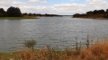
The battlefield of the Wars of the Vendée around Cholet

This route, created during the land consolidation linked to the construction of the motorway, takes you alongside the many streams of this cattle-rearing plateau, runs alongside the Angers–Cholet–Nantes railway line, then past Cholet-Le Pontreau aerodrome, before returning to the starting point. You’ll pass a viewpoint just before arriving.

Details

2538183
Creation:
Last update:
Last review:
  • Walking
    Activity: Walking
  • ↔
    Distance: 4.65 mi
  • ◔
    Average duration: 2h 15 
  • ▲
    Difficulty: Easy

  • ⚐
    Back to start: Yes
  • ↗
    Ascent: + 121 ft
  • ↘
    Descent: - 102 ft

  • ▲
    Highest point: 482 ft
  • ▼
    Lowest point: 341 ft
  • ⚐ Country: France
  • ⚐ City: Cholet (49280|49300)
  • ⚑
    Start/End: N 47.073957° / W 0.855681°
  • ❏
    IGN map(s): Ref. 1424SB
  • Hour-by-hour weather

Photos

Description of the walk

Park in the Champ du Bois car park, Rue de Tours.

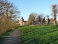
(S/E) Head north and cross a small stream. Immediately afterwards, turn right and follow the track running alongside the stream on the right-hand side. At a three-way junction, take the track on the right, still following the stream.

(1) Cross the stream and turn left. Continue along the stream on your left, ignoring the path on the left that leads to Le Grand Patis. After about a hundred metres, turn left and cross the stream again.

(2) Cross the road and continue along the path opposite. Then turn right. Head towards the bank of the La Bellivière stream, turn left and follow the stream.

(3) Cross the road and continue along the path opposite, following the stream. Before reaching a railway line, turn left. After about 400 metres, turn right and join the railway line.

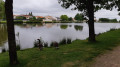
(4) Turn left and follow the railway line on your right-hand side. Further on, pass between the railway line and a small pond. The path runs between the railway line and the pond.

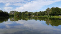
(5) At the end of the pond, just before a level crossing, turn sharply left. Then veer to the right. At the fork, take the path that goes straight on and runs alongside Cholet aerodrome (on your right). The path continues further on to the left (south-east). Pass a large pond about a hundred metres away on your left. Join a tarmac road and continue south.

(6) Take thefirst left into the industrial estate and cross through it. At the end of the road, at the junction, turn left.

(7) 50 metres before leaving Cholet (town boundary sign), take the path hidden in the thuja tree-lined avenue on the right, next to a sign (see photo). Then carry on straight ahead, climbing the hill towards the top. Pass the sign telling you to carry on straight ahead.

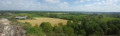
(8) Once you reach the top, there is a beautiful 300° view of Cholet. Head back down the winding path, which ends in the woodland. At the junction, turn right to return to the starting point (S/E).

Waypoints

  1. S/E : mi 0 - alt. 387 ft - Champ du Bois car park
  2. 1 : mi 0.63 - alt. 364 ft - Crossing watercourses
  3. 2 : mi 0.96 - alt. 377 ft - Road crossing
  4. 3 : mi 1.53 - alt. 348 ft - Road crossing
  5. 4 : mi 2.1 - alt. 361 ft - Railway line
  6. 5 : mi 2.62 - alt. 390 ft - End of the pond
  7. 6 : mi 3.75 - alt. 420 ft - Industrial estate
  8. 7 : mi 4.18 - alt. 410 ft - Path through the thuja trees
  9. 8 : mi 4.27 - alt. 472 ft - Towards the panoramic viewpoint
  10. S/E : mi 4.65 - alt. 387 ft - Champ du Bois car park

Notes

The entire walk follows a track suitable for vehicles. There are few, if any, proper footpaths.
It can be done on foot or by bike (mountain bike).

Worth a visit

Towards the end of the walk, you may spot some Galloway cattle (long-haired) taking part in ecological grazing.
The route ends in an industrial estate, which is the least interesting part, but finishes on a high note with a panoramic view of Cholet at a historic site commemorating the Battles of the Vendée on 17 October 1793. However, the orientation board is no longer there.

Reviews and comments

3.8 / 5
Based on 4 reviews

Reliability of the description
3.8 / 5
Ease of following the route
3.3 / 5
Route interest
4.3 / 5
lespiquet
lespiquet

Overall rating : 4.3 / 5

Date of your route : Jan 05, 2026
Reliability of the description : ★★★★☆ Good
Ease of following the route : ★★★★☆ Good
Route interest : ★★★★★ Very good
Very busy route : No

A very pleasant hike in the sunshine. At the end, the view of the town of Cholet from above is very beautiful.

Machine-translated

Corciulo Giuseppe
Corciulo Giuseppe

Overall rating : 2.3 / 5

Date of your route : Jun 30, 2023
Reliability of the description : ★★☆☆☆ Disappointing
Ease of following the route : ★★☆☆☆ Disappointing
Route interest : ★★★☆☆ Average
Very busy route : No

It was impossible to follow the route description (which wasn’t very clear). There were no signposts.

Machine-translated

manuuher
manuuher

That’s right. Thanks to your comment, I went back to the spot in question (I work right next door) and there is indeed a possible route right next to it to avoid the area closed to the public.
The only drawback is that you really need to spot the path that starts from the road.
I’ll amend the route accordingly.

Machine-translated

Véro66
Véro66

Overall rating : 3.3 / 5

Date of your route : Aug 22, 2022
Reliability of the description : ★★★★☆ Good
Ease of following the route : ★★☆☆☆ Disappointing
Route interest : ★★★★☆ Good
Very busy route : No

Hello,
Two-thirds of this walk are very pleasant. However, there is a problem with the route; luckily I had the app with GPS to help me find my way, as there were very few signposts along the entire route.
What’s more, I think there have been some changes, as at the end of the route I had to go through an area closed to the public (in the town of Cholet) to reach the finish. On a Sunday, it’s no problem to slip through unnoticed, but I’m not sure about the rest of the time.
It would be a good idea to review the final section of the route.

Machine-translated

roro49
roro49

Overall rating : 5 / 5

Date of your route : Apr 19, 2021
Reliability of the description : ★★★★★ Very good
Ease of following the route : ★★★★★ Very good
Route interest : ★★★★★ Very good
Very busy route : No

It’s not very busy on Sundays, which is better, but the signposting is poor towards the end of the walk

Machine-translated

Other walks in the area

For more walks, use our search engine .

The GPS track and description are the property of this route's author. Please do not copy them without permission.