Country:
 City:


Starts from the Place de l’Église in Le May-sur-Èvre.
Red signposting
(S/E) Take Rue Pasteur towards Trémentines, heading north-east. Carry on straight ahead until you leave the built-up area. At the roundabout, take the left-hand exit and carry on straight ahead.
(1) Pass the large statue of the Virgin and Child, which stands at a crossroads. Leave it on your right and carry on straight ahead until you reach a shrine.
(2) Turn right towards the hamlet of Red Cross. The road overlooks the village of Le May-sur-Èvre. Carry on straight ahead along the road until you reach a Stop sign.
(3) At the Stop sign, take the road on the left for a few metres.
(4) At the next crossroads with a cross, take the road on the right towards the hamlet of La Poisetière. Pass through this hamlet and carry on straight ahead; this is where the tarmac road ends. Continue along the dirt track through the meadows, where you may spot some cows. The track descends and then climbs again after crossing the stream. Once you reach La Gastine, the track becomes passable again and turns right until you reach a crossroads where there is a statue of the Virgin Mary in a niche.
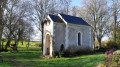
(5) Take a moment to admire the statuette in its niche – quite a surprising sight in this spot (see photo). Continue along the road to the right, straight on, until you reach the Moulin de Pégon.
(6) After crossing the stream at Moulin de Pégon, take the road that climbs to the left towards the south and walk for about 600 metres until you reach a path branching off to the right.
(7) Leave the road and follow this track, which gets narrower and narrower, until you reach the Caltière farm. Go round it on the right (there’s a shortcut straight ahead, not necessarily suitable for mountain bikes but possible on foot).
(8) When you reach the road, turn left and follow it to the next junction.
(9) Follow signs for “La Bourie”. Take the path straight ahead, ignoring the private track on the right that leads to the farm. Continue straight on along the path, which becomes more picturesque as it runs alongside the Ruisseau du Cazeau.
At the hamlet of La Malville, ignore the tarmac road and continue left onto a track. At the T-junction, turn right and join a road.
(10) Turn right and carry on for about 1 km.
(11) Just before the turn-off for La Grande Haie, take the path branching off to the left which leads into the countryside.
(12) When you reach the road, do not take it; instead, follow the path that climbs to the right, heading due north. Pass La Retière; the path becomes passable again until you reach a fairly major road (D15).
(13) Follow this road to the right for 500 m until you reach a crossroads.
(14) Take the path leading off to the left, opposite the road on the right. The path continues between the road and a field, then turns 90° at the end of the field. After another right-angle bend to the right, carry on straight ahead until you reach a road.
(15) Turn right, pass the Chapelle des Fossés and enter May-sur-Èvre. Cross the Boulevard du Huit Mai 1945 and, at the end of Rue Honoré Neveu, turn left then right in front of the church to return to the starting car park (S/E).

 Visorando Member

 Easy