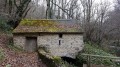
Around Issarbe from the Nordic Centre

This path follows a cross-country ski trail in winter (provided there’s snow!). I walked it in the middle of winter as there wasn’t enough snow. It can be done on foot. There’s very little elevation gain, making it an easy, family-friendly walk.

Details

3034603
Creation:
Last update:
Last review:
  • Walking
    Activity: Walking
  • ↔
    Distance: 2.20 mi
  • ◔
    Average duration: 1h 20 
  • ▲
    Difficulty: Easy

  • ⚐
    Back to start: Yes
  • ↗
    Ascent: + 331 ft
  • ↘
    Descent: - 322 ft

  • ▲
    Highest point: 4,921 ft
  • ▼
    Lowest point: 4,629 ft

Photos

Description of the walk

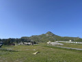
Park in the car park at the Issarbe Nordic Centre, which is designated for cross-country skiing starts in winter.

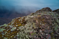
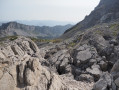
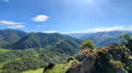
(S/E) Head north-west towards the Col de Hournères after crossing the road leading to the car park. Pass the restaurant and refreshment bar at the top and take the path below, which isn’t very clearly marked. The scenery is magnificent, with unobstructed views of the mountains. The path then continues in hairpin bends before moving onto another side of the mountain.

(1) At this point, a signpost provides a summary of the walk. This sign describes the cross-country ski trails. Carry on straight ahead and ignore the hairpin bend that branches off to the left above the sign. You’ll reach the orientation table.

(2) Do not take the balcony path to the left, but head down along the ridge to a wider path, which you should take to the left, heading south-east. Follow this path through the woodland until you reach the road.

(3) Walk alongside it, turning left: watch out for cars, but the road seems to have little traffic. Return to the starting car park (S/E).

Waypoints

  1. S/E : mi 0 - alt. 4,642 ft - Car park at the Issabe Nordic Centre
  2. 1 : mi 0.7 - alt. 4,911 ft - Signpost.
  3. 2 : mi 0.81 - alt. 4,918 ft - Orientation board
  4. 3 : mi 1.9 - alt. 4,721 ft - Road junction - Col de la Hourcère (1438m}
  5. S/E : mi 2.2 - alt. 4,629 ft - Car park at the Issarbe Nordic Centre

Notes

Bring a cap in summer as the first section is in direct sunlight.
In winter, make sure the area is clear for walking.

Worth a visit

(2) Halfway along the route, there is an orientation board providing information on the Pyrenean mountain landscape.
The walk is divided into two sections: the first section is in open terrain (take care in summer as it is in direct sunlight) and the second section is through woodland.

Reviews and comments

4.5 / 5
Based on 2 reviews

Reliability of the description
4.5 / 5
Ease of following the route
5 / 5
Route interest
4 / 5
User 25913528

Overall rating : 4.7 / 5

Date of your route : Jun 02, 2025
Reliability of the description : ★★★★★ Very good
Ease of following the route : ★★★★★ Very good
Route interest : ★★★★☆ Good
Very busy route : No

A lovely walk

Machine-translated

ludovic80500
ludovic80500

Overall rating : 4.3 / 5

Date of your route : Jul 29, 2024
Reliability of the description : ★★★★☆ Good
Ease of following the route : ★★★★★ Very good
Route interest : ★★★★☆ Good
Very busy route : No

An easy route – perfect for the start of the holidays to get you up and running.

Machine-translated

Other walks in the area

For more walks, use our search engine .

The GPS track and description are the property of this route's author. Please do not copy them without permission.