Country:
 City:
City:


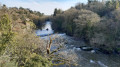
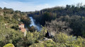
You can start the walk at La Grossière, but there aren’t many parking spaces available – just a few in a car park reserved for a restaurant. It is easier to park in Boussay, in the square by the dance school, after point (6). It is actually better to set off from there so that you can check whether the Rousselin footbridge is passable, which is not always the case. It is then easy to turn back.
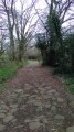
(S/E) After leaving your car at La Grossière, head out of the hamlet towards the north-west, climbing slightly to the left. Pass a few houses below you and continue along the road, which quickly turns into a path known as the Sentier des Trois Provinces.
(1) Carry on climbing along this path, which overlooks the valley. Keep going straight on until the path enters a forest.
(2) Just after turning left, cross the stream using the large stones placed there for this purpose. It’s a truly picturesque spot. The path then climbs again until it reaches a junction.
(3) Carry on straight ahead along the road, following it for about 1 km. Watch out for cars, although they are fairly rare. Carry on until you spot a path on the left.
(4) Between two bends, leave the road and turn left, whilst the road continues to climb. The path then descends to a picnic area on the right.
(5) A few dozen metres from the river, turn right, heading due west, to reach the picnic area with toilet facilities at the water’s edge. 500 m further on, the path joins a road behind a factory, an industrial mill (flour mill). Continue along this road, keeping straight on, until you reach a fork.
(6) Carry on to the right along the road that climbs up to the right towards Boussay (yellow and red signposts). Head for the dance school car park (another starting point), then turn left onto Boulevard de Sèvre and follow it for about a hundred metres.
(7) Turn right onto Rue de Clémenceau for 50 metres, then turn left onto Avenue des Mimosas, which ends in a path leading down towards the River Sèvre; follow this path.
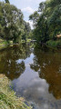
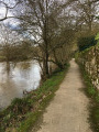
(8) Just before you reach the very bottom, at the water’s edge, take a short detour to the left to admire two magnificent successive views of the river, offering a superb vantage point overlooking the Sèvre. There are signposts to help you find your way. It’s a bit of a climb, but nothing too strenuous. Turn back. At the foot of the river, turn left to walk alongside the Sèvre until you reach the hamlet of Le Rousselin. Walk behind the restaurant/inn where the footbridge is located.
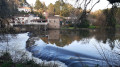
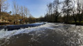
(9) Cross it whilst admiring the magnificent reflections and eddies created by the Sèvre at this spot. Please note: the footbridge has no guardrails, so cross at your own risk. The planks are also a bit worn. Once on the other side, turn left. The path widens and climbs towards the Grand Goulet, where it joins a road. Continue straight on along this road until you reach the main crossroad.
(10) Cross it carefully and join theGRP® Sèvre et Maine, a path overlooking the region. In the distance stands the church at Boussay. Ignore a path on the right and head towards a junction of paths and roads.
(11) Take care: do not follow the path straight ahead, but take the road that descends to the left, towards La Tuaudière, for about 200 metres. You’ll reach a fork in the road.
(12) Do not continue towards La Tuaudière, but turn left onto the path which joins the road; cross this road again with care. The path winds its way down to the Sèvre Nantaise.
(13) Pass the Bapaume mill, which has been converted into a lodge. Rooms are available to rent depending on the season. Continue along the path, following the river, until it joins a road. At the stop sign, take the road to the left for just under 100 metres, taking care.
(14) Then leave the road and head for the picnic area by the water’s edge on the right. There is a signpost – a Yellow Cross – which might suggest you are straying from the path, but this is not the case. Continue along the path that runs alongside the Sèvre Nantaise until you reach a bend that climbs towards the south-south-west. The path then turns into a track suitable for vehicles.
(15) At the crossroads, turn left until you reach another road at a junction.
(16) Take the road on the left, towards the hamlet of La Poinsetière. Walk through the hamlet, then head down towards the Sèvre again for 200 metres.
(17) Leave the main track and follow a path on the right which leads down to the riverbank. You will eventually reach a road (D102).
(18) Turn sharply left – taking care – onto this road, which takes you back to La Grossière after crossing the Sèvre one last time (S/E).

 Visorando Member
 Easy
Easy 
 Tourist office