Route of wind turbines around Saint-Christophe-du-Bois

This route combines two walks around Saint-Christophe-du-Bois.
The full route is described starting from the town centre.
Finally, there is an alternative route connecting (1) directly to (4) via a footpath.

Details

n°3231679
Creation:
Last update:
Last review:
  • Mountain biking
    Activity: Mountain biking
  • ↔
    Distance: 9.33 mi
  • ◔
    Duration according to the author: 1.5 hrs 
  • ▲
    Difficulty: Easy

  • ⚐
    Back to start: Yes
  • ↗
    Ascent: + 236 ft
  • ↘
    Descent: - 223 ft

  • ▲
    Highest point: 456 ft
  • ▼
    Lowest point: 262 ft
  • ⚐ Country: France
  • ⚐ City: Saint-Christophe-du-Bois (49280)
  • ⚑
    Start/End: N 47.028244° / W 0.945533°
  • ❏
    IGN map(s): Ref. 1424SB

  • ◶
    Type of surface:
  •  
     
     
    ■ 20% Road ■ 25% Byway ■ 55% Path
  • ⇧
    Bike carrying: Not specified
  • ▲
    Difficulty: Easy
  • Hour-by-hour weather

Photos

Description of the route

Park either in the Place de l’Église, which has a car park, or at point 2.

(S/E) Leave the village heading north, taking Rue Pasteur then Rue de la Sallette. Go past the roundabout and continue out of the village, still heading north.
Follow the road, which runs along a plateau offering unobstructed views.

(1) After 1.5 km, you’ll reach the start of the wind turbine route. You can take this to reach point 3. This is an alternative route that shortens the walk by 1.5 km. From here, you can make a detour to the Pont de la Rousse by taking the path on the other side of the road (1 km round trip heading east).

(2) After another 1.5 km, take the path branching off to the left heading south. You can park at the start of this path to avoid the 3 km drive from the village.

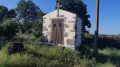
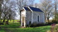
(3) The path and its alternative route join at the “Notre-Dame-de-Pitié” Chapel (see photo). Just beyond this, the road ends at a crossroads. Leave the road and take the footpath that continues straight ahead.

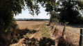
(4) Walk along the right-hand side of the hamlet of Les Quatre Chênes without entering it. Continue along the path which runs behind the farmyard.

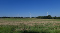
(5) The path reaches the edge of a field where there is a lovely view of the wind turbines (see photo). A sign warns that you are entering private property and should respect the landowner’s rights. Walk along the right-hand side of this field and turn left 200 metres further on. Continue walking along the edge of the field heading south-west.

(6) Once you reach the road, turn right onto it and follow it for about a hundred metres. The path then continues on the left.

(7) Do not take the path that branches off to the right. Carry on straight ahead towards the west.

(8) The path takes a hairpin bend, heading south-east. It widens enough for a four-wheel drive vehicle!

(9) You’ll reach the car park, where you can end the walk here. Ideally, you should have two cars so you can pick one up here. Otherwise, walk along the road for 1.5 km.

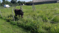
(10) Turn right at a place called La Choltière, where you might be lucky enough to spot a pony (see photo). Continue along the track heading south-east, which turns into a footpath.

(11) Pass the junction and carry on heading south. 500 m further on, the path turns left, then right again 500 m further on.

(12) You’ll then reach the road at a place called La Gauvière. Follow it back to Saint-Christophe-du-Bois and the car park at Place de l’Église (S/E).

Waypoints

  1. S/E : mi 0 - alt. 318 ft - Start 1 from the village
  2. 1 : mi 1.24 - alt. 312 ft - Start of the official wind turbine route
  3. 2 : mi 2.11 - alt. 318 ft - Start 2
  4. 3 : mi 3.05 - alt. 312 ft - Junction with the alternative route
  5. 4 : mi 3.89 - alt. 335 ft - The Four Oaks
  6. 5 : mi 4.3 - alt. 404 ft - Entrance to the field
  7. 6 : mi 4.66 - alt. 404 ft - End of the trail.
  8. 7 : mi 5.24 - alt. 440 ft - Carry on straight ahead
  9. 8 : mi 5.34 - alt. 449 ft - Hairpin bend.
  10. 9 : mi 6.32 - alt. 449 ft - Car park 3. Intermediate arrival point.
  11. 10 : mi 7.34 - alt. 354 ft - La Choletière
  12. 11 : mi 7.62 - alt. 364 ft - Junction
  13. 12 : mi 8.11 - alt. 348 ft - Return via the road
  14. S/E : mi 9.33 - alt. 318 ft - Arrival in the village

Notes

This hike can be done as a circular route by mountain bike or on foot between points (1) and (10), which is the most interesting section. You can either walk back or leave a vehicle at each end.
Take care when mountain biking: some sections of the trail are narrow, particularly between waypoints (4 and 5).
Please be considerate of walkers.

Worth a visit

At point (1), you can take a detour to see the old Gallo-Roman Pont de la Rousse.
The Pont de la Rousse, whose two arches span the Copechanière stream, was built in the Gallo-Roman period on the ancient Roman road. It was a crossroads where the roads from Le Longeron, Torfou and La Séguinière met, leading towards Cholet.
(3) The beautiful Chapel of La Pitié. The Chapel of Notre-Dame de Pitié (near La Proutière) dates from 1689. It stands on the old Roman road leading to the Pont de la Rousse. In days gone by, people would come here on pilgrimage to place fearful children under the protection of the Virgin Mary, particularly to encourage them to take their first steps.
You can also visit the Notre-Dame-de-Lourdes Grotto at the entrance to the village of Saint-Christophe.

Reviews and comments

4.2 / 5
Based on 2 reviews

Reliability of the description
4.5 / 5
Ease of following the route
4 / 5
Route interest
4 / 5
Françoislerandonneur

Overall rating : 4.7 / 5

Date of your route : Apr 12, 2023
Reliability of the description : ★★★★★ Very good
Ease of following the route : ★★★★★ Very good
Route interest : ★★★★☆ Good
Very busy route : No

An easy walk… A wide variety of scenery and pleasant surroundings, particularly this spring as nature comes to life!

Machine-translated

didfly
didfly

Overall rating : 3.7 / 5

Date of your route : Aug 23, 2020
Reliability of the description : ★★★★☆ Good
Ease of following the route : ★★★☆☆ Average
Route interest : ★★★★☆ Good
Very busy route : No

A walk. Enjoyable. There were some discrepancies between the route shown on the map and the signposting, but it was easy to find your way.

Machine-translated

For more walks, use our search engine .

The GPS track and description are the property of this route's author. Please do not copy them without permission.