Country:
 City:
City:


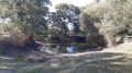
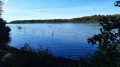
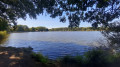
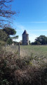
You can park in the Place de l’Église in Chanteloup-les-Bois or in the car park opposite the town hall.
Unless otherwise stated in the description, follow the blue markings.
(S/E) Leave the church car park and first turn right then left at the corner by the town hall to follow the Route de Vezins (D147).
(1) Take the second left, Rue de la Fontaine, and follow this road to the end.
(2) At the junction, take the second left (south-west), Chemin de la Foulette, and you’ll come out onto the D158.
(3) Follow the road to the left for about 500 metres.
(4) Take the first road on the right, the D196. Ignore the turn-off on the left for the hamlet of Le Pied de la Bauge and continue until you reach a Fork in the road marked by a cross. Then turn right onto a small road that leads into the forest.
(5) Pass the Étang de Cayenne (private property) and continue straight on through the forest until you reach the Carrefour des Quatre Allées.
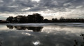
(6) Turn right towards the Étang de Péronne (marked ‘Verte’ as an exception). The tarmac road then begins and continues to the edge of the pond.
(7) Turn left and walk along the pond on your right. You’ll come out onto a small road; follow it to the left for about 200 metres: old windmills.
(8) Then turn left towards a restaurant. Pass it and continue along the road as it heads into the forest.
(6) Once back at the Carrefour des Quatre Allées, turn right. Follow a wide forest track for about 1 km. Cross the D196 carefully and continue along the track opposite; you’ll soon reach a junction.
(9) Turn left. You’ll soon reach the D196; follow it to the right, taking care. Ignore the first road on the right and pass the hamlet known as Le Bocage. Continue for a further 250 m or so until you reach another junction.
(10) Turn right here. Shortly afterwards, at the hamlet of Les Guérineaux, turn left and pass a sewage treatment plant. When the road bends sharply to the right at the hamlet known as La Chesnaie, carry on straight ahead along a track.
(11) At the T-junction, turn right.
(12) At the next junction (chapel), turn left onto a small road. At the end, turn right at the corner of the church and you’ll immediately find the car park on your right (S/E).
 Visorando Member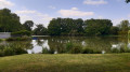

 Tourist office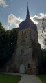
 Easy
Easy