


kris.teyran

 Association / Club / Walk leader
PRO  Premium user
Premium user Sign up:
Published route(s)
 Col de Porte
 7.07 mi
 +1,358 ft
 -1,358 ft
 4 hrs
4 hrs
 Average
 Departure from Sarcenas (Isère)
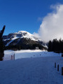
In the heart of the Chartreuse mountains, the Col de Porte is a former family ski resort whose ski lifts are now closed. The paths are more or less well marked allowing you to enjoy the trails on cross-country skis or snowshoes. The proposed circuit climbs through forest, coming out on a crest and offers superb views over the entire Chartreuse mountain range.
 Saint-Maximin - Uzès
 7.30 mi
+794 ft
-801 ft
4h 05
Average
Departure from Saint-Maximin (Gard)
7.30 mi
+794 ft
-801 ft
4h 05
Average
Departure from Saint-Maximin (Gard)
A route that starts in the heath and climbs up ancient paths to the heart of Uzès. Take a short tour of the town and descend via the pleasant green area around the Eure fountain. Then climb back up to "the Mountain" (as it is called), where you can enjoy a superb view of the bishopric of Uzès. The return journey through the woods and heath is dotted with drystone shelters.
Le Roc de la Vigne
 7.90 mi
+2,211 ft
-2,211 ft
5h 35
7.90 mi
+2,211 ft
-2,211 ft
5h 35
 Difficult
Departure from Saint-Guilhem-le-Désert (Hérault)
Difficult
Departure from Saint-Guilhem-le-Désert (Hérault)
This trek works its way up from the Hérault valley to Roc de la Vigne. Leaving the village, off the beaten tracks, you'll explore Forêt Domaniale de Saint-Guilhem-le-Désert on cobblestone roads. Along the way, the remains of old farms, caves, a semi-troglodyte retreat and a breath-taking view from the top of Roc de la Vigne.
The Pic de Nore
 6.26 mi
+1,598 ft
-1,601 ft
4h 15
Average
Departure from Pradelles-Cabardès (Aude)
6.26 mi
+1,598 ft
-1,601 ft
4h 15
Average
Departure from Pradelles-Cabardès (Aude)
Pic de Nore is the highest point of the Montagne Noire (1,211 m). The climb is fairly easy from the typical village of Pradelles Cabardès. It mainly takes you through beech forests with views of moorland offering superb panoramas to the south over the Pyrenees and to the north over the Espinouse.
In addition to the Pic de Nore, which offers a magnificent 360° view, this circuit allows you to visit the "Cabane d'Hélène" menhirs and the famous ice houses of Pradelles.
The Col de la Caumette
 8.71 mi
+866 ft
-866 ft
4h 45
Average
Departure from Valleraugue (Gard)
8.71 mi
+866 ft
-866 ft
4h 45
Average
Departure from Valleraugue (Gard)
When it's very hot in the plains, there's nothing like coming to cool off on a short route in the Aigoual forest on its northern slope.
Wine tour in Teyran
 4.35 mi
+167 ft
-138 ft
2h 10
4.35 mi
+167 ft
-138 ft
2h 10
 Easy
Departure from Teyran (Hérault)
Easy
Departure from Teyran (Hérault)
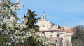
This short route of the commune of Teyran will take you to wine tasting cellars and show you around the old village.
Col de Menée - Mont Barral
 4.46 mi
+1,791 ft
-1,811 ft
3h 35
Average
Departure from Percy (Isère)
4.46 mi
+1,791 ft
-1,811 ft
3h 35
Average
Departure from Percy (Isère)
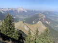
Are you looking for fresh air and wide open spaces with breathtaking views of the Vercors mountain range and the Ecrins massif? This moderately difficult hike will give you the feeling of being high in the mountains.
The Oppidum of Nage and Langlade Mill in Saint-Dionisy
 6.22 mi
+866 ft
-850 ft
3h 35
Average
Departure from Saint-Dionizy (Gard)
6.22 mi
+866 ft
-850 ft
3h 35
Average
Departure from Saint-Dionizy (Gard)
Not far from Nîmes, Roman and Gallo-Roman ruins are legion (so to speak). Castellas, an oppidum and a Roman fountain mark this route on the hill of Roque-de-Vif, surrounded by four charming villages in the Vaunage region: Saint-Dionisy to the north, Nages and Solorgues to the south, and Langlade to the east with its pretty mill.
From Boulbon to Frigolet
 8.37 mi
+1,043 ft
-1,024 ft
4h 45
Average
Departure from Boulbon (Bouches-du-Rhône)
8.37 mi
+1,043 ft
-1,024 ft
4h 45
Average
Departure from Boulbon (Bouches-du-Rhône)
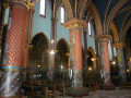
From the beautiful medieval village of Boulbon, you can reach the Abbey of Saint-Michel de Frigolet, dear to Père Gaucher, inventor of his famous liqueur, via the Montagnette. On the way back, you will pass the cross and the Romanesque chapel of Saint-Julien. And finally, the fully restored Moulin Bonnet and the feudal castle of Boulbon.Moderator's note: reviews of this hike indicate that it is useful to use a GPS or the Visorando app.
Bois de Paris
 6.72 mi
+755 ft
-774 ft
3h 45
Average
Departure from Aspères (Gard)
6.72 mi
+755 ft
-774 ft
3h 45
Average
Departure from Aspères (Gard)
In the heathland hinterland between Sommières and Quissac, this wild, wooded hill dominates the Vidourle valley and offers a beautiful view to the south, all the way to the sea.
The Col de Finiels
 4.51 mi
+423 ft
-423 ft
4 hrs
Easy
Departure from Le Pont-de-Montvert (Lozère)
4.51 mi
+423 ft
-423 ft
4 hrs
Easy
Departure from Le Pont-de-Montvert (Lozère)
The Col de Finiels is the road crossing over Mont Lozère, between its two peaks, Finiels and Pic Cassini. This means that, once out of the woods, on the moors and peaks, the views are extraordinary, sometimes to the south over the Cévennes, to the north over the chain of volcanoes, and to the east, further away, when the weather is clear, over the Alps.
The Montcalmès plateau
 9.14 mi
+906 ft
-925 ft
5h 00
Average
Departure from Puéchabon (Hérault)
9.14 mi
+906 ft
-925 ft
5h 00
Average
Departure from Puéchabon (Hérault)
(Warning) Part of the route is closed by municipal order. See comments posted on 15 February and 12 May 2025.
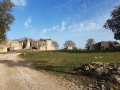
From the Montcalmès plateau, near Puéchabon, you can see the exit of the Hérault gorges with a breathtaking view of the legendary village of Saint-Guilhem-le-Désert. This small plateau, once grazed by sheep, is home to some beautiful sheepfolds, some of which have been abandoned. Below, the Saint-Sylvestre-des Brousses chapel is worth a visit, as is the famous Pont du Diable (Devil's Bridge).
The mills of Fontvieille
 6.36 mi
+528 ft
-531 ft
3h 25
Average
Departure from Fontvieille (Bouches-du-Rhône)
6.36 mi
+528 ft
-531 ft
3h 25
Average
Departure from Fontvieille (Bouches-du-Rhône)
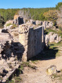
Climb up into the heath in search of the remains of a Gallo-Roman aqueduct. Visit the windmills of Fontvieille. Discover the ruins of the imposing Roman water mill at Barbegal and the aqueduct crossing the Vallon des Arcs.
Le Coulazou
 9.22 mi
+722 ft
-715 ft
4h 50
Average
Departure from Cournonterral (Hérault)
9.22 mi
+722 ft
-715 ft
4h 50
Average
Departure from Cournonterral (Hérault)
Starting from the beautiful medieval village of Cournonterral, this loop trail runs through heathland and plunges into the small gorges of Coulazou.
The Opies Tower
 8.47 mi
+1,375 ft
-1,368 ft
5h 05
Difficult
Departure from Eyguières (Bouches-du-Rhône)
8.47 mi
+1,375 ft
-1,368 ft
5h 05
Difficult
Departure from Eyguières (Bouches-du-Rhône)
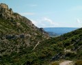
The Tour des Opies is the highest point in the Alpilles mountain range, rising to 498 m and offering a 360° panoramic view of the Durance plain, the Rhône, the Comtat Venaissin, the Camargue plain and the Crau plain as far as the Étang de Berre. The route, located in the Alpilles Natural Park, begins in the wooded valley of Les Glauges. It leads to the ruins of a Gallo-Roman villa. On the way back, a visit to the charming village of Aureille is a must.
Saint-Guiral from the Col de l'Homme Mort
 6.54 mi
+863 ft
-860 ft
3h 45
Average
Departure from Aumessas (Gard)
6.54 mi
+863 ft
-860 ft
3h 45
Average
Departure from Aumessas (Gard)
Saint-Guiral, the legendary rock of the Aigoual massif, can be reached from the Col de l'Homme Mort. The first part overlooks the upper Vis valley. The view stretches from Pic d'Anjau to the whole of Séranne. From the summit of Saint-Guiral, you can enjoy a 360° view. But you'll need to climb with your hands!
In the second part, the trail is off the beaten track and runs alongside the charming Crouzoulous stream. It will take you to the beautiful abandoned farm of Grandesc Haute, lost in the forest.
Mirabel circuit
 4.84 mi
+505 ft
-505 ft
2h 40
Easy
Departure from Alboussière (Ardèche)
4.84 mi
+505 ft
-505 ft
2h 40
Easy
Departure from Alboussière (Ardèche)
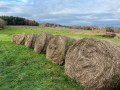
This short circuit, near Alboussière, alternates between wooded passages, opening onto pretty panoramas, and typical hamlets: the countryside wins us over!
Corniche de la Vis starting from Blandas
 6.39 mi
+646 ft
-627 ft
3h 30
Average
Departure from Blandas (Gard)
6.39 mi
+646 ft
-627 ft
3h 30
Average
Departure from Blandas (Gard)
From the cliff edge, there is an exceptional bird’s-eye view of the Navacelles cirque.The Blandas Causse lies at an average altitude of 700 metres, offering unobstructed views of the surrounding region. The vegetation here presents a striking contrast, with its black pines, cedars, boxwoods and meadows. This Causse also harbours numerous prehistoric remains.
The tunnels and hills of Sernhac
 6.10 mi
+958 ft
-961 ft
3h 40
Average
Departure from Sernhac (Gard)
6.10 mi
+958 ft
-961 ft
3h 40
Average
Departure from Sernhac (Gard)
Sernhac is located on the route of the Roman aqueduct, between the Pont du Gard and Nîmes.
In the middle of the nearby heath, two tunnels dug into the limestone rock are the remains of this aqueduct.
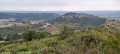
Continuing the walk, you will visit an old windmill. You will then climb Ferraud Hill, offering beautiful views of the lower Rhône Valley, the Alpilles, and more. Then, on Marduel Hill, overlooking Remoulin and the Gardon River at its end, the view extends all the way to Ventoux.
The Col des Fosses and La Rouvrière at the start of Colognac
 7.28 mi
+1,467 ft
-1,440 ft
4h 40
Average
Departure from Colognac (Gard)
7.28 mi
+1,467 ft
-1,440 ft
4h 40
Average
Departure from Colognac (Gard)
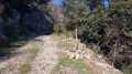
Situated at an altitude of 600 m, on the foothills of the Cévennes, Colognac is a village with typical Cévennes character. The lush vegetation of the meadows, chestnut trees and oaks contrasts sharply with the arid heath. We are in the mountains. From the Col des Fosses (900 m), the views stretch northwards over the Borgne valley as far as the Barre des Cévennes, and south-westwards over the Viganais and beyond. At the start, the Mouleyrette mill is a little gem.
Le Bois des Coufines: a balcony overlooking the Gardon, with arches and caves
 6.29 mi
+968 ft
-988 ft
3h 45
Average
Departure from Cabrières (Gard)
6.29 mi
+968 ft
-988 ft
3h 45
Average
Departure from Cabrières (Gard)
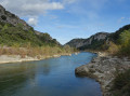
This walk is only permitted from 1 July to 14 JanuaryThis route, on the right bank of the Gardon, alternates between balcony-like paths overlooking the Gardon Gorges with unobstructed views to the north, then descends to river level and climbs back up through a wild ravine. On the higher ground, the cliffs feature arches and caves carved into the limestone.Moderator’s note: Please note that some sections of the trail are in poor condition; see the warnings
Du château de Montlaur au Ruisseau du Braou
3.25 mi
+220 ft
-220 ft
1h 40
Easy
Departure from Montaud (Hérault)
Du charmant petit hameau de Montlaur, on chemine parmi le vignoble et les oliveraies entrecoupés de bosquets. Depuis la crête de Coste Bertine, la vue s'étend au Sud vers le littoral et jusqu'au Ventoux à l'Est. On termine par la visite des ruines de ce fantastique château.
The Chapel of Aleyrac and the Cammaous Bridge
 7.94 mi
+387 ft
-404 ft
4h 00
Average
Departure from Vacquières (Hérault)
7.94 mi
+387 ft
-404 ft
4h 00
Average
Departure from Vacquières (Hérault)
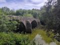
This short hike, located between the villages of Fontanès and Vacquières, crosses the famous vineyards of Pic Saint-Loup and forests of pine and holm oak, leading you to a superb chapel listed as a historic monument and the 11th-century Pont des Cammaous bridge.
The hamlet of Cézas and the Priory of Saint-Martin
 3.99 mi
+928 ft
-948 ft
2h 40
Easy
Departure from Sumène (Gard)
3.99 mi
+928 ft
-948 ft
2h 40
Easy
Departure from Sumène (Gard)
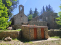
The hamlet of Cézas, in the commune of Sumène, clings to an altitude of 650 m between the Cagnasses and Fage mountains, in the heart of a national forest. This short mid-mountain route alternates between numerous shaded passages and views of the Cévennes and beyond. On the way, a visit to the 12th-century Priory of Saint-Martin is a must, offering a peaceful spot for a picnic.
Circular of the karstic cave and Bois de Long cave in Brissac
 4.85 mi
+902 ft
-896 ft
3h 00
Average
Departure from Brissac (Hérault)
4.85 mi
+902 ft
-896 ft
3h 00
Average
Departure from Brissac (Hérault)
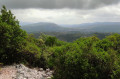
Brissac Park is home to numerous springs that form the Avèze River, creating a haven of coolness. The eastern slope of Bois de Long is home to karstic caves and sinkholes. On our route, we will visit the Aven de la Dame, the Bois Long cave and the Rabanel chasm.
Candillargues, Étang de l'Or
 7.58 mi
+7 ft
-7 ft
3h 30
Average
Departure from Candillargues (Hérault)
7.58 mi
+7 ft
-7 ft
3h 30
Average
Departure from Candillargues (Hérault)
Natura 2000 site closed from 1 April to 30 June 2024
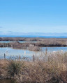
At the eastern end of the Étang de Mauguio, a multitude of marshes separated by canals are home to all kinds of birds from the Petite Camargue, a protected site of the Étang de l'Or.
Please note: access to the marshes is closed from 1 April to 30 June so that the birds can lay and hatch their eggs in peace.
From the Térondel Ecomuseum to the Col de Faubel
 7.88 mi
+843 ft
-843 ft
4h 20
Average
Departure from Saint-Sauveur-Camprieu (Gard)
7.88 mi
+843 ft
-843 ft
4h 20
Average
Departure from Saint-Sauveur-Camprieu (Gard)
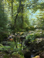
This route, in the Aigoual National Forest, is a cool haven when it’s hot in the heath. It first follows the River Trévezel and passes through forests of fir, spruce and ancient beech trees.
Mont Haut and Ermitage du Bois de Monnier
 7.44 mi
+1,283 ft
-1,289 ft
4h 30
Difficult
Departure from Montoulieu (Hérault) (Hérault)
7.44 mi
+1,283 ft
-1,289 ft
4h 30
Difficult
Departure from Montoulieu (Hérault) (Hérault)
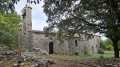
Mont Haut, isolated between the Alzon valley and the Pompignan plain, offers breathtaking views of the entire Cévennes region as far as the Aigoual massif. Hidden away in its holm oak woods is a hermitage, a true haven of peace.
Mont Gaussier, Rocher des Deux Trous and Grotte des Peirou
 6.12 mi
+1,348 ft
-1,352 ft
4h 00
Difficult
Departure from Saint-Rémy-de-Provence (Bouches-du-Rhône)
6.12 mi
+1,348 ft
-1,352 ft
4h 00
Difficult
Departure from Saint-Rémy-de-Provence (Bouches-du-Rhône)
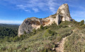
After admiring the Roman monuments of Les Antiques, hikers will set off on a short route through the Alpilles, featuring exposed sections and leading to small peaks offering breathtaking views.
Along the Gave de Brousset from Soques
 2.62 mi
+584 ft
-594 ft
1h 45
Easy
Departure from Laruns (Pyrénées-Atlantiques)
2.62 mi
+584 ft
-594 ft
1h 45
Easy
Departure from Laruns (Pyrénées-Atlantiques)
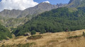
A round trip along the Gave de Brousset, offering superb views of the surrounding mountains. The route is often shaded. If you are not sensitive to the cold, you can swim in the river.
Circular Caylar route via La Couvertoirade
 9.07 mi
+541 ft
-564 ft
4h 40
Average
Departure from Le Caylar (Hérault)
9.07 mi
+541 ft
-564 ft
4h 40
Average
Departure from Le Caylar (Hérault)
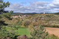
From the charming little Causse village of Caylar and its legendary carved tree, a beautiful detour onto the Causse du Larzarc takes us to the medieval village of La Couvertoirade. The vegetation, typical of the great Causses, alternates between meadows, fields, and groves of pine and white oak trees. The paths are lined with box trees. From the top of the hills, at an altitude of around 800 m, the view stretches eastwards towards the Aigoual massif. A visit to the village of La Couvertoirade, founded by the Knights Templar and the Knights Hospitaller, is a must.