Corniche de la Vis starting from Blandas

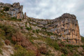
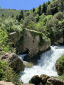
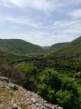
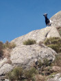
From the cliff edge, there is an exceptional bird’s-eye view of the Navacelles cirque.
The Blandas Causse lies at an average altitude of 700 metres, offering unobstructed views of the surrounding region. The vegetation here presents a striking contrast, with its black pines, cedars, boxwoods and meadows. This Causse also harbours numerous prehistoric remains.

Details

1609456
Creation:
Last update:
Last review:
  • Walking
    Activity: Walking
  • ↔
    Distance: 6.39 mi
  • ◔
    Average duration: 3h 30 
  • ▲
    Difficulty: Moderate

  • ⚐
    Back to start: Yes
  • ↗
    Ascent: + 646 ft
  • ↘
    Descent: - 627 ft

  • ▲
    Highest point: 2,385 ft
  • ▼
    Lowest point: 1,795 ft

Photos

Description of the walk

In Blandas, park at Place de l’Église.

(S/E) Continue for a few metres north-west. Turn left onto the Route de Vissec (D113).
200 metres further on, after passing a cross, head downhill to the left onto the signposted path. Follow this path, ignoring the tracks branching off to the left and right.
Descend to the cliff ledge, which offers a beautiful view of the Navacelles cirque.

(1) Continue along the ledge path, which heads west. It descends along the hillside and joins the D713.

(2) Head back up the path on the right and go round a bend. Continue along the ledge path, which climbs gently. Pass another bend and you’ll come to the D113.

(3) Cross the D113 and follow the D813 for a few metres towards La Rigalderie. Turn right onto the track which runs alongside the D113 through the woods and leads to a clearing.

(4) Take the path furthest to the left and head due north. Continue straight on, ignoring the path on the right which leads back towards Blandas. The path curves in an S-shape.

(5) After passing under the high-voltage power line, veer left to reach the Mercouline Cromlech.

(6) Retrace your steps, keeping directly opposite the power line.

(5) Turn left. The path is barely visible at first, but you’ll find parallel tracks further on. It gradually moves away from the high-voltage power line and heads uphill towards a junction at the D843.

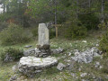
(7) Continue straight ahead, heading south-east. Pass in front of the St John’s Cross. Follow the fitness trail.
Head straight down, ignoring the cross-shaped markers on the ground, and head for the church tower. Reach the car park at the foot of the church (S/E).

Waypoints

  1. S/E : mi 0 - alt. 2,123 ft - Car park at Blandas Church
  2. 1 : mi 0.88 - alt. 2,142 ft - Viewpoint over Navacelles
  3. 2 : mi 1.45 - alt. 1,795 ft - Junction with the D173
  4. 3 : mi 3.1 - alt. 2,224 ft - Crossing the D113
  5. 4 : mi 3.72 - alt. 2,241 ft - Clearing
  6. 5 : mi 4.66 - alt. 2,260 ft - High-voltage power lines
  7. 6 : mi 4.82 - alt. 2,267 ft - Mercouline Cromlech – prehistoric site
  8. 7 : mi 5.35 - alt. 2,333 ft - St John’s Cross
  9. S/E : mi 6.39 - alt. 2,123 ft - Car park at Blandas Church

Notes

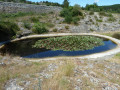
Fontaret spring (dry in summer).
Hiking boots recommended.

Worth a visit

Reviews and comments

4.6 / 5
Based on 45 reviews

Reliability of the description
4.6 / 5
Ease of following the route
4.6 / 5
Route interest
4.7 / 5
Boukroukee
Boukroukee

Overall rating : 5 / 5

Date of your route : Apr 22, 2026
Reliability of the description : ★★★★★ Very good
Ease of following the route : ★★★★★ Very good
Route interest : ★★★★★ Very good
Very busy route : No

A really lovely walk!!

Machine-translated

PH84
PH84

Overall rating : 3 / 5

Date of your route : Apr 25, 2026
Reliability of the description : ★★☆☆☆ Disappointing
Ease of following the route : ★★☆☆☆ Disappointing
Route interest : ★★★★★ Very good
Very busy route : No

Lost our way from the viewpoint overlooking Navacelles. First attempt: set off to the left = ended up at the Maison du Geand site, then turned back; second attempt to the right along a path marked as dangerous, descending towards Navacelles via a steep, rocky path. We should have stayed on the plateau; lost our way at the junction with the road; path to the right = rocky ground towards Navacelles.

Machine-translated

User 3641188

Overall rating : 5 / 5

Date of your route : Apr 17, 2026
Reliability of the description : ★★★★★ Very good
Ease of following the route : ★★★★★ Very good
Route interest : ★★★★★ Very good
Very busy route : No


The menhirs are extremely interesting

Machine-translated

lemarcheur65
lemarcheur65 ★
User 27416792
• Edited:

Overall rating : 4 / 5

Date of your route : Aug 25, 2025
Reliability of the description : Not used / Not applicable
Ease of following the route : ★★★☆☆ Average
Route interest : ★★★★★ Very good
Very busy route : Yes

Very difficult to download your app

Machine-translated

vallat aurore
vallat aurore

Overall rating : 5 / 5

Date of your route : Aug 11, 2025
Reliability of the description : ★★★★★ Very good
Ease of following the route : ★★★★★ Very good
Route interest : ★★★★★ Very good
Very busy route : Yes

nice pleasant walk

Machine-translated

vienot.pierre@orange

Overall rating : 4.3 / 5

Date of your route : Jun 27, 2025
Reliability of the description : ★★★★☆ Good
Ease of following the route : ★★★★☆ Good
Route interest : ★★★★★ Very good
Very busy route : No

a varied and interesting route offering beautiful panoramic views: limestone plateaus, forests and gorges.
not very physically demanding, so accessible. One descent on gravel requires caution.

Machine-translated

Carles Willy
Carles Willy

Overall rating : 4.7 / 5

Date of your route : Apr 21, 2025
Reliability of the description : ★★★★★ Very good
Ease of following the route : ★★★★☆ Good
Route interest : ★★★★★ Very good
Very busy route : Yes

Great hike with no difficulty. Be careful on the descent to the road, as rocks can roll down.
Magnificent views of the cirque.
Back in Blandas, take a short detour (by car) to the viewpoint to see more views of the waterfall and the cirque.
A very beautiful day, definitely worth repeating.

Machine-translated

kris.teyran
kris.teyran

With a diameter of 104 metres and around forty standing stones, the Lacam cromlech on the Blandas plateau is one of the largest in Europe.

Machine-translated

VDBdu30
VDBdu30
• Edited:

Overall rating : 4.7 / 5

Date of your route : Nov 11, 2024
Reliability of the description : ★★★★★ Very good
Ease of following the route : ★★★★★ Very good
Route interest : ★★★★☆ Good
Very busy route : Yes

A beautiful loop along the Corniche de Navacelles on the first part, then through the steppes of the Causses.
We shortened the trip by 5 to 7 kilometres because we were short on time, which saved us an hour. So no Cromlech, but there are plenty of them in the area anyway!

Machine-translated

kris.teyran
kris.teyran

Hello YannickV

With the visit to the cromlech, we had to expect a "tick-filled" tour

Machine-translated

YannickV
YannickV

Overall rating : 4.3 / 5

Date of your route : Jul 14, 2024
Reliability of the description : ★★★★★ Very good
Ease of following the route : ★★★☆☆ Average
Route interest : ★★★★★ Very good
Very busy route : No

Hundreds of butterflies, one deer, three eagles and... ticks, ticks, ticks everywhere! I've never seen so many...
Otherwise, the sites were exceptional.

Machine-translated

Fatoche
Fatoche

Overall rating : 5 / 5

Date of your route : May 19, 2024
Reliability of the description : ★★★★★ Very good
Ease of following the route : ★★★★★ Very good
Route interest : ★★★★★ Very good
Very busy route : No

WARNING
The path is blocked three times by tree trunks that must be crossed (easy to cross)
At this time of year, the flowers were in full bloom and nature smelled wonderful after the rain and with the sun coming out again.
A very pleasant trail to walk along, with beautiful views and changing landscapes.
Don't forget your tick repellent

Machine-translated

Ritchie.07
Ritchie.07
• Edited:

Overall rating : 5 / 5

Date of your route : Apr 03, 2024
Reliability of the description : Not used / Not applicable
Ease of following the route : ★★★★★ Very good
Route interest : ★★★★★ Very good
Very busy route : No

My wife and I enjoyed this hike, which offered beautiful views of the Cirque de Navacelle in thefirst part, the main attraction of the hike and actually easier than the hike that descends into the cirque.
I use a GPS, so I don't necessarily follow the description, but I do consult it beforehand for safety information and points of particular interest.
When you come to this loop, depending on your itinerary, take 15 minutes to stop at the Vis waterfalls in St Laurent le Minier, the site is magnificent. Alain

Machine-translated

carolepa
carolepa

Overall rating : 4.7 / 5

Date of your route : Nov 08, 2023
Reliability of the description : ★★★★★ Very good
Ease of following the route : ★★★★☆ Good
Route interest : ★★★★★ Very good
Very busy route : No

A very beautiful hike offering stunning views of the Cirque de Navacelles. Varied landscapes. Only the Cromlech de Mercouline section is a little difficult to find, as the site is not visible from a distance.

Machine-translated

Other walks in the area

For more walks, use our search engine .

The GPS track and description are the property of this route's author. Please do not copy them without permission.