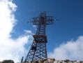
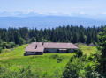
The summit of the Reculet as seen from the Lavanches car park

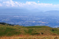
In the Jura Mountains, the Crêt de la Neige offers a unique view: to the west over the Jura, but above all to the east, towards Switzerland, with Lake Geneva below and, if the weather is clear, the Mont Blanc massif as a bonus.
This is a round-trip hike.

Details

n°60241832
Creation:
Last update:
Last review:
  • Walking
    Activity: Walking
  • ↔
    Distance: 7.16 mi
  • ◔
    Average duration: 5h 30 
  • ▲
    Difficulty: Difficult

  • ⚐
    Back to start: Yes
  • ↗
    Ascent: + 2,549 ft
  • ↘
    Descent: - 2,549 ft

  • ▲
    Highest point: 5,627 ft
  • ▼
    Lowest point: 3,077 ft

Photos

Description of the walk

On the D991, between Rosset and La Rivière, a small road takes you to Vernet Dessus and continues to the right to the Lavanches car park, the starting point of the walk.

(S/E) After parking your car, take the forest track at the far right, passing through the gate and after reading the signpost.
The path climbs gradually in hairpin bends. Ignore all the offshoots to the right and left. Pass the 1,114-metre mark.

(1) Continue along the track, then pass the 1,194-metre mark, and arrive at the Chalets de Lachat, visible below.

(2) Continue round the bend to the left. The path becomes narrower and steeper, leading to the Plan des Serras.

(3) The path ends on a flat area. Look out for the path opposite that climbs into the woods. Ignore the one branching off to the right. Try to follow the track that winds its way up between the trees. The slope becomes steeper and steeper.
The path emerges from the forest and leads onto grassland. At an altitude of 1,550 metres, you’ll come across a path coming from the left.

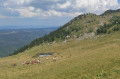
(4) Turn right. You’ll see a ‘lavogne’ (or kneading trough) below on the left. Walk past the Derrière Thoiry hut to join theGR®9‘Balcon du Léman’ at 1,647 m.

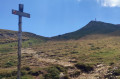
(5) Head up to the right until you reach the cross at the summit of the Reculet (1,718 m).

(6) Head back down to the car park, following the same route as the ascent. (S/E)

Waypoints

  1. S/E : mi 0 - alt. 3,077 ft - Lavanches car park
  2. 1 : mi 1.14 - alt. 3,652 ft - Altitude: 1,114 metres
  3. 2 : mi 2.12 - alt. 4,173 ft - The Chalets de Lachat
  4. 3 : mi 2.33 - alt. 4,324 ft - Map of Les Serras
  5. 4 : mi 3.15 - alt. 5,115 ft - The 32 Contours Trail
  6. 5 : mi 3.4 - alt. 5,400 ft - GR9 The Balcons du Léman
  7. 6 : mi 3.62 - alt. 5,627 ft - Summit - Le Reculet
  8. S/E : mi 7.16 - alt. 3,077 ft - Lavanches car park

Notes

The Lachat chalet, although private, can be used as a refuge.

This route passes through multiple protected areas, which may be subject to special regulations:

Always be cautious and plan ahead when you're outdoors. Visorando and the author of this route cannot be held responsible for any accidents occurring on this route.

The GR® and PR® markings are the intellectual property of the Fédération Française de Randonnée Pédestre.

Reviews and comments

5 / 5
Based on 1 review

Reliability of the description
5 / 5
Ease of following the route
5 / 5
Route interest
5 / 5
Orny
Orny

A trip I go on quite regularly…
Just a quick note: the last 800 metres of the road leading to the car park aren’t tarmacked and are becoming increasingly difficult to drive on
Otherwise, it’s a lovely trip, especially in autumn, Jacques

Machine-translated

Geugeu
Geugeu

Overall rating : 5 / 5

Date of your route : Sep 22, 2024
Reliability of the description : ★★★★★ Very good
Ease of following the route : ★★★★★ Very good
Route interest : ★★★★★ Very good
Very busy route : No

A lovely walk, ending with views of the Geneva basin, the Alps and the Jura.
To reach the car park at the start of the walk, take the ‘Chemin du Reculet’ road and continue along it until you reach the forest track

Machine-translated

Other walks in the area

For more walks, use our search engine .

The GPS track and description are the property of this route's author. Please do not copy them without permission.