Country:

 City:
City:



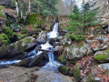
Park near the eco-museum at a place called Le Pont du Moulin.
(S/E) Walk down about fifteen metres to the Route du Suquet and cross the bridge.
(1) At the bend, turn left onto the Chemin de Tailladette, heading towards the Col de Faubel, as indicated on the signpost. Follow the yellow markings. This shaded path runs alongside the River Trévezel, a few metres above it. Continue straight on until you reach the fourth track at Serre Long.
(2) Leave the yellow markings and continue straight on, climbing towards the Col de Faubel.
(3) At the pass (elevation 1286), take the first path on the right, which winds upwards, until you reach the next fork (elevation 1322).
(4) Turn left and follow this path for 1.3 km, then, at a left-hand bend, take a faint path on the right.
(5) A few old cairns mark this ancient path here and there. It joins another forest track (Chemin de la Taillade) at an elevation of 1,284 metres.
(6) Turn left and continue until you reach another forest track at elevation 1209.
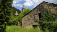
(7) Turn left and carry on until you reach the stone hut on the left, at the junction with the Chemin du Valat de Tédounès.
(8) Turn right at the hairpin bend and carry on until you reach the D710.
(9) Follow the road to the right, which crosses the bridge and takes you back to the starting point (S/E).

 Visorando Member
 Easy
Easy 
 Association / Club / Walk leader