


Incantesimu

 Visorando Member
 Premium user
 - Gender: man
Sign up:
Published route(s)
 Mare è Stagnu trail
 4.65 mi
 +148 ft
 -121 ft
 2h 15
2h 15
 Easy
Easy
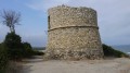
 Departure from Aléria (Haute-Corse)
Located north of Aléria, the Etang de Diane is renowned for its oyster and mussel production. It is surrounded by wetlands and marshes that constitute protected areas, thus hosting large populations of sedentary or migratory birds and sometimes endemic species.
Arcu di u Scandulaghiu or the Arch of Corte
 5.48 mi
+3,602 ft
-3,583 ft
5h 40
5.48 mi
+3,602 ft
-3,583 ft
5h 40
 Difficult
Departure from Corte (Haute-Corse)
Difficult
Departure from Corte (Haute-Corse)
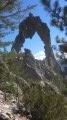
The Arche de Corte or Arche de Padule (referring to the sheepfolds located higher up) or Arcu di Scandulaghiu (in Corsican) is a granite sculpture located at an altitude of 1,500 metres, overlooking the Tavignano valley. The Arche is located between the citadel of Corte and the Calacuccia dam.
Monte Santu
 2.15 mi
+640 ft
-640 ft
1h 35
2.15 mi
+640 ft
-640 ft
1h 35
 Moderate
Departure from Sari-Solenzara (Corse-du-Sud)
Moderate
Departure from Sari-Solenzara (Corse-du-Sud)
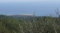
Rocky summit with beautiful panoramic views.
Climbing towards Sari Solenzara, view of the Bavella peaks.
Located between earth and sky, in the shadow of Monte Santu, in the heart of untouched wild scrubland, the monastery of Assunta Gloriosa is set in a majestic landscape. To the west, the Bavella peaks rise up with force and grandeur. To the south, the terrain overlooks the Tyrrhenian Sea, which stretches as far as the eye can see.
The Tolla sheepfold and the Meli waterfall
 6.63 mi
+1,099 ft
-1,086 ft
4h 00
Moderate
Departure from Vivario (Haute-Corse)
6.63 mi
+1,099 ft
-1,086 ft
4h 00
Moderate
Departure from Vivario (Haute-Corse)
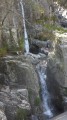
Waterfall hikes in a magical mountain setting. This beautiful and varied hike through the Manganello Valley is suitable for all.
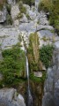
The Ucelluline Waterfall or Bucatoggio Waterfall
 4.70 mi
+1,388 ft
-1,421 ft
3h 20
Easy
Departure from Santa-Maria-Poggio (Haute-Corse)
4.70 mi
+1,388 ft
-1,421 ft
3h 20
Easy
Departure from Santa-Maria-Poggio (Haute-Corse)
When nature becomes a spectacle.
Secret yet welcoming, the Ucelluline waterfall (meaning "little bird" in Corsican) offers a striking setting that will leave a lasting impression. Between the villages of Santa Maria Poggio and San Nicolao, discover this wild and unspoilt site where fresh, clear water flows before your eyes and continues its journey to the sea. This walk is very popular during the day, but also at night, when its misty veil is fully illuminated and will fill you with wonder.
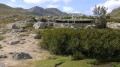
Les Bergeries des Pozzi
 8.78 mi
+2,329 ft
-2,339 ft
6h 05
Moderate
Departure from Palneca (Corse-du-Sud)
8.78 mi
+2,329 ft
-2,339 ft
6h 05
Moderate
Departure from Palneca (Corse-du-Sud)
The Pozzines (from the Corsican word i Pozzi, meaning wells) are acidic peat bogs crossed by winding streams.
They are located at altitudes between 1,700 and 2,300 metres.
They occupy depressions formed by ancient glacial lakes, which were filled in by clay deposits and numerous dead plants.
In Corsica, the deposits of the oldest pozzines are thought to date back around 12,000 years.
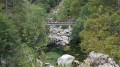
Gorges du Tavignano and the Rossolinu footbridge
 10.06 mi
+2,211 ft
-2,201 ft
6h 35
Moderate
Departure from Corte (Haute-Corse)
10.06 mi
+2,211 ft
-2,201 ft
6h 35
Moderate
Departure from Corte (Haute-Corse)
The Tavignano Valley is one of Corsica's most beautiful mountain valleys. It offers a deep, rocky gorge with numerous pools, and above all, the valley is a hiker's kingdom. From Corte, only a well-preserved old mule track leads into the wild Tavignano Gorge. At the Passerelle di u Russulinu, you'll find pools in the torrent, guaranteed to cool you down in hot weather like this year (2017).
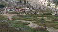
The Cappelaccia and Alzo sheepfolds as seen from the Frasseta Bridge
 6.61 mi
+2,641 ft
-2,644 ft
5h 20
Moderate
Departure from Corte (Haute-Corse)
6.61 mi
+2,641 ft
-2,644 ft
5h 20
Moderate
Departure from Corte (Haute-Corse)
You’ll be delighted by the unique view of the Cappelaccia sheepfolds. We are now at the highest point of the vast Alzo plateau and can enjoy a magnificent panoramic view stretching from Rotondo to Cinto, via Punta Artica and Paglia Orba. A large sign and red markings show us the way forward.
Col de la Croix (Croce à a Sera)
 4.15 mi
+1,079 ft
-1,102 ft
2h 50
Easy
Departure from Ghisoni (Haute-Corse)
4.15 mi
+1,079 ft
-1,102 ft
2h 50
Easy
Departure from Ghisoni (Haute-Corse)
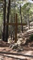
Arriving on a small plateau, the path continues until it crosses a small stream. Then, a narrow, winding path where you may encounter some wild pigs takes you up under chestnut trees to the Col de la Croix. From there, follow the track to the right and discover the splendid panorama of the eastern plain, the sea, and the Monti Renoso and Kyrie Eleison (Christe Eleison). The track then descends to the village of Ghisoni.
Tallone Trail
 4.20 mi
+791 ft
-791 ft
2h 35
Easy
Departure from Tallone (Haute-Corse)
4.20 mi
+791 ft
-791 ft
2h 35
Easy
Departure from Tallone (Haute-Corse)
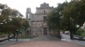
The village of Tallone will charm you with its view of the natural heritage of the coastline, where the Tyrrhenian Sea meets the ponds of Diane, Urbinu, del Sale and Terrenzana.
The lower part of the village opens onto an imposing square where the Baroque church of Saint-Cézaire stands, its forecourt built with a particular type of rock called gneiss.
Its carved door and bell tower are truly admirable.
The Undella Waterfall at San Gavinu di Fium'Orbu
 4.33 mi
+1,765 ft
-1,739 ft
3h 30
Moderate
Departure from San-Gavino-di-Fiumorbo (Haute-Corse)
4.33 mi
+1,765 ft
-1,739 ft
3h 30
Moderate
Departure from San-Gavino-di-Fiumorbo (Haute-Corse)
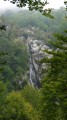
You will be delighted to discover the surrounding high peaks; this path will lead you through a beautiful beech forest and to the foot of the Undella waterfall (Ondella waterfall).
The Bughja Waterfall
 2.67 mi
+784 ft
-797 ft
1h 55
Easy
Departure from San-Gavino-di-Fiumorbo (Haute-Corse)
2.67 mi
+784 ft
-797 ft
1h 55
Easy
Departure from San-Gavino-di-Fiumorbo (Haute-Corse)
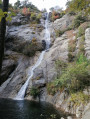
At a height of 100 metres, the Buja waterfall (Piscia di a Bughja) is one of the highest in Corsica. At its base is a pool where you can enjoy a refreshing dip, and you can relax on the rocks. If you look carefully, this waterfall is visible from a distance, particularly from the road leading to the village. The long white trail it leaves on the mountainside is particularly impressive in winter, when the water flows in abundance.Bughja (from the word ‘Bughju’: darkness).
Customs officers' path starting from the port of Macinaggio
 6.93 mi
+738 ft
-728 ft
3h 50
Moderate
Departure from Haute-Corse
6.93 mi
+738 ft
-728 ft
3h 50
Moderate
Departure from Haute-Corse
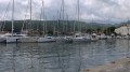
The trail starts at the northern end of the long beach of Macinaggio, covered with a thick layer of Posidonia leaves. The route, marked in yellow, follows the rugged coastline and is punctuated by two Genoese towers. Superb views of the neighbouring islands of Capraia and Elba. Some Corsican specialities, the Filles du Cap on the beach (see photos). Caution! This is an extremely fragile area with a wealth of flora and fauna.
The Casevecchie Trail
 7.76 mi
+2,326 ft
-2,313 ft
5h 35
Moderate
Departure from Casevecchie (Haute-Corse)
7.76 mi
+2,326 ft
-2,313 ft
5h 35
Moderate
Departure from Casevecchie (Haute-Corse)
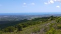
Casevecchie is a French commune situated in the departmental district of Haute-Corse and within the territory of the Corsican regional authority. Formerly part of the villages of Noceta and Rospigliani, it belongs to the Piève de Rogna. This walk will quickly take you up to a ridge line, leading to the highest point, Punta Capizzali (728m), where the boundaries of three communes meet: Antisanti, Casevecchie and Vezzani (360° view, sea and mountains).
The Gracieuse trail (Bombannes - Hourtin)
 8.16 mi
+131 ft
-131 ft
3h 50
Moderate
Departure from Carcans (Gironde)
8.16 mi
+131 ft
-131 ft
3h 50
Moderate
Departure from Carcans (Gironde)
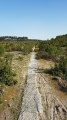
In all seasons, Lac de Carcans Hourtin (the largest natural lake in France, 18 km long and 5 km wide) inspires tranquillity. We take the old La Gracieuse cycle path, which is unfortunately now in poor condition. It runs alongside theGR®8, the Way of St James, and leads from the Bombannes base to the tip of La Gracieuse on the western shore of the lake.
Sentier de l'Abécédaire (Cap Ferret)
 5.95 mi
+102 ft
-102 ft
2h 50
Easy
Departure from Lège-Cap-Ferret (Gironde)
5.95 mi
+102 ft
-102 ft
2h 50
Easy
Departure from Lège-Cap-Ferret (Gironde)
The Dunes ABC at Cap Ferret is a nature trail. On this trail, which runs along the back of the dunes, walkers will discover a large photo album from north to south, organised alphabetically from A for "Algae" to Z for "Zoster".
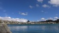
Traggette sheepfolds - Lake Bastani
 3.96 mi
+2,165 ft
-2,152 ft
3h 40
Moderate
Departure from Ghisoni (Haute-Corse)
3.96 mi
+2,165 ft
-2,152 ft
3h 40
Moderate
Departure from Ghisoni (Haute-Corse)
From the Capanelle Refuge, on theGR®20, it takes about 30 minutes to reach the Traggette sheepfolds. This is followed by the climb to Bastani Lake, which peaks at an altitude of 2,089 metres opposite Monte Renoso (2,352 metres). Bastani Lake, located in Haute-Corse, is one of the highest lakes in Corsica. This magnificent glacial lake, frozen for seven months of the year, owes its beautiful emerald green colour to the presence of filamentous algae.
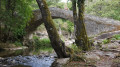
The Zalana-Matra Trail
 3.66 mi
+1,555 ft
-1,552 ft
3h 00
Moderate
Departure from Zalana (Haute-Corse)
3.66 mi
+1,555 ft
-1,552 ft
3h 00
Moderate
Departure from Zalana (Haute-Corse)
Following this Zalana-Matra trail, you will cross a chestnut grove, then take a steep, sloping path that winds through thick scrubland and overlooks impressive precipices in places. Along the way, you will admire a very old mill, then cross an authentic Genoese bridge over the Bravone, the Alisu bridge. Then climb back up through a chestnut forest and finish your walk at the Matra cross (the return point of the hike).
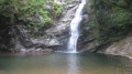
The Pianellu Waterfall and La Punta di Caldane
 8.47 mi
+3,757 ft
-3,740 ft
7h 10
Difficult
Departure from Pianello (Haute-Corse)
8.47 mi
+3,757 ft
-3,740 ft
7h 10
Difficult
Departure from Pianello (Haute-Corse)
A little-known but magnificent waterfall. It is situated on the outskirts of the village of Pianello on the D16, on the road to Matra, just past the bridge. It is an oasis of coolness and flows in the shade of trees so leafy that they barely let any sunlight through.
Next comes Punta di Caldane, offering a magnificent view of the sea, passing through the forgotten hamlet of Saint-Vincent and its chapel, then the I Peri sheepfolds. You can, of course (!!), shorten the walk.
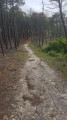
The Atlantic Wall trail at Carcans Plage
 8.28 mi
+39 ft
-39 ft
3h 50
Moderate
Departure from Carcans (Gironde)
8.28 mi
+39 ft
-39 ft
3h 50
Moderate
Departure from Carcans (Gironde)
The Atlantic Wall (Atlantikwall in German) is an extensive system of coastal fortifications built by the Third Reich during the Second World War along the western coast of Europe to prevent an invasion of the continent by the Allies from Great Britain.
This walking trail follows the concrete road that served the blockhouses, which were used as forward posts.
A story of stones and water in Murato
 4.17 mi
+771 ft
-768 ft
2h 35
Easy
Departure from Murato (Haute-Corse)
4.17 mi
+771 ft
-768 ft
2h 35
Easy
Departure from Murato (Haute-Corse)
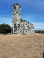
The village of Murato invites you to discover a trail called Histoire de pierres et d'eau (History of Stones and Water). It is a tourist circuit between village and nature where you can discover Murato Supranu (upper part of the village) and Murato Sottanu. You will pass through narrow streets, old houses, churches, chapels, fountains, pagliaghji (straw huts), wash houses and bread ovens.
This route is not intended to be a long hike, but it has the merit of allowing you to discover the past and can be enjoyed by the whole family.
Lake Nielluccio (Lavu di Niellucciu)
 3.30 mi
+1,949 ft
-1,949 ft
3h 15
Difficult
Departure from Ghisoni (Haute-Corse)
3.30 mi
+1,949 ft
-1,949 ft
3h 15
Difficult
Departure from Ghisoni (Haute-Corse)
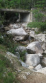
Beautiful hike, beautiful landscapes, beautiful beech and Laricio pine forests, superb lake. Lake Nielluccio is located between Monte Renoso and the Ventosa ridge (1,954 m) in the municipality of Ghisoni in the department of Haute-Corse. Lake Nielluccio is a glacial lake in Haute-Corse and is one of five lakes around Monte Renoso (2,352 m) and the Fiumorbo watershed.
GPS coordinates of the lake: 42° 03′ 42″ North, 9° 08′ 28″ East
Source: Wikipedia
La Pieve d'Aregno - Lavatoggio - Sant'Antonino circular loop
 6.31 mi
+1,644 ft
-1,670 ft
4h 20
Moderate
Departure from Lavatoggio (Haute-Corse)
6.31 mi
+1,644 ft
-1,670 ft
4h 20
Moderate
Departure from Lavatoggio (Haute-Corse)
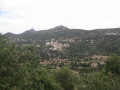
Sant'Antonino is located in the heart of Balagne, perched at an altitude of 500 metres on a granite peak near L'Île-Rousse and Calvi, between the sea and the mountains. The village overlooks the Aregno plain on one side and part of the Reginu plain on the other. A veritable eagle's nest, it consists of around 75 houses, built close together and winding around a granite peak, forming a labyrinth to better resist any invaders (Source: Wikipedia).
The ruined village of Occi (formerly Occi Lumio)
 3.53 mi
+1,070 ft
-1,056 ft
2h 35
Moderate
Departure from Lumio (Haute-Corse)
3.53 mi
+1,070 ft
-1,056 ft
2h 35
Moderate
Departure from Lumio (Haute-Corse)
At an altitude of 377 m above Lumio lies the ruined village of Occi. In the 15th century, it was inhabited by people who had deserted the coast to flee the Saracens. The 17th and 18th centuries saw the decline of the village. Occi was attached to Lumio in 1852. Felice Giudicelli, known as Fra Felice, the last inhabitant, died there on 22 November 1918.
The 15th-century Baroque church of the Annunziata was rebuilt from its ruins (the work was partly financed by Laetitia Casta).
The old mule track from Piana to Ota
 1.95 mi
+518 ft
-512 ft
1h 20
Easy
Departure from Piana (Corse-du-Sud)
1.95 mi
+518 ft
-512 ft
1h 20
Easy
Departure from Piana (Corse-du-Sud)
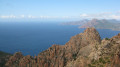
This paved path, supported by a magnificent dry stone wall, can be considered exceptional for the quality of its construction. It was the only route available to those travelling by mule from Piana to Porto and Ota in the early19th century. The Piana-Porto road was only opened in 1850 by Napoleon III. From then on, this route was used for communication. Source: Piana Town Hall.
The return journey is via the Calanche di Piana.
The old Petra Rossa lead mine.
 2.11 mi
+604 ft
-630 ft
1h 30
Easy
Departure from Ghisoni (Haute-Corse)
2.11 mi
+604 ft
-630 ft
1h 30
Easy
Departure from Ghisoni (Haute-Corse)
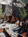
The old Petra Rossa mine, known as the Finosa mine, opened in 1912 to extract lead, silver, manganese and iron ores, and was closed after the Second World War. Source: WikipediaThe Finosa mines extracted silver-bearing lead (galena, cerussite), zinc (blende) and copper (bornite).Most of the mining at La Finosa was carried out in open pits.Prospecting on the site began in the 1910s. Source: Ghisoni Civil Heritage.
The Porri Cave
 2.42 mi
+958 ft
-971 ft
1h 55
Moderate
Departure from Porri (Haute-Corse)
2.42 mi
+958 ft
-971 ft
1h 55
Moderate
Departure from Porri (Haute-Corse)
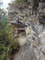
In Haute-Corse, the village of Porri was one of the strongholds of the island's resistance movement. Near the village, a refuge cave known as the "Grotte des Maquisards" (Maquis Cave), which served as the Resistance's headquarters, recalls the contribution of Porri and the Casinca region to the liberation of Corsica. It is well guarded by the Vincetti, Vittori, Bébé Arrighi, Antoine Battesti, Noël Agostini and many others.
Source: France 3 Corse ViaStella
The Riviseccu Sheepfolds (Rivisecco)
 5.58 mi
+1,814 ft
-1,798 ft
4h 10
Moderate
Departure from Corte (Haute-Corse)
5.58 mi
+1,814 ft
-1,798 ft
4h 10
Moderate
Departure from Corte (Haute-Corse)
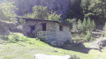
These sheepfolds, which are in very good condition, mark the end of a forest area. The group of sheepfolds forms a small hamlet of several well-restored huts. The surroundings are magnificent, with large rock formations and the Riviseccu stream.
Shaded throughout, the route follows an old forest track that climbs gradually through a forest where beech trees are omnipresent, in contrast to the Laricio pine trees along the stream.
The Memory Trail: path at Rutali - Trà aghje è Pagliaghji
 4.21 mi
+335 ft
-338 ft
2h 15
Easy
Departure from Rutali (Haute-Corse)
4.21 mi
+335 ft
-338 ft
2h 15
Easy
Departure from Rutali (Haute-Corse)
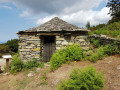
This is a route with little elevation gain in the mountains above Rutali, ideal for a family walk. In the middle of the scrubland, there are arbutus trees, oaks and a few chestnut trees. You quickly find yourself isolated in wild nature at an altitude of 600 metres with views of the sea to the east and west. We are facing the base of Cap Corse.
Aranzazu Chapel from the Pinodieta Pass
 3.84 mi
+801 ft
-804 ft
2h 30
Easy
Departure from Souraïde (Pyrénées-Atlantiques)
3.84 mi
+801 ft
-804 ft
2h 30
Easy
Departure from Souraïde (Pyrénées-Atlantiques)
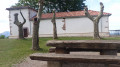
The chapel of Ainhoa, dedicated to Our Lady, was built on the side of Mount Atsulai at an altitude of 389 metres. Below the chapel, a small cave has been reconstructed. The statue of the Blessed Virgin dominates a spring near which Mary is said to have appeared in a hawthorn bush to a shepherd who exclaimed: "aranza zu" or "you in a hawthorn bush!".
Source: Heritage of the Basque Country
Route around Bouliac
 5.57 mi
+623 ft
-620 ft
3h 05
Easy
Departure from Bouliac (Gironde)
5.57 mi
+623 ft
-620 ft
3h 05
Easy
Departure from Bouliac (Gironde)
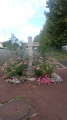
Bouliac boasts a rich heritage. Numerous stately homes and châteaux dot the commune’s landscape, bearing witness to a rich past and an era when Bordeaux merchants made their fortunes through the commercial activity of the Port de la Lune and sought to acquire beautiful residences on the hillsides, just a few kilometres from the city.
Source: Bouliac Town Hall
Route around Fargues-Saint-Hilaire
 4.56 mi
+164 ft
-177 ft
2h 15
Easy
Departure from Fargues-Saint-Hilaire (Gironde)
4.56 mi
+164 ft
-177 ft
2h 15
Easy
Departure from Fargues-Saint-Hilaire (Gironde)
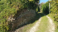
This 7.7 km circular route starts in the current village of Fargues-Saint-Hilaire, at the Sunday market square, and takes you on a tour of beautiful shaded paths. Part of the route passes through Carignan-de-Bordeaux, where you will discover an unusual place.
.
Tobacco-drying trail: Lamonzie–Montastruc
 6.11 mi
+505 ft
-482 ft
3h 15
Moderate
Departure from Lamonzie-Montastruc (Dordogne)
6.11 mi
+505 ft
-482 ft
3h 15
Moderate
Departure from Lamonzie-Montastruc (Dordogne)
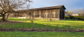
The route takes you through the Louyre catchment area to admire the remains of a former flagship of the local economy: tobacco farming. From the 17th to the 20th century, tobacco cultivation left a lasting mark on the Dordogne valley. After several stages of intense threshing, the tobacco passed through these tobacco drying sheds before being packaged and shipped to the global markets of cigarette manufacturers.