From Ainhoa to boundary markers 64 and 65

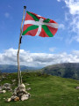
“The boundary markers”… The term ‘frontière’ (border) derives from the noun ‘front’; it implies a notion of opposition between two areas separated by this very front, like a “troop which, drawing up in battle formation to fight, forms a boundary…” The border is marked by 602 boundary markers, numbered from west to east starting in 1856, following a route that is often ancient.

Source: Basque Country Heritage

Details

n°9006214
Creation:
Last update:
Last review:
  • Walking
    Activity: Walking
  • ↔
    Distance: 7.17 mi
  • ◔
    Average duration: 3h 50 
  • ▲
    Difficulty: Moderate

  • ⚐
    Back to start: Yes
  • ↗
    Ascent: + 574 ft
  • ↘
    Descent: - 558 ft

  • ▲
    Highest point: 433 ft
  • ▼
    Lowest point: 154 ft

Photos

Description of the walk

(S/E) Car park at the bottom of the village on Dolhareko Bidea; follow the red and whiteGR®10markings.

(1) Take theGR®10track, which is suitable for vehicles

(2) Ignore the path on the left (Dantxarineko Bide Zaharra); continue along the track (GR®10)

(3) Pass a sheep pen on the left.

(4) Leave the track (GR®10) on the left and continue towards the old fish farm (Urrutieneko Errota), with the River Nivelle on your left.

(5) Former fish farm.

(6) Cross the River Nivelle via the bridge and continue on theGR®10, turning immediately right after the bridge. The River Nivelle is now on your right.

(7) Cross the D 4 at a place known as Pont du Diable, and take theGR®10opposite (not the Zorribenta track).

Warning!!! Do not mistakenly take the Pont du Diable

(8) Cross the stream and take the Zorribenta track; continue until you reach a house on the left and head slightly uphill.

(9) At Border Marker 65, turn left to reach the next ‘BF’.

(10) Border Marker 64.

(11) Intermediate boundary marker between BF 65 and 66: ‘S’ (Sarre) for the French side, ‘B’ (Baztan) for the Spanish side; see photos. Please note that Marker 66 is situated on private property.

Retrace your steps in the opposite direction to return to the Ainhoa car park (S/E).

Waypoints

  1. S/E : mi 0 - alt. 354 ft - Car park at the bottom of the village on Dolhareko Bidea
  2. 1 : mi 0 - alt. 354 ft - Take the GR°°®°°10 track, which is suitable for vehicles
  3. 2 : mi 0.13 - alt. 390 ft - Ignore the path on your left
  4. 3 : mi 0.3 - alt. 397 ft - Pass a sheep pen on your left.
  5. 4 : mi 0.56 - alt. 394 ft - Leave the track (GR°°®°°10) to the left
  6. 5 : mi 0.98 - alt. 207 ft - Former fish farm
  7. 6 : mi 1.08 - alt. 167 ft - Cross the Nivelle and continue along the GR10
  8. 7 : mi 1.62 - alt. 164 ft - Cross the D4 at a place known as ‘Pont du diable’
  9. 8 : mi 2.5 - alt. 171 ft - Cross the stream
  10. 9 : mi 3.29 - alt. 361 ft - Border Marker 65
  11. 10 : mi 3.6 - alt. 397 ft - Border Marker 64
  12. 11 : mi 3.96 - alt. 322 ft - Intermediate boundary marker
  13. S/E : mi 7.17 - alt. 354 ft - Car park at the bottom of the village on Dolhareko Bidea

Notes

There are no water sources along the route.

Good walking boots and a walking stick are essential.

IGN map: 1245OT

Route recorded in the field using a Twonav Sportiva 2 GPS.

Worth a visit

The village of Ainhoa and its beautiful Basque houses.

The old washhouse.
On 23 September 1858, the village of Ainhoa was visited by Emperor Napoleon III and Empress Eugénie de Montijo. Having alighted from their carriage at Alaxurruta – the name given to the washhouse fountain – they continued their walk with their entourage to the Dancharia bridge, after drinking water from the fountain.

Always be cautious and plan ahead when you're outdoors. Visorando and the author of this route cannot be held responsible for any accidents occurring on this route.

The GR® and PR® markings are the intellectual property of the Fédération Française de Randonnée Pédestre.

Reviews and comments

4.7 / 5
Based on 1 review

Reliability of the description
5 / 5
Ease of following the route
5 / 5
Route interest
4 / 5
DedeCiboure
DedeCiboure

Hello,
A comment regarding waypoint 66.
The GPS track doesn’t go all the way to this marker, and the description states that it is on private land.
Is it inaccessible? If so, I think the number 66 should be removed from the route title.
Kind regards

Machine-translated

Lifab
Lifab

Overall rating : 4.7 / 5

Date of your route : Jan 24, 2022
Reliability of the description : ★★★★★ Very good
Ease of following the route : ★★★★★ Very good
Route interest : ★★★★☆ Good
Very busy route : Yes

A route with sections through woodland, which can therefore be quite muddy in wet weather

Machine-translated

Other walks in the area

For more walks, use our search engine .

The GPS track and description are the property of this route's author. Please do not copy them without permission.