Tobacco-drying trail: Lamonzie–Montastruc

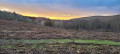
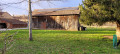
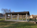
The route takes you through the Louyre catchment area to admire the remains of a former flagship of the local economy: tobacco farming. From the 17th to the 20th century, tobacco cultivation left a lasting mark on the Dordogne valley. After several stages of intense threshing, the tobacco passed through these tobacco drying sheds before being packaged and shipped to the global markets of cigarette manufacturers.

Details

69127209
Creation:
Last update:
Last review:
  • Walking
    Activity: Walking
  • ↔
    Distance: 6.11 mi
  • ◔
    Average duration: 3h 15 
  • ▲
    Difficulty: Moderate

  • ⚐
    Back to start: Yes
  • ↗
    Ascent: + 505 ft
  • ↘
    Descent: - 482 ft

  • ▲
    Highest point: 407 ft
  • ▼
    Lowest point: 197 ft

Photos

Description of the walk

Start opposite Lamonzie-Montastruc Town Hall

(S/E) Walk past the Town Hall and take Rue du Tacot towards the village of Lamonzie-Montastruc.

(1) At the junction, carry straight on along Rue du Tacot, leaving the church on your left.

(2) At the Fork in the road, turn right onto the old Roman road. Pass the cemetery and continue right into Impasse de Lartigue.

(3) At the hamlet, ignore the path on the left, turn right and carry on towards Le Cluzel.

(4) Cross the Louyre stream.

(5) Pass through the hamlet and carry on straight ahead to reach the D32.

(6) Cross the Route de Saint-Alvère–Bergerac. Take care! Take the DFCI Liorac track opposite and continue for about 900 m until you reach a path on the right.

(7) Leave the DFCI Liorac track, turn right onto this path heading south-west then north-west to join another track.

(8) Turn right and continue towards the D32 Route de Saint-Alvère.

(9) Cross the D32 with care and pass to the left of Camping Paradis (formerly l’Escapade). After about 300 m, turn left onto the Route du Désert to join the Route des Femmes.

(10) Turn right, then left, and continue along the track towards the Route de Jolivie.

(11) At the junction, turn left towards Route des Mazeaux, then follow it to the right for about a hundred metres.

(12) Turn left onto the Chemin des Versannes and you’ll reach the Impasse de la Croix Vieille. Turn right onto this road to reach this hamlet.

(13) In the hamlet, continue along a track until you reach the Route de la Jolivie.

(14) Carry on along this road, join the D21 and follow it to the right to reach the car park opposite the Town Hall (S/E).

Waypoints

  1. S/E : mi 0 - alt. 210 ft - Car park opposite the Town Hall. Near the - Caudeau (rivière) - Affluent de la Dordogne
  2. 1 : mi 0.21 - alt. 200 ft - Église Notre-Dame de l'Assomption (Lamonzie-Montastruc)
  3. 2 : mi 0.36 - alt. 220 ft - Roman road
  4. 3 : mi 1.41 - alt. 292 ft - Lartigue hamlet
  5. 4 : mi 1.55 - alt. 220 ft - Louyre (ruisseau) - Affluent du Caudeau
  6. 5 : mi 2.11 - alt. 374 ft - Le Cluzel
  7. 6 : mi 2.53 - alt. 292 ft - Crossing the D32
  8. 7 : mi 3.08 - alt. 407 ft - Junction on the path
  9. 8 : mi 3.63 - alt. 371 ft - Junction on the track
  10. 9 : mi 3.95 - alt. 341 ft - Crossing the D32
  11. 10 : mi 4.33 - alt. 371 ft - Women’s Routes
  12. 11 : mi 4.6 - alt. 361 ft - Route de la Jolivie
  13. 12 : mi 4.86 - alt. 387 ft - Junction on Chemin de Versannes
  14. 13 : mi 5.32 - alt. 367 ft - La Croix Vieille
  15. 14 : mi 5.74 - alt. 279 ft - Route de la Jolivie
  16. S/E : mi 6.11 - alt. 210 ft - Car park opposite the Town Hall

Notes

There are no water points along the route – please take care during periods of high temperatures.

- Please bring the IGN 1836E map.

- Route mapped using a GPS.

Worth a visit

The tobacco drying sheds

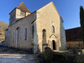
Notre-Dame de l’Assomption Church in Lamonzie-Montastruc (12th century, listed as a Historic Monument)

Montastruc Castle (13th century, listed as a Historic Monument)

Bellegarde Castle (14th century; listed as a Historic Monument)
Guided tour of the main rooms in English and French
Self-guided tour of the grounds
Monday to Friday from 2pm to 8pm. Sundays from 2pm to 8pm

Guided tours in English and French – 15 June–31 July and 1–30 September

Reviews and comments

4.7 / 5
Based on 2 reviews

Reliability of the description
5 / 5
Ease of following the route
4.5 / 5
Route interest
4.5 / 5
User 27826686

Overall rating : 4 / 5

Date of your route : Oct 12, 2025
Reliability of the description : Not used / Not applicable
Ease of following the route : ★★★★☆ Good
Route interest : ★★★★☆ Good
Very busy route : No

A very pleasant route with varied landscapes and beautiful drying sheds. I would happily do it again. It's a shame that the start isn't clearly marked, but otherwise the signage is good.

Machine-translated

joegoux
joegoux

Overall rating : 5 / 5

Date of your route : May 20, 2025
Reliability of the description : ★★★★★ Very good
Ease of following the route : ★★★★★ Very good
Route interest : ★★★★★ Very good
Very busy route : No

A superb walk – thank you to the author for taking the time to introduce us to this route.
Joë

Machine-translated

Other walks in the area

For more walks, use our search engine .

The GPS track and description are the property of this route's author. Please do not copy them without permission.