The Casevecchie Trail

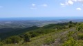
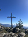
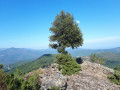
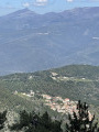
Casevecchie is a French commune situated in the departmental district of Haute-Corse and within the territory of the Corsican regional authority. Formerly part of the villages of Noceta and Rospigliani, it belongs to the Piève de Rogna. This walk will quickly take you up to a ridge line, leading to the highest point, Punta Capizzali (728m), where the boundaries of three communes meet: Antisanti, Casevecchie and Vezzani (360° view, sea and mountains).

Details

1067010
Creation:
Last update:
Last review:
  • Walking
    Activity: Walking
  • ↔
    Distance: 7.76 mi
  • ◔
    Average duration: 5h 35 
  • ▲
    Difficulty: Moderate

  • ⚐
    Back to start: Yes
  • ↗
    Ascent: + 2,326 ft
  • ↘
    Descent: - 2,313 ft

  • ▲
    Highest point: 2,323 ft
  • ▼
    Lowest point: 892 ft

Photos

Description of the walk

Parking is available at the entrance to the village by the cross (subject to there being sufficient spaces in the car park).

(S/E) Follow the path to the village centre. Cross the Presa di Piazza road (D443) and head towards Solaro to reach the village.

(1) Turn right and stay on the Presa di Tondo road to reach the footpath.

(2) Take the path on the left; stay on this path, ignoring any that branch off to the left or right. Pass a reservoir on your left. Continue along this well-marked path, following a wide circular path to the left. You will then reach the junction with the D443.

(3) Cross the D243 and you’ll soon reach the San Michele Chapel and then the tomb. Carry on along the path towards the ruined village of La Serra. Turn right to reach it.

(4) From the ruined village of La Serra, return to the main path and continue to the right. You’ll reach the edge of the forest.

(5) Stay on the path and head towards the ruined village of Cava di Fiorellu.

(6) Turn right onto the path leading to the Casacce Spring.

(7) Return to the hamlet via the same route.

(6) Turn right to head back towards Teppa. Join the road leading to the village (cheese dairy on site).

(8) Follow the same route as on the way out to return to the car park where you started (S/E).

Waypoints

  1. S/E : mi 0 - alt. 1,529 ft - Village centre
  2. 1 : mi 0.21 - alt. 1,729 ft - Keep right onto Route Presa di Tondo
  3. 2 : mi 0.35 - alt. 1,765 ft - Start of the Casevecchie trail.
  4. 3 : mi 1.54 - alt. 2,093 ft - Crossing the D243.
  5. 4 : mi 2.17 - alt. 2,014 ft - Ruined village of La Serra.
  6. 5 : mi 2.67 - alt. 1,850 ft - Path to Cava di Fiorellu
  7. 6 : mi 3.48 - alt. 1,253 ft - Ruined village of Cava di Fiorellu
  8. 7 : mi 3.58 - alt. 1,214 ft - Casacce Fountain
  9. 8 : mi 3.98 - alt. 892 ft - Route
  10. S/E : mi 7.76 - alt. 1,539 ft - Village centre

Notes

(7) Casacce spring: Please note, there is little water in summer.
Sturdy walking boots, walking poles and water.
Route plotted using a Twonav Sportiva 2 GPS. To avoid getting lost, it is strongly recommended that you carry the IGN map: 4352OT
Please note: This trail is open subject to ongoing works nearing completion; please check with the Oriente Tourist Office. Tel: 04 95 57 01 51

Worth a visit

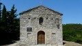
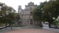
After (3) La Chapelle San Michele.
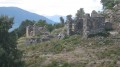
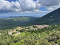
(4) The ruined village of La Serra.
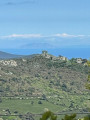
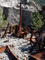
The ruined village of Cava di Fiorellu.
(7) Casacce Fountain

(360° view, sea and mountains).

Reviews and comments

3.1 / 5
Based on 5 reviews

Reliability of the description
3.2 / 5
Ease of following the route
3 / 5
Route interest
3.2 / 5
THISIS2B
THISIS2B

Overall rating : 4.3 / 5

Date of your route : Jan 26, 2025
Reliability of the description : ★★★★★ Very good
Ease of following the route : ★★★★☆ Good
Route interest : ★★★★☆ Good
Very busy route : No

The description and route map for the walk are accurate; the tracks and paths are well-maintained and marked with yellow signposts.
However, the starting point is not easy to spot – is it in the village centre? Or towards Solaro?
A small yellow signpost is therefore needed at the start, as is common throughout Corsica.
It was impossible to find the road leading to the village of Teppa; the end of the path is surrounded by fences.
Nevertheless, the walk was pleasant, with lovely views, an orientation board at the pretty chapel and magnificent trees all along the route.

Machine-translated

ID81360
ID81360

Overall rating : 3 / 5

Date of your route : Sep 22, 2023
Reliability of the description : ★★☆☆☆ Disappointing
Ease of following the route : ★★☆☆☆ Disappointing
Route interest : ★★★★★ Very good
Very busy route : No

We couldn’t find the start of the route; it’s not explained very clearly. The walk along the road was rather dull; we were made to park the car too far from the start of the route. In the end, we got back in the car and joined the route from the chapel, where it’s easy to park. After that, the walk is superb, but very poorly signposted. From the ruins, it’s difficult to find the path leading down to the fountain, and the rest of the route is just as confusing.

Machine-translated

AURE2B
AURE2B

Overall rating : 4.3 / 5

Date of your route : Feb 03, 2019
Reliability of the description : ★★★★★ Very good
Ease of following the route : ★★★★★ Very good
Route interest : ★★★☆☆ Average

Walk undertaken with two 8-year-old children
The path is in good condition, with no major technical difficulties
The main attraction is the abandoned village

Machine-translated

Incantesimu
Incantesimu

Hello Evelyne123,

Thank you for taking the time to check out the route and for helping to ensure the walks ran smoothly.

Have a lovely day.

Incantesimu

Machine-translated

Evelyne123
Evelyne123

Yes, that sounds perfect to me!
Thanks for your prompt response

Machine-translated

Incantesimu
Incantesimu

Hello,

Following the mishaps experienced by Lega and Eveline123 due to a section of the route becoming overgrown, I have altered the route and retained only the section from (S/E) to (8). Nevertheless, the route remains pleasant and scenic (according to Eveline123 – see comment below); opinions depend on what one is looking for and each person’s individual experience.

Incantesimu

Machine-translated

Incantesimu
Incantesimu

Hello Evelyne123,

You’re quite right – when I say ‘you’, I mean both Lega and you. The old mule track after point (8) is no longer maintained. So I’ve modified the route and kept only the S/E point at point 8. This route will no longer feature in the ‘Bouger en Oriente’ booklet. Could you please check whether the route on Visorando looks correct? Sorry about this unfortunate mix-up.
If you’re on holiday on the island, have a great time and enjoy your hike.
Kind regards
Incantesimu

Machine-translated

Evelyne123
Evelyne123

Yes, absolutely!
Thank you for your prompt response...

Machine-translated

Incantesimu
Incantesimu

Hello Evelyne 123,

I did this route in 2015; it was partly finished (cleared of undergrowth) and was due to be open by 2016, but clearly that isn’t the case. I’ll go and have a look for myself and, if necessary, I’ll contact the Aleria Tourist Office so they can take the necessary action. Please could you confirm that the route is open from 8 to S/E? Pending your reply, I’ll correct the route on Visorando as soon as I get back from Casevecchie.
I look forward to hearing from you.
Kind regards
Incantesimu

Machine-translated

Evelyne123
Evelyne123

Overall rating : 2.5 / 5

Date of your route : May 09, 2018
Reliability of the description : ★★☆☆☆ Disappointing
Ease of following the route : Not used / Not applicable
Route interest : ★★★☆☆ Average

We’d decided to do the route in reverse, starting from point 9, so as to begin with the climb, but I can confirm that, at the start, the path that follows the stream is completely impassable – unless you bring a brush cutter! So we followed the road (often cutting across it) as far as point 8.
From there, the walk is very, very lovely all the way to point 1 (A/D).
Unfortunately, the rain (and the fear of encountering that impassable path along the stream again) meant we ended up walking 8 km along the road!

Machine-translated

Incantesimu
Incantesimu

Hello Gazok54,

I don’t understand. This route is featured in the ‘Bougez en Oriente’ booklet. I did it myself without any problems, which is why I shared it on the website. The route was downloaded from my GPS. I can well understand that it isn’t easy, but it’s not impossible to do – the photos are clear proof that I’ve been there. However, the route was subject to completion of the works. Please could you specify what’s wrong?

Kind regards

Incantesimu

Machine-translated

Incantesimu
Incantesimu

Hello Lega,

I don’t understand. This route is featured in the ‘Bougez en Oriente’ booklet. I did it myself without any problems and so shared it on the website. The route was downloaded from my GPS. I can well accept that it isn’t easy, but it’s not impossible to do – the photos are clear proof that I’ve been there. However, the route was supposed to be open, subject to the completion of the works. Please could you explain what’s wrong?

Kind regards

Incantesimu

Machine-translated

gazok54
gazok54 ★

Thank you, Lega
Could you give us a few examples of where you’ve come across inconsistencies?

Machine-translated

Lega
Lega

Overall rating : 1.3 / 5

Date of your route : May 12, 2018
Reliability of the description : ★★☆☆☆ Disappointing
Ease of following the route : ★☆☆☆☆ Very disappointing
Route interest : ★☆☆☆☆ Very disappointing

We tried to do this hike, but the description doesn’t match the reality on the ground
A hike that is impossible to complete

Machine-translated

Other walks in the area

For more walks, use our search engine .

The GPS track and description are the property of this route's author. Please do not copy them without permission.