Grawl

 Visorando Member
 Premium user
- Location: Pont-à-Mousson (54700)
- Gender: man
- Website: https://histoiresdemarche.wordpress.com/
Sign up:
Published route(s)
 Le Tanet and Lac Vert
 4.55 mi
 +902 ft
 -912 ft
 2h 55
 Moderate
 Departure from Soultzeren (Haut-Rhin)
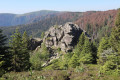
This easy loop allows you to discover Tanet, one of the most beautiful peaks in the Vosges, with stunning views and the Haut-Fourneau stone cairns. In late June or early July, you can also enjoy the mountain flowers. The return journey is sheltered by Lac Vert.
Morizécourt - Bourbonne-les-Bains
14.52 mi
+377 ft
-804 ft
7h 00
 Difficult
Departure from Morizécourt (Vosges)
A route showcasing the transition in landscapes and architecture between the Vosges and the Haute-Marne.
Méloménil – Relanges
 23.56 mi
+1,460 ft
-1,424 ft
12 hrs
 Very difficult
Departure from Uzemain (Vosges)
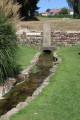
The trail continues through the forests of the Vôge and follows the Saône’s original course from its source.
Remiremont - Méloménil
 19.59 mi
+1,608 ft
-1,883 ft
10 hrs
Very difficult
Departure from Remiremont (Vosges)
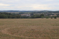
The path leaves the Moselle valley and heads towards the Canal des Vosges. This mainly wooded walk is enhanced by traditional Lorraine farmhouses.
Circular route between Maidières and Petite Suisse Lorraine
 19.96 mi
+1,663 ft
-1,654 ft
10h 40
Difficult
Departure from Maidières (Meurthe-et-Moselle)
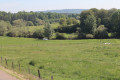
The Ruisseau d’Esch valley is known as ‘Little Lorraine’ due to its rolling terrain and bucolic landscapes combining forests and grazing meadows. The route is dotted with villages featuring typical Lorraine farmhouses and unassuming little monuments (churches, crosses and fountains).
Ballon d'Alsace - Chalet de l'Alouette
 14.19 mi
+1,860 ft
-3,665 ft
8h 10
Difficult
Departure from Lepuix (Territoire-de-Belfort)
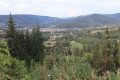
This beautiful route begins with two remarkable peaks in the Vosges and offers beautiful views of the upper Moselle valley, before reaching the Pays des Étangs.
Bray-Dunes – Dunkirk
 9.57 mi
+66 ft
-33 ft
4h 30
Moderate
Departure from Bray-Dunes (Nord)
The start of the coastal path, which takes you along the beaches and seafront between the Belgian border and Dunkirk, passing through the Dune Marchand Nature Reserve. The route largely follows theGR®120but not entirely.
Gravelines – Calais
 17.04 mi
+30 ft
-33 ft
7h 50
Difficult
Departure from Gravelines (Nord)
The route rejoins the coast at the beautiful Aa estuary and Fort-Grand-Philippe. It then crosses the Platier d’Oye nature reserve. It continues along a wide beach, heads back inland and arrives at the Centre Jules Ferry. It then leads to the centre of Calais.
Dunkirk - Bergues
 8.58 mi
+46 ft
-56 ft
4h 00
Moderate
Departure from Dunkerque (Nord)
After Dunkirk, theGR® 120 takes a detour inland. Once out of Dunkirk, the route passes peacefully through the Bois des Forts and reaches the pretty fortified town of Bergues with its canals and medieval ruins.
The stage is fairly short, leaving plenty of time to wander around Bergues.
Hardelot-Plage (Neufchâtel-Hardelot) - Étaples
 12.37 mi
+262 ft
-256 ft
5h 55
Moderate
Departure from Neufchâtel-Hardelot (Pas-de-Calais)
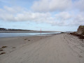
From Hardelot, the trail continues along the beach. It temporarily leaves the beach to cross the Mont Saint-Frieux dune. At Camier, it leaves the coast to join the trail that crosses the Baie de Canche Nature Reserve, offering a beautiful view of the bay. It then descends to the Canche estuary, which it follows up to Étaples.
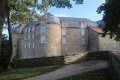
Boulogne – Hardelot-Plage (Neufchâtel-Hardelot)
 9.67 mi
+443 ft
-449 ft
4h 50
Moderate
Departure from Boulogne-sur-Mer (Pas-de-Calais)
After two stages along the cliffs, the trail, once past Le Portel, returns to beaches fringed by dunes, with a few diversions: the walk through Equihen-Plage and the Dune Trail before Hardelot-Plage.
Make the most of this short stage to visit the walled town of Boulogne before setting off.
The route follows theGR® 120.
Framezelle (Audinghen) - Boulogne
 13.64 mi
+377 ft
-499 ft
6h 35
Difficult
Departure from Audinghen (Pas-de-Calais)
The coastal path winds its way through the countryside and past magnificent cliffs, with a few breaks after passing through Audresselles, Ambleteuse and Wimereux. To round off the day nicely, make the effort to climb up to the old fortified town of Boulogne.The route follows theGR® 120, which has been rerouted as the Sentier des Crans has been closed.
⚠️ 16/06/2026: route modified to follow the GR®120 diversion. From Cap Gris Nez to Audresselles, it no longer passes through Les Crans.
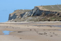
Calais - Framezelle
 15.42 mi
+761 ft
-643 ft
7h 45
Difficult
Departure from Calais (Pas-de-Calais)
This superb stage alternates between beaches and cliffs and passes through the remarkable sites of Cap Blanc-Nez, Petit Blanc-Nez and Wissant Bay, ending at Cap Gris-Nez.
The coastal path from Bray-Dunes to Étaples
105.81 mi
+2,001 ft
-1,978 ft
8 days
Difficult
Departure from Bray-Dunes (Nord)
This beautiful route allows you to discover a varied coastline with vast sandy beaches, pebble beaches and a long stretch of cliffs between Calais and Boulogne. It also offers short detours away from the coast into dune nature reserves.This multi-day hike will appeal not only to lovers of remarkable natural sites, but also to enthusiasts of architectural heritage and birdwatchers (during migration periods).
The old Moselle valley
 16.70 mi
+1,391 ft
-1,286 ft
8h 55
Difficult
Departure from Toul (Meurthe-et-Moselle)
This route follows the ancient valley of the Moselle, which used to flow into the Meuse at Pagny-sur-Meuse before it was diverted, some 200,000 years ago, towards the Meurthe due to the accumulation of alluvial deposits at the Foug weir.
Starting from Toul, you follow the Ingressin valley, which runs along the former course of the Moselle; you then cross the Foug weir to emerge into the Val de l’Asne and arrive at Pagny-sur-Meuse at the former confluence of the two rivers.