


 Country:

 City:


(S) Set off from Place Charles Valentin (Town Hall and belfry), turn your back on the belfry and head towards the arsenal. Leave the footbridge leading to the arsenal on your left and head down to the right through the gardens running alongside the street towards the ‘Parking des Islandais’. At the bottom, cross a moat and immediately turn left onto Rue des Islandais. Walk along the harbour.
(1) At the junction after a sharp left-hand bend, turn right and cross the River Aa. Turn right again straight away and follow the RD11 (Quai Ouest) round the harbour, towards Grand-Fort-Philippe. When the road bends to the left, opposite a garage, turn right onto Rue de l’Aa.
(2) Turn left onto the street running alongside the Aa channel (Route du Chenal). Follow this road to the Grand-Fort-Philippe maritime wayside shrine.
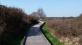
(3) Turn left. After the car park, turn right onto the wooden boardwalk. At the junction with the Allée de Salicornes, carry straight on along the Allée des Garennes towards Platier d’Oye. At the next junction, take the grassy path opposite on the right. Enter the nature reserve and you’ll come to another junction.
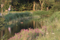
(4) Carry on straight ahead along the track (to continue on theGR® 120, you will probably need to take the path branching off to the left). Cross a dune and reach a junction with a track. Turn left. The track disappears. Carry on in the same direction, passing two hunting ponds, cross a small dune and walk alongside further hunting ponds on the inland side. You’ll come to a track again; when it turns right, take the sandy path opposite, which crosses another dune and leads to the beach.
(5) Turn left and follow the beach to a lifeguard station. Turn left and leave the beach via a flight of steps just before the lifeguard station, followed by a footbridge. A few metres further on, you’ll rejoin the GR®.
(6) Continue straight on, then turn right at a junction with an information sign, a few metres from a car park. Follow this concrete path and ignore the path leading to the car park. Then pass two paths on the left leading to houses and arrive at another information sign. Pass a flight of steps on your right (the path to the beach is blocked a little further on) and turn left. Further on, in a wide bend to the left, pass a path on your right. Continue along a grassy path which climbs towards a viewing point. Immediately afterwards, take a wide bend to the left and follow the grassy path running alongside a fence.
(7) At the next junction, turn right onto the path between two fences. It bends left, then right, running some distance alongside a road, and leads to a car park with an information board.
(8) Turn right straight ahead from the car park, then turn left a little further on. Join a path with wooden decking and continue in the same direction. Further on, pass a path on your right and arrive at Les Huttes d’Oye.
(9) Cross Rue de la Mer and go through the gate on the other side. Follow the grassy path opposite on the right, which runs behind the houses. Go down a flight of steps, cross a dune, join another path and turn left. Reach the beach and continue in the same direction for half an hour. Pass a hunting pond and arrive at a large salt marsh with glasswort and sea lilac. Look out for a beach access point on the left with street lamps.
(10) Leave the beach, walk past a sand yachting centre and take the first street on the right.
After passing a racecourse, take the path opposite on the right and ignore the road that bends to the left. Continue along a footpath, cross through some woodland and arrive at a car park with a wooden fence.
(11) Ignore the path on the left and carry on straight ahead along the track closed to traffic. After three-quarters of an hour, you’ll reach the Centre Jules Ferry.
(12) Follow the road as it bends to the left and join the RD119.
(13) Turn right onto the small road running parallel to the RD119, then rejoin the departmental road to cross the bridge over the RN 216 (a four-lane road enclosed by high wire fencing). Continue for a long stretch along the RD119.
(14) Just past an electricity substation, turn right into the street and, at the end of the street, turn left. Continue to the end of the street and turn right. At the first roundabout, take the left-hand exit. At the second roundabout, continue straight ahead. Cross a bridge and arrive in Calais.
(15) Turn immediately right onto Boulevard des Alliés. You’ll come to a roundabout. Turn left onto Rue de la Mer, then cross Place d’Armes to reach the Guet Tower on the corner with Rue Royale (E).

 Visorando Member

 Easy
 Tourist office
 Moderate


 Very difficult

