Boulogne – Hardelot-Plage (Neufchâtel-Hardelot)

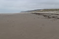
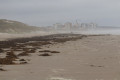
After two stages along the cliffs, the trail, once past Le Portel, returns to beaches fringed by dunes, with a few diversions: the walk through Equihen-Plage and the Dune Trail before Hardelot-Plage.
Make the most of this short stage to visit the walled town of Boulogne before setting off.
The route follows theGR® 120.

This walk is part of a multi-day hike: The coastal path from Bray-Dunes to Étaples

Details

2519306
Creation:
Last update:
Last review:
  • Walking
    Activity: Walking
  • ↔
    Distance: 9.67 mi
  • ◔
    Average duration: 4h 50 
  • ▲
    Difficulty: Moderate

  • ⚐
    Back to start: No
  • ↗
    Ascent: + 443 ft
  • ↘
    Descent: - 449 ft

  • ▲
    Highest point: 259 ft
  • ▼
    Lowest point: 13 ft

Photos

Description of the walk

(S) Start from the Pont Marguet in Boulogne, on the old town side.

Cross the Liane channel via the Marguet Bridge (take the covered footpath). Pass a car park, then keep to the right to walk along the quays in front of the ULCO (Université du Littoral Côté d’Opale). When you reach a paved area at the far end of the Bassin Napoléon, take the street that curves sharply to the left past a shipyard and the Chamber of Commerce buildings.

Continue along the long straight stretch through the warehouses (part of the road is reserved for pedestrians and cyclists; however, take great care with traffic as there is no physical separation). Pass the fish auction and reach the end of the road. Turn left onto the cycle path and continue to the end of the street, where you’ll find a lorry wash.

(1) Follow the road to the right, then turn right again to cross a railway line and turn left. After passing under a bridge, veer right and cross a car park to reach the beach.

(2) Turn left and follow the beach. You’ll come to a coastal stream just before a leisure centre. Cross it and turn left. Leave the beach via a tarmac path. This turns right after about ten metres and leads onto the Quai du Calvaire in Le Portel.

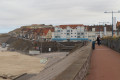
(3) Turn right and walk along the seafront. After a left-hand bend heading inland, cross the bridge on your right, then rejoin the seafront promenade. Walk to the end of the promenade.

(4) Leave the customs officers’ path opposite and turn left to head uphill along Rue de la Mer. Join Boulevard d’Alprech and continue uphill in the same direction. Take the second street on the right and enter a residential area. Then turn into the first street on the left and continue straight ahead.

At the end of the street, turn right onto Rue Champlain, then onto Rue du Commandant Charcot after a left-hand bend. At the junction, carry on straight ahead, then turn left to head back down Allée Paul Dukas. At the dead end, take a small tarmac lane on the left between two hedges and you’ll reach a road. Turn right and follow the road to a crossroads.

(5) Turn right and head uphill towards Stade Ravel. Pass the rocks blocking the way, walk alongside the stadium and reach the end of the track.

(6) Turn left onto a path running alongside a field. Continue in the same direction until you reach a hangar belonging to a microlight flying school.

(7) Turn right just before the hangar. Continue in the same direction, going round two earth mounds, and join a partially tarmac-surfaced track where it turns left. Continue downhill along this track, which ends at the entrance to a private property.

Carry on in the same direction along a path running alongside the property on the left. The path climbs and turns left, then veers slightly to the right alongside a power line. After the last pylon, you’ll reach a junction. Take the concrete track opposite, which passes close to a row of three blockhouses. Further on, carry straight on along a small tarmac road that descends and then climbs again to join the RD119 at Équihen-Plage.

(8) Turn right and follow the RD119. Head downhill to a roundabout.
(Note: leave theGRP® trail, marked in red and yellow, on your left as it follows Rue de l’Égalité).
At the roundabout, head back up the opposite side via the RD236 and follow it all the way. After a right-hand bend, it descends again and ends in a cul-de-sac on the beach.

(9) Continue along the beach in the same direction. After 300m, turn left, just before a coastal stream.

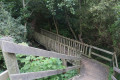
(10) Leave the beach via a path that leads to a small car park. Further on, turn right onto the Dunes Path (next to an information board), which begins with a wooden staircase followed by a footbridge. The sandy path winds through the dune amidst the vegetation. At the two junctions you come to, turn right.

You’ll reach a concrete track branching off to the left. At the observation post, carry on straight ahead. The track descends. At the first junction, turn right and you’ll reach a second junction

(11) Change direction sharply by turning right once more. At the end of the concrete track, turn 90° to the left and cross the dunes to reach the beach.

(12) Turn left and follow the beach to Hardelot Plage. Just before reaching Hardelot, turn left inland, following a coastal river upstream to a footbridge. Cross the footbridge and, immediately afterwards, take the path on the right. This path joins a small road which you follow without changing direction, leading to the seafront promenade.

(13) Follow this promenade to the end of the route, at a flight of steps leading down to the beach a few metres past the lifeguard station (E).

Waypoints

  1. S : mi 0 - alt. 23 ft - Marguet Bridge, Boulogne-sur-Mer
  2. 1 : mi 1.45 - alt. 26 ft - Heavy goods vehicle wash facility
  3. 2 : mi 1.85 - alt. 13 ft - Access to Portel Beach
  4. 3 : mi 2.34 - alt. 62 ft - Quai du Calvaire, Le Portel
  5. 4 : mi 2.74 - alt. 69 ft - Start of the Sentier des Douaniers, Le Portel
  6. 5 : mi 3.4 - alt. 108 ft - Starts from the Route du Stade Ravel, Le Portel
  7. 6 : mi 3.63 - alt. 180 ft - Ravel Stadium, Le Portel
  8. 7 : mi 3.88 - alt. 190 ft - Microlight school
  9. 8 : mi 4.69 - alt. 197 ft - Entrance at Equihen-Plage
  10. 9 : mi 5.87 - alt. 36 ft - Equihen-Plage walk
  11. 10 : mi 6.1 - alt. 23 ft - Access to the Sentier des Dunes
  12. 11 : mi 7.68 - alt. 115 ft - Return to the beach
  13. 12 : mi 8.19 - alt. 16 ft - Beach access between Equihen and Hardelot
  14. 13 : mi 9.29 - alt. 36 ft - Access to the seafront, Hardelot-Plage
  15. E : mi 9.67 - alt. 33 ft - Seafront walk in Hardelot-Plage

Notes

FFRP rating: difficulty = 2; technical difficulty = 2; risk = 1

Worth a visit

Boulogne: the old fortified town (the ramparts, the belfry, the town hall, the castle and its museum, the Basilica-Cathedral of Notre-Dame-de-l’Immaculée-Conception, the rampart walk), St Nicholas’ Church, the National Maritime Centre.
The beaches from Equihen-Plage to Hardelot-Plage.
The Dune Trail before Hardelot-Plage.

Always be cautious and plan ahead when you're outdoors. Visorando and the author of this route cannot be held responsible for any accidents occurring on this route.

The GR® and PR® markings are the intellectual property of the Fédération Française de Randonnée Pédestre.

Reviews and comments

4.2 / 5
Based on 4 reviews

Reliability of the description
4.3 / 5
Ease of following the route
4.3 / 5
Route interest
4 / 5
User 26426300
• Edited:

Overall rating : 4.3 / 5

Date of your route : Jul 06, 2025
Reliability of the description : ★★★★★ Very good
Ease of following the route : ★★★★☆ Good
Route interest : ★★★★☆ Good
Very busy route : Yes

A good route to take along the coast from Boulogne town centre. The Sentier du Douanier is a pleasant walk.
However, the start of the route takes you through the rather gloomy logistics area of the port before reaching Portel beach. An alternative is to turn off immediately after the Napoleon basin towards the cliff park, which is very pleasant. This means you only have to walk for 10 minutes through the warehouses before climbing up to the park.
And above all, I think it's better to stay along the coast rather than walk inland with this trail, or at least mix the two.

Machine-translated

Plaforet
Plaforet

Overall rating : 4.7 / 5

Date of your route : Aug 15, 2023
Reliability of the description : ★★★★☆ Good
Ease of following the route : ★★★★★ Very good
Route interest : ★★★★★ Very good
Very busy route : No

A very enjoyable hike. A splendid walk along the vast beach.

Machine-translated

alf1967
alf1967

Overall rating : 4.7 / 5

Date of your route : Feb 27, 2023
Reliability of the description : ★★★★★ Very good
Ease of following the route : ★★★★☆ Good
Route interest : ★★★★★ Very good
Very busy route : Yes

A brilliant route starting from Hardelot Castle.
You then visit the village, set in a very wooded area, before heading to the beach and dunes. The return journey involves a fair bit of elevation gain, partly through the dunes and partly through wooded terrain.

Very good

Machine-translated

mhasse
mhasse
• Edited:

I’m sorry if I offended you; I didn’t realise the word ‘ballot’ might have caused such offence!
And yet, taking the roads – i.e. tarmac – when the path you’re trying to avoid is absolutely stunning… I don’t see what’s so derogatory about that…
What I think is that the GR follows the route you describe because the customs officers’ path has only been reopened for two years… well, in my humble opinion, anyway!

Machine-translated

Grawl
Grawl
• Edited:

On the substance:
you’re right, this detour off the GR 120 inland – which isn’t just tarmac, contrary to what you claim – which I followed and described, is of no interest whatsoever. When I reached the start of the customs officers’ path, I wondered why the GR didn’t follow this route, which seemed more appealing to me: perhaps it was a dead end, or a dangerous stretch. In the end, I decided against it out of caution, and I’ve clearly missed out on something.

On the presentation:

“That’s a bit daft”

This derogatory term adds nothing to the discussion.

“Take such-and-such street, then so-and-so street, then head into the residential area...”

If you can think of another way to describe this route, please do feel free to suggest it...

Generally speaking, if you’d like to maintain a cordial and respectful relationship with the people you’re talking to, I’d have suggested you write your post as follows: “There is / I suggest (take your pick) a superb alternative route between Le Portel and the Crevasse d’Equihen via the coastal path” and describe it so that other hiking enthusiasts can enjoy it.

Machine-translated

mhasse
mhasse
• Edited:

Overall rating : 2.5 / 5

Date of your route : Jun 21, 2020
Reliability of the description : ★★★☆☆ Average
Ease of following the route : Not used / Not applicable
Route interest : ★★☆☆☆ Disappointing
Very busy route : No

It’s a bit of a shame to specify that you should ‘carefully avoid the most beautiful stretch of this section – Le Portel to the Equihen crevasse – via the Customs Officers’ Path’, when the description given from point 4 onwards is ‘take such-and-such street, then so-and-so street, then head into the residential area…: so it’s all tarmac, whereas the stretch along the customs officers’ path is magnificent!
Fortunately, I took the Customs Officers’ Path!

Machine-translated

Other walks in the area

For more walks, use our search engine .

The GPS track and description are the property of this route's author. Please do not copy them without permission.