


gk

 Visorando Member
 Premium user
 Sign up:
Published route(s)
 Cassel and Oxelaëre from Sainte-Marie-Cappel

 7.62 mi
 +604 ft
 -594 ft
 4h 00
4h 00
 Moderate
 Departure from Sainte-Marie-Cappel (Nord)
Circular starting from Sainte-Marie-Cappel, passing through Cassel and Oxelaëre.
The Doustre ponds
 10.26 mi
+545 ft
-558 ft
5h 10
Moderate
Departure from Montaignac-Saint-Hippolyte (Corrèze)
10.26 mi
+545 ft
-558 ft
5h 10
Moderate
Departure from Montaignac-Saint-Hippolyte (Corrèze)
A pleasant walk through the woods and around the ponds near Montaignac-Saint-Hippolyte.
Through the puys and ponds at Rosiers-d’Égletons
 6.96 mi
+433 ft
-440 ft
3h 35
Moderate
Departure from Rosiers-d'Égletons (Corrèze)
6.96 mi
+433 ft
-440 ft
3h 35
Moderate
Departure from Rosiers-d'Égletons (Corrèze)
A walk starting from the pretty village of Rosiers-d’Égletons, which will take you towards Les Puys before descending towards the ponds, through woods and fields.
70 per cent of the route is through woodland.
Yellow markings
On the paths of Marcouyeux
 4.12 mi
+272 ft
-266 ft
2h 10
4.12 mi
+272 ft
-266 ft
2h 10
 Easy
Departure from Le Jardin (Corrèze)
Easy
Departure from Le Jardin (Corrèze)
A route along forest tracks starting from the impressive Sully Oak in Puyhabilier. A family walk in the heart of nature, almost entirely through woodland.
Around the village of Le Jardin
 2.66 mi
+144 ft
-138 ft
1h 20
Easy
Departure from Le Jardin (Corrèze)
2.66 mi
+144 ft
-138 ft
1h 20
Easy
Departure from Le Jardin (Corrèze)
A short route starting from the village of Le Jardin, which takes you through the forest for most of the route.
A lovely, very easy family walk to explore the forest.
On the heights of Beaulieu-sur-Dordogne
 3.83 mi
+558 ft
-528 ft
2h 15
Easy
Departure from Beaulieu-sur-Dordogne (Corrèze)
3.83 mi
+558 ft
-528 ft
2h 15
Easy
Departure from Beaulieu-sur-Dordogne (Corrèze)
A lovely route that climbs to higher ground for beautiful views of the Dordogne Valley and the village of Altillac, before descending for a visit to Beaulieu-sur-Dordogne.
The Montamar hill
 8.21 mi
+1,138 ft
-1,168 ft
4h 45
Moderate
Departure from Saint-Yrieix-le-Déjalat (Corrèze)
8.21 mi
+1,138 ft
-1,168 ft
4h 45
Moderate
Departure from Saint-Yrieix-le-Déjalat (Corrèze)
A walk starting from Saint-Yrieix-le-Déjalat towards the fortified house of Montamar in the Limousin mountains. Landscapes of pastures, forests, moors, heather and streams. The walk follows the River Corrèze for a while before crossing it to climb towards Puy Lignou.
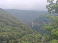
Circular from the Viaduc des Rochers Noirs to Soursac
 3.82 mi
+879 ft
-896 ft
2h 30
Moderate
Departure from Soursac (Corrèze)
3.82 mi
+879 ft
-896 ft
2h 30
Moderate
Departure from Soursac (Corrèze)
This route takes you along a very quiet road and narrow paths on either side of the Viaduc des Rochers Noirs viaduct to a metal suspension footbridge over the Luzège. Lovely views of the viaduct and the Luzège Valley.
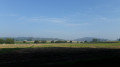
The source of the Peene at Sainte-Marie-Cappel
 6.32 mi
+75 ft
-75 ft
3h 00
Easy
Departure from Sainte-Marie-Cappel (Nord)
6.32 mi
+75 ft
-75 ft
3h 00
Easy
Departure from Sainte-Marie-Cappel (Nord)
A route through the fields following the course of the Peene’s sources, starting from Sainte-Marie-Cappel, with Mont Cassel and Mont des Récollets as a backdrop. Passing by one of the two documented sources of the Peene or Peene Becque.
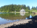
The Bourdouze and Montcineyre lakes from Les Chirouzes
 8.71 mi
+669 ft
-679 ft
4h 35
Moderate
Departure from Besse-et-Saint-Anastaise (Puy-de-Dôme)
8.71 mi
+669 ft
-679 ft
4h 35
Moderate
Departure from Besse-et-Saint-Anastaise (Puy-de-Dôme)
This route will take you to two lakes in the region, which are less visited than Lake Pavin but just as worth exploring.
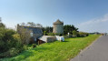
Cherrueix beaches and marshes
 5.11 mi
+10 ft
-10 ft
2h 20
Easy
Departure from Cherrueix (Ille-et-Vilaine)
5.11 mi
+10 ft
-10 ft
2h 20
Easy
Departure from Cherrueix (Ille-et-Vilaine)
An easy route to explore the marsh, then return to the seaside via the beach.
Views of the islands of Saint-Jouan-des-Guérets
 5.88 mi
+276 ft
-266 ft
2h 55
Easy
Departure from Saint-Jouan-des-Guérets (Ille-et-Vilaine)
5.88 mi
+276 ft
-266 ft
2h 55
Easy
Departure from Saint-Jouan-des-Guérets (Ille-et-Vilaine)
A walk that allows you to explore the Rance estuary and a few islands. This is a shorter version of walk 88877, ‘Around Saint-Jouan-des-Guérets’.
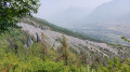
The Ravin des Merles and the Demoiselles Décoiffées
 3.66 mi
+1,329 ft
-1,342 ft
2h 50
Moderate
Departure from Puy-Saint-André (Hautes-Alpes)
3.66 mi
+1,329 ft
-1,342 ft
2h 50
Moderate
Departure from Puy-Saint-André (Hautes-Alpes)
Loop starting from Pierre Feu. This circuit will take you to the chapels and hamlets around Puy-Saint-André, sundials and the "Décoiffées" fairy chimneys. An easy circuit, except for the descent to Pierre Feu, which has a few sections where you need to take care not to slip.
The meandering trail in Saint-Philbert-sur-Orne
 3.94 mi
+407 ft
-423 ft
2h 10
Easy
Departure from Saint-Philbert-sur-Orne (Orne)
3.94 mi
+407 ft
-423 ft
2h 10
Easy
Departure from Saint-Philbert-sur-Orne (Orne)
Hike through woods, countryside, villages and rivers, from Roches d'Oëtre to Méandre de Rouvrou. From Roches d'Oëtre, follow a well-marked path that will take you through the meanders of La Rouvre.
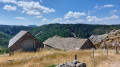
The Bramont Gorges, La Fage and Bassy
 5.66 mi
+1,122 ft
-1,102 ft
3h 35
Moderate
Departure from Saint-Étienne-du-Valdonnez (Lozère)
5.66 mi
+1,122 ft
-1,102 ft
3h 35
Moderate
Departure from Saint-Étienne-du-Valdonnez (Lozère)
An alternative route to walkno. 2842225:the Bramont Gorges and the hamlet of La Borie. Explore the Bramont Gorges starting from Saint-Étienne-du-Valdonnez, passing through the hamlet of La Fage and returning via Bassy. Most of the route runs through woodland. Beautiful views over the Cham des Bondons, the Echino d’Aze and one of the puechs, as well as the Truc de Balduc.
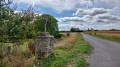
The Dénézé-sous-Doué Dolmens Trail
 8.04 mi
+187 ft
-171 ft
3h 50
Moderate
Departure from Dénezé-sous-Doué (Maine-et-Loire)
8.04 mi
+187 ft
-171 ft
3h 50
Moderate
Departure from Dénezé-sous-Doué (Maine-et-Loire)
A trail around Dénezé-sous-Doué, taking you past several dolmens, including the imposing Saugré Dolmen, as well as a number of heritage sites in Dénezé and the surrounding area. This trail is described on a sign at the entrance to the washhouse. The yellow signposting is very easy to follow.
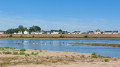
Amidst the Loire, vineyards, hedgerows and orchards in Saint-Rémy-la-Varenne
 7.01 mi
+548 ft
-571 ft
3h 40
Moderate
Departure from Saint-Rémy-la-Varenne (Maine-et-Loire)
7.01 mi
+548 ft
-571 ft
3h 40
Moderate
Departure from Saint-Rémy-la-Varenne (Maine-et-Loire)
This easy route will allow you to explore the varied landscapes around Saint-Rémy-la-Varenne. It alternates between open countryside and woodland along paths and roads with very little traffic. This route follows a Yellow route, then the GR®3 before branching off from it. During high water, the path along the Loire may be inaccessible.