The Doustre ponds

A pleasant walk through the woods and around the ponds near Montaignac-Saint-Hippolyte.

Details

11528299
Creation:
Last update:
Last review:
  • Walking
    Activity: Walking
  • ↔
    Distance: 10.26 mi
  • ◔
    Average duration: 5h 10 
  • ▲
    Difficulty: Moderate

  • ⚐
    Back to start: Yes
  • ↗
    Ascent: + 545 ft
  • ↘
    Descent: - 558 ft

  • ▲
    Highest point: 2,060 ft
  • ▼
    Lowest point: 1,762 ft

Photos

Description of the walk

(S/E) Start at Rue de l’Artisanat in Montaignac-Saint-Hyppolyte, opposite the railway line (car park). Head towards the little church along Rue de l’Artisanat, then turn left onto Rue des Fauvettes, which, after the cemetery, becomes a path running alongside the railway line.

(1) Take the path on the right through the Bois de Mars. When it joins a road (D66e), turn left, walk alongside a pond (private property) then turn left onto a path that runs alongside the pond again, following a fence.

(2) Turn right onto the path leading away from the pond and carry on straight ahead.

(3) At the three-way junction, take the right-hand path, then turn right at the junction. Ignore the path that branches off to the right after about 300 metres. When you reach the road, cross it, continue straight on, ignoring the paths on the right, and you’ll arrive at the Gros pond with a quiet picnic area.

(4) At the dyke, turn right and head for Saint-Hippolyte.

(5) Take the D66 on the left as far as the bridge over the Doustre. Just after the bridge, take the path on the right to Salins.

(6) Walk through the hamlet to the next crossroads. Then take the road on the right.

(7) Cross the Doustre again, leave the road via the first path on the left and continue to the fork before the Étang de Larchet.

(8) At the crossroads, turn right to join the D66 and follow it to the right. Then, at the three-way junction, continue left towards Neyrat. Walk alongside the lake and then cross its embankment on the left.

(9) Continue along the path until it joins a wider path; take this path to the left.

(10) At the road (D60), turn left and then, almost immediately, turn right onto the narrow road, which becomes a track once you have passed the Étang de Ruffaud.

(11) Keep to the right, on the path that crosses pasture and woodland until you reach a road.

(12) Turn left towards La Chèze, go through the first junction, then at the next one in La Chèze, turn right towards Montaignac-Saint-Hippolyte. Enjoy the view of the château on your right and return to the starting point (S/E).

Waypoints

  1. S/E : mi 0 - alt. 2,031 ft - Rue de l’Artisanat - Gare de Montaignac-St-Hippolyte
  2. 1 : mi 0.74 - alt. 2,014 ft - Path on the right
  3. 2 : mi 2.04 - alt. 1,844 ft - T-junction after the pond
  4. 3 : mi 2.18 - alt. 1,873 ft - On the right
  5. 4 : mi 3.82 - alt. 1,850 ft - Étang de Gros
  6. 5 : mi 4.38 - alt. 1,857 ft - D66 road - Église Saint-Hippolyte (Saint-Hippolyte)
  7. 6 : mi 5.14 - alt. 1,893 ft - The hamlet of Salins
  8. 7 : mi 5.7 - alt. 1,768 ft - Bridge over the Doustre
  9. 8 : mi 6.31 - alt. 1,916 ft - T-junction - Étang de Larchet
  10. 9 : mi 7.26 - alt. 1,867 ft - Étang de Neyrat
  11. 10 : mi 7.85 - alt. 1,955 ft - D60 road
  12. 11 : mi 8.3 - alt. 1,883 ft - Étang de Ruffaud
  13. 12 : mi 9.41 - alt. 2,024 ft - Towards La Chèze
  14. S/E : mi 10.26 - alt. 2,028 ft - Rue de l’Artisanat - Gare de Montaignac-St-Hippolyte

Worth a visit

The church of Saint-Hippolyte, dating from 1495.
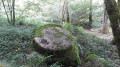
After Saint-Hippolyte, as you pass through Le Doustre, look out for the “wobbly rock” in the riverbed, topped with a cross.
Montaignac Castle, rebuilt in 1879 but whose origins are thought to date back to the Middle Ages.
The ponds, including the Étang de Gros, an ancient and fish-rich pond. In the evening or early in the morning, you might spot an otter coming to feast there.

Reviews and comments

4.8 / 5
Based on 2 reviews

Reliability of the description
5 / 5
Ease of following the route
5 / 5
Route interest
4.5 / 5
kichou
kichou

I’ve already given my opinion! A really lovely nature walk!

Machine-translated

GaëlleF
GaëlleF

Overall rating : 5 / 5

Date of your route : Aug 17, 2026
Reliability of the description : ★★★★★ Very good
Ease of following the route : ★★★★★ Very good
Route interest : ★★★★★ Very good
Very busy route : No

A lovely, easy walk
A very peaceful, well-shaded route with few roads
Very pleasant ponds
Picnic by the River Doustre
Definitely worth doing

Machine-translated

kichou
kichou

Overall rating : 4.7 / 5

Date of your route : Aug 18, 2025
Reliability of the description : ★★★★★ Very good
Ease of following the route : ★★★★★ Very good
Route interest : ★★★★☆ Good
Very busy route : No

a superb route that isn't too physically demanding and is very enjoyable! A nature walk with magnificent forests and splendid ponds!

Machine-translated

Other walks in the area

For more walks, use our search engine .

The GPS track and description are the property of this route's author. Please do not copy them without permission.