Through the puys and ponds at Rosiers-d’Égletons

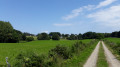
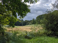
A walk starting from the pretty village of Rosiers-d’Égletons, which will take you towards Les Puys before descending towards the ponds, through woods and fields.
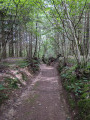
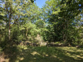
70 per cent of the route is through woodland.
Yellow markings

Details

13054381
Creation:
Last update:
Last review:
  • Walking
    Activity: Walking
  • ↔
    Distance: 6.96 mi
  • ◔
    Average duration: 3h 35 
  • ▲
    Difficulty: Moderate

  • ⚐
    Back to start: Yes
  • ↗
    Ascent: + 433 ft
  • ↘
    Descent: - 440 ft

  • ▲
    Highest point: 2,198 ft
  • ▼
    Lowest point: 1,850 ft

Photos

Description of the walk

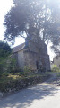
Start from the church. Parking available 150 metres away.

(S/E) Take the Route de Seugnac heading north-west (D142E1). Pass through the hamlets of La Taulie and Le Pont de Seugnac. After the latter, at the three-way junction, take the Route de Rouclioux on the left.

(1) Turn onto the track leading into the woods on the left. Follow this main track as it circles round the Puy de Ceyre.

(2) At the junction with a main track, turn left towards l’Arbre Epic.

(3) Cross the road and continue straight on until you reach the D1089.

(4) Go under the main road using the underpass on the right, then cross the railway line (level crossing). Carry on along the path opposite.

(5) At a junction where several paths meet, turn left heading due north (if you carry on, you’ll see a pond on your right. At that point, turn back).

(6) At the next junction, turn right and, at the three-way junction, keep left. Cross the road and carry on straight ahead. Follow the path on the left at the three-way junction towards the Étang de Gros.

(7) Follow the edge of the pond, keeping to the right. At the junction, the yellow signposts indicate either right or left. Turn left, cross the pond’s embankment and turn left again.

(8) At the sign saying ‘No vehicles allowed’, carry on along this path and then take the path on the left. Continue until you reach the road, which you take to the left.

(9) Turn left onto a well-marked track and join a road.

(10) At the road, turn right towards Rosiers-d’Égletons to cross the railway line again, then the departmental road, and arrive at the church (S/E).

Waypoints

  1. S/E : mi 0 - alt. 1,919 ft - Église Sainte-Croix (Rosiers-d'Égletons)
  2. 1 : mi 0.79 - alt. 1,936 ft - Path on the left
  3. 2 : mi 1.57 - alt. 2,077 ft - Crossroads
  4. 3 : mi 2.23 - alt. 2,083 ft - Crossroads at the ‘Arbre Epic’
  5. 4 : mi 2.87 - alt. 2,021 ft - Passage under the departmental road
  6. 5 : mi 3.5 - alt. 1,873 ft - Turn left at the fork
  7. 6 : mi 3.77 - alt. 1,982 ft - Crossroads
  8. 7 : mi 4.88 - alt. 1,854 ft - Étang de Gros
  9. 8 : mi 5.24 - alt. 1,857 ft - Sign: no vehicles permitted
  10. 9 : mi 6.07 - alt. 1,962 ft - Junction on the path
  11. 10 : mi 6.47 - alt. 1,893 ft - Road junction
  12. S/E : mi 6.96 - alt. 1,916 ft - Église Sainte-Croix (Rosiers-d'Égletons)

Notes

Picnic table by the Étang de Gros.
The forest tracks you’ll be using are sometimes rutted by machinery, but it’s always possible to get through. Avoid periods of heavy rain, however.

Worth a visit

The village of Rosiers-d’Égletons was the birthplace of two popes from the same family: Clement VI, who commissioned the construction of the second Papal Palace in Avignon, and Gregory XI (his nephew), who restored the papal seat to Rome.

Étang de Gros: enjoy the tranquillity of this spot (picnic tables), ideal for a break.

Reviews and comments

4.4 / 5
Based on 3 reviews

Reliability of the description
4.7 / 5
Ease of following the route
4.3 / 5
Route interest
4.3 / 5
Chris.b
Chris.b

Overall rating : 4 / 5

Date of your route : Aug 17, 2026
Reliability of the description : ★★★★☆ Good
Ease of following the route : ★★★★☆ Good
Route interest : ★★★★☆ Good
Very busy route : No

A lovely walk, half through the woods and the rest along paths and roads. Be careful – due to logging operations, you’ll lose the path after leaving the pond, but with the GPS route, everything falls into place.

Machine-translated

croulet
croulet

Overall rating : 4.7 / 5

Date of your route : Jun 15, 2026
Reliability of the description : ★★★★★ Very good
Ease of following the route : ★★★★★ Very good
Route interest : ★★★★☆ Good
Very busy route : No

We went on this hike in May; the forest sections made it a pleasant walk. We followed the route using the GPX track.
We made a detour via St Hyppolyte, which has a beautiful chapel and a lovely waterfall – highly recommended!
The picnic tables by the Gros pond were much appreciated.
Watch out for ticks along the route.

Machine-translated

cmarliac
cmarliac

Overall rating : 4.7 / 5

Date of your route : Aug 17, 2024
Reliability of the description : ★★★★★ Very good
Ease of following the route : ★★★★☆ Good
Route interest : ★★★★★ Very good
Very busy route : No

A lovely walk that is fairly well signposted.
However, take care at point 6 as there are no signposts at the entrance to the path you need to take opposite.
There are no markings after you’ve started point 9, as the path has been cut through the woodland; follow the main path to the right, which joins the road and takes you back towards Rosiers d’Egletons.

Machine-translated

Other walks in the area

For more walks, use our search engine .

The GPS track and description are the property of this route's author. Please do not copy them without permission.