Country:
 City:
City:




The route starts from the car park to the left of the church in Saint-Rémy-la-Varenne. Plenty of parking spaces available, as well as a picnic area.
(S/E) From the car park, take the well-marked path starting under a portico alongside the picnic area, then take the first path on the right until you reach the banks of the Loire.
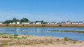
(1) Follow the Loire to the left, pass under the metal-framed road bridge, then walk past an open-air café and continue to a small bridge spanning a ditch.
(2) Once past the bridge, turn left again and follow a lovely, wide path until you reach the D132.
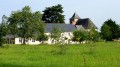
(3) Take this road to the right until you reach a junction signposted ‘Manoir de Chauvigné’: there is a timber-framed well and a lovely view of the Manoir de Chauvigné.
(4) Head towards the manor house and the well (signposted) on the left. Enter Chauvigné. The manor house and the well (which, unfortunately, are not open to visitors) are on the right. Towards the end of the hamlet, you’ll rejoin the GR®3 route, which you’ll follow to Boissay.
(5) Turn left onto Ruelle du Haut Chevigné, then onto Rue de Chauvigné.
(6) Turn right onto the Chemin de la Chênaie, which opens up in front of you at a bend. Follow the path to the entrance to Saint-Rémy-la-Varenne. Take care when crossing the D55.
(7) Continue along Rue de Rochereau past some lovely market gardens. At the junction with a road, turn right (wash house 50 m ahead).
(8) Walk past it, then take the path on the left – still signposted GR®3 – to the hamlet of Boissay.
(9) Leave the GR®3 here and carry on straight ahead, past a pretty manor house with a coat of arms on its gable: take a moment to admire the lovely rear façade. The path winds down through orchards and vineyards and joins the Route Thoureil–Saint-Rémy (D132).
(10) Take this road to the left, towards Saint-Rémy. Pass the orchard offices, then come to a path on the right which descends between two entrances to private properties.
(11) Take this path, continuing straight on until you reach the banks of the Loire, which you’ll follow on your left.
(1) Go past the path you took on the way there and continue straight ahead until you reach the path that branches off to the left, just before the bridge. Take this path to reach the car park (S/E).
 Visorando Member
 Easy
Easy 

 Tourist office