The Montamar hill

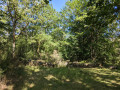
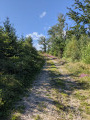
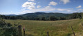
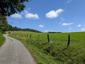
A walk starting from Saint-Yrieix-le-Déjalat towards the fortified house of Montamar in the Limousin mountains. Landscapes of pastures, forests, moors, heather and streams. The walk follows the River Corrèze for a while before crossing it to climb towards Puy Lignou.

Details

13591648
Creation:
Last update:
Last review:
  • Walking
    Activity: Walking
  • ↔
    Distance: 8.21 mi
  • ◔
    Average duration: 4h 45 
  • ▲
    Difficulty: Moderate

  • ⚐
    Back to start: Yes
  • ↗
    Ascent: + 1,138 ft
  • ↘
    Descent: - 1,168 ft

  • ▲
    Highest point: 2,454 ft
  • ▼
    Lowest point: 2,051 ft

Photos

Description of the walk

Park in the centre of the village of Saint-Yrieix-le-Déjalat.

(S/E) Take the road leading down behind the church (Rue du Pré du Château). This road winds its way down, crosses a stream and then climbs again.

(1) Leave the forest track on your left – this will be your return route – and carry on along the road. Do the same for the next forest track and continue towards Commerly.

(2) Before you reach the village, take the road on the left through the pastures.

(3) Ignore the track branching off to the left and cross the Dadalouze.

(4) Carry on along the road, ignoring the track that branches off to the right at a bend. Pass through the hamlet of Les Pradeleix, continuing to follow the road. Cross the bridge over the Corrèze.

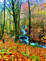
(5) Immediately afterwards, turn right onto the path which runs pleasantly alongside the river towards the ruins of the Maison Forte de Montamar. Follow this path until you reach the sign pointing to the ruins on the right.

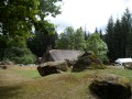
(6) A very short climb leads to the ruins of the fortified house, which was built to monitor commercial traffic. Please note: on the way down, do not continue along the main path, but follow the much less visible path that veers off to the right towards Corrèze. You’ll come to a small wooden bridge crossing the river; cross it and then follow the path which will take you up to higher ground, offering a lovely view of the surrounding hills.

(7) Once back on the road, carry on towards Viossanges, which you should pass through by going straight on at the junction. As you leave the village, look out for a coat of arms in the shape of an angel above a barn door on your left. Carry on until you reach the road.

(4) Turn left onto the road and cross the bridge over the Dadalouze once more.

(3) Take the first path on the left, following theGR® 440.

(8) Leave theGR® 440 at the first junction on the right, which takes you up a path lined with heather. This path takes a hairpin bend to the left and, after the climb, descends back down to the road.

(1) Carry on straight ahead until you return to Saint-Yrieix-le-Déjalat (S/E).
:

Waypoints

  1. S/E : mi 0 - alt. 2,454 ft - Église Saint-Yrieix (Saint-Yrieix-le-Déjalat)
  2. 1 : mi 0.87 - alt. 2,195 ft - Junction with the Combes circular loop
  3. 2 : mi 1.48 - alt. 2,352 ft - Junction
  4. 3 : mi 1.8 - alt. 2,234 ft - Junction
  5. 4 : mi 2.02 - alt. 2,215 ft - Junction with the Montamar circular loop
  6. 5 : mi 3 - alt. 2,054 ft - Pont des Pradeix
  7. 6 : mi 3.87 - alt. 2,139 ft - Junction at the Montamar ruins
  8. 7 : mi 4.78 - alt. 2,441 ft - Road junction
  9. 8 : mi 6.24 - alt. 2,320 ft - Leaving the GR°°®°°440
  10. S/E : mi 8.21 - alt. 2,454 ft - Église Saint-Yrieix (Saint-Yrieix-le-Déjalat)

Notes

Sign at the start showing various trails, including the route described here. The route is clearly signposted.

Worth a visit

The fortified house of Montamar was built inthe 14th century by the lords of Saint-Yrieix to control trade at a time when the landscape was much less wooded. It consists of a large rectangular building situated on a summit platform. Two annexe buildings flank it to the north and south. A bread oven remains below, to the east. Access to the ramparts is defended, to the west, by two half-moon-shaped moats lined with earthen ramparts. These features are typical of the fortified houses of that period in the Limousin. In 2021, the ruins are barely visible amongst the vegetation.

Always be cautious and plan ahead when you're outdoors. Visorando and the author of this route cannot be held responsible for any accidents occurring on this route.

The GR® and PR® markings are the intellectual property of the Fédération Française de Randonnée Pédestre.

Reviews and comments

4.3 / 5
Based on 3 reviews

Reliability of the description
4.5 / 5
Ease of following the route
5 / 5
Route interest
3.3 / 5
chipie33290
chipie33290

Overall rating : 4.5 / 5

Date of your route : Oct 10, 2023
Reliability of the description : Not used / Not applicable
Ease of following the route : ★★★★★ Very good
Route interest : ★★★★☆ Good
Very busy route : No

There are quite a few roads on this route. A bit too many for my liking.
Fortunately, there are lovely views of the Puys, beautiful forests and hamlets with interesting architecture.
The fortified house at Montamar isn’t really all that interesting.
Thanks for this route

Machine-translated

Allorent
Allorent

Overall rating : 4 / 5

Date of your route : Jul 18, 2023
Reliability of the description : ★★★★☆ Good
Ease of following the route : ★★★★★ Very good
Route interest : ★★★☆☆ Average
Very busy route : No

A route that involves a lot of road cycling. A bit tedious overall.

Machine-translated

Jojo19
Jojo19

Overall rating : 4.3 / 5

Date of your route : Oct 19, 2021
Reliability of the description : ★★★★★ Very good
Ease of following the route : ★★★★★ Very good
Route interest : ★★★☆☆ Average
Very busy route : No

Very pleasant, lovely scenery, but lots of narrow roads (about an hour’s walk for a 3-hour 15-minute hike). And it’s true that there’s hardly anything left of the fortified house. An easy hike, although there are some lovely little ‘climbs’. And there’s water everywhere for my hiking dog to drink, which is nice.

Machine-translated

Other walks in the area

For more walks, use our search engine .

The GPS track and description are the property of this route's author. Please do not copy them without permission.