Country:
 City:
City:


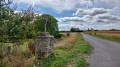
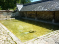
Starts at the Saugré wash house (picnic table). Parking is available for a small number of vehicles at the start.
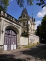
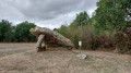
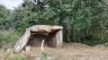
(S/E) With your back to the washhouse, follow the road to the left. Turn right immediately and pass the Domaine de la Garenne on your right. About 400 m further on, don’t miss the path on the right which leads very quickly to the Pierre Petouse dolmen (spelled ‘Péteuse’ on IGN maps).
(1) Return to the road and follow it to the right.
(2) Take the first path on the right. At the next junction, veer left towards a wood. Walk along the edge of the wood until you reach a three-way junction.
(3) Then take the path on the right and enter the woods.
(4) You’ll come to a path running at right angles; follow it to the right. The path soon gives way to a small road. Leave the woods and carry straight on along this road.
(5) Carry on straight ahead towards the Saugré Dolmen. Cross a small road and continue along the path opposite to reach the dolmen in no time.
(6) Turn back, cross the small road again and carry on straight ahead.
(5) Take the first path on the right towards a wood. At the junction (elevation 74), turn right at the edge of the wood. This will take you to a crossroads with four paths (Carrefour de l’Échallier).
(7) Then turn left and head uphill. You’ll reach the Pierre Couverte dolmen (information board).
(8) Just past the dolmen, turn left. Ignore a path branching off to the left, then another to the right.
(9) Join the D213 (a quiet road) and follow it to the left until you reach a large house behind a pond (a place called Rousse).
(10) Take the path on the right, which is just past the house. You’ll come to a Fork in the road at the edge of the woods.
(11) Take the path on the right (south), which stays along the edge of the woods. Walk past the Moulin des Bruyères.
(12) You’ll come out onto a small road; follow it to the right.
(13) Cross the D213 and continue along the small road to the hamlet of La Carte.
(14) Take the road on the left and immediately ignore a turn-off on the right. At the next junction (marker 75), take the second road on the right (west). At the next crossroads, turn left.
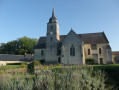
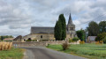
(15) Join the D177 and follow it to the right. After about 300 m, turn right towards the church and the cemetery (enter the cemetery to see the gateway to this very old church).
(16) Follow the road which goes round the church on the left. Carry on straight on until you reach the entrance to Dénezé-sous-Doué and a wayside cross.
(17) Turn right towards Gastineau.
(18) After about 500 m, turn right towards the old mill. Go round the mill on the right and continue along a country lane. You’ll reach the hamlet of Saugré (withits many cellars and remarkable houses built at the bottom of a quarry). Turn left and head for the Saugré washhouse (S/E).
 Visorando Member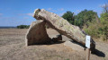
 Easy
Easy 
 Tourist office