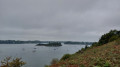
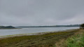
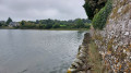
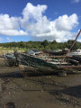
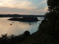
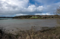
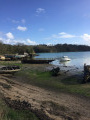
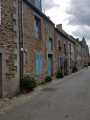
Views of the islands of Saint-Jouan-des-Guérets

A walk that allows you to explore the Rance estuary and a few islands. This is a shorter version of walk 88877, ‘Around Saint-Jouan-des-Guérets’.

Details

63544389
Creation:
Last update:
Last review:
  • Walking
    Activity: Walking
  • ↔
    Distance: 5.88 mi
  • ◔
    Average duration: 2h 55 
  • ▲
    Difficulty: Easy

  • ⚐
    Back to start: Yes
  • ↗
    Ascent: + 276 ft
  • ↘
    Descent: - 266 ft

  • ▲
    Highest point: 171 ft
  • ▼
    Lowest point: 13 ft

Photos

Description of the walk

Start from the car park of the community centre, Rue de la Croix aux Merles in Saint-Jouan-des-Guérets.

Yellow markings

(S/E) On leaving the car park, turn left towards the town centre. Walk past the town hall and take the road towards Saint-Père until you reach the left-hand bend on this road.

(1) Continue straight on along Rue du Moulin de Quinard until you reach the mill.

Yellow and red markings

(2) Take the path on the right, which runs alongside the Rance estuary. At Pointe du Grouin, the path climbs up the cliff. Follow this path, which runs alongside the Rance estuary and offers lovely views of the islands and the boats at anchor. Continue, following the markings and the sign for “Regards sur les îles”, until you reach a small beach near the hamlet of Val ès Bouillis.

(3) If the tide allows, walk along the beach until you reach a wooden staircase on your right, which takes you up the embankment. Otherwise, take the signposted alternative route.

(4) Take the steps and follow the path, which leads you – still skirting the Rance – to the Pointe de la Roche du Port and then to the far end of a cove opposite the Saint-Elier estate.

(5) Walk along the property wall, following the stone path running alongside it, until you reach a small beach. If the tide is too high, follow the signposted bypass route.

Yellow markings

(6) At the foot of a wooden staircase, beneath a large fig tree, leave the Rance and take the path leading inland. This path continues alongside the property and passes through the hamlet of La Chaise. At the junction with a road, carry on straight ahead (sign for “Regards sur les îles”) then take the path that veers to the left, passes between several properties and enters an area of fields which it skirts around.

(7) Take the signposted path on the left, which runs through hedgerows forming a tunnel before widening out and reaching a road; cross this road and head towards the campsite opposite, following the “Regards sur les îles” signposting. The trail information sign at this point indicates that you are on a Blue-marked route; this is incorrect – it is in fact signposted in Yellow.

(8) Just before the D137, turn right onto a path that initially runs parallel to this departmental road before veering away from it. When you reach the back of a retail park, continue along the path which runs alongside a low dry-stone wall. Pass in front of the Malouinière de la Plussinais, then a chapel.

(9) At the junction, turn left, then right 25 metres further on. Follow the road, then the path (marked in yellow), which will take you back to Rue de la Croix aux Merles; turn left here to reach the community centre (S/E).


Waypoints

  1. S/E : mi 0 - alt. 157 ft - Saint-Jouan-des-Guérets Community Centre
  2. 1 : mi 0.42 - alt. 138 ft - Junction at the bend
  3. 2 : mi 0.83 - alt. 26 ft - Junction at - Moulin de Quinard
  4. 3 : mi 2.31 - alt. 16 ft - Le Val ès Bouillis Beach
  5. 4 : mi 2.4 - alt. 20 ft - Wooden steps - Rance (fleuve)
  6. 5 : mi 3.64 - alt. 26 ft - Saint-Elier Estate
  7. 6 : mi 3.72 - alt. 33 ft - Fig tree
  8. 7 : mi 4.46 - alt. 121 ft - Path through a tunnel of hedges
  9. 8 : mi 4.9 - alt. 157 ft - Junction before the D137
  10. 9 : mi 5.43 - alt. 141 ft - Chapel
  11. S/E : mi 5.88 - alt. 157 ft - Saint-Jouan-des-Guérets Community Centre

Notes

From the start to (2): yellow markings.
From (2) to (6): yellow and red markings.
From (6) to the finish: yellow markings.
Two sections ((3) to (4) and (5) to (6) ) may be impassable during high tide. A diversion route is signposted.

Worth a visit

The Quinard mill (under restoration). Built in 1806, the mill operated until 1898, initially using the power of the marshes and later a steam engine.

Reviews and comments

4.6 / 5
Based on 3 reviews

Reliability of the description
4.7 / 5
Ease of following the route
4.3 / 5
Route interest
4.7 / 5
lagire
lagire
• Edited:

Overall rating : 4 / 5

Date of your route : May 08, 2026
Reliability of the description : ★★★★☆ Good
Ease of following the route : ★★★★☆ Good
Route interest : ★★★★☆ Good
Very busy route : No

A lovely walk near the Rance.
However, I find some sections near the cliffs rather dangerous (one false step and that’s it...)
The end of the route isn’t quite right, as you have to go through a park with a children’s playground.

Machine-translated

"Betty et Bertrand"
"Betty et Bertrand"
• Edited:

Overall rating : 4.7 / 5

Date of your route : Feb 17, 2025
Reliability of the description : ★★★★★ Very good
Ease of following the route : ★★★★☆ Good
Route interest : ★★★★★ Very good
Very busy route : No

A pleasant walk with lovely views of the Rance and the islands. Varied scenery.
Well-signposted route. During our walk, the staircase mentioned at point 4 of the description was
closed due to subsidence, and a fairly easy-to-follow diversion had been put in place (green signs).

Machine-translated

Ricou et Domi
Ricou et Domi

Overall rating : 5 / 5

Date of your route : Oct 14, 2024
Reliability of the description : ★★★★★ Very good
Ease of following the route : ★★★★★ Very good
Route interest : ★★★★★ Very good
Very busy route : No

Hello,
We completed this walk in 2 hours and 15 minutes; it’s a really lovely route and fairly easy.
Watch out for the tides… otherwise, the route is clean and dry despite the weather over the last few days.
We chose to do it in the opposite direction – that was a personal choice.

Machine-translated

Other walks in the area

For more walks, use our search engine .

The GPS track and description are the property of this route's author. Please do not copy them without permission.