On the paths of Marcouyeux

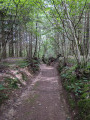
A route along forest tracks starting from the impressive Sully Oak in Puyhabilier. A family walk in the heart of nature, almost entirely through woodland.

Details

13382854
Creation:
Last update:
Last review:
  • Walking
    Activity: Walking
  • ↔
    Distance: 4.12 mi
  • ◔
    Average duration: 2h 10 
  • ▲
    Difficulty: Easy

  • ⚐
    Back to start: Yes
  • ↗
    Ascent: + 272 ft
  • ↘
    Descent: - 266 ft

  • ▲
    Highest point: 2,162 ft
  • ▼
    Lowest point: 1,906 ft

Photos

Description of the walk

Start at the Sully Oak.

(S/E) Head down the road on the right, which quickly turns into a forest track down the slope. Take the track on the right that leads into the forest and follow it to the Quatre Routes crossroads.

(1) Cross the D18 and take the road opposite towards the village of Le Jardin. Take the first path on the right, then the first on the left about 200 metres further on. Follow it straight on until you reach a fork.

(2) Turn right towards Marcouyeux. Take a short detour to the left to reach the small reservoir. Retrace your steps and continue to the left to rejoin the main road (D18E2). Cross it and head straight on to pass through the hamlet.

(3) At the next junction, carefully cross the D18 and take the path opposite which leads back into the forest. At the first fork, keep right.

(4) Carry on straight ahead, ignoring a path branching off to the right, and at the next junction (Les Combes), head straight on until you join theGRP® between Dordogne and Ventadour.

(5) Follow it to the right as far as Puyhabilier and the finish (S/E).

Waypoints

  1. S/E : mi 0 - alt. 2,110 ft - Chêne de Sully
  2. 1 : mi 1.02 - alt. 2,024 ft - Les Quatre Routes
  3. 2 : mi 1.93 - alt. 1,919 ft - Junction
  4. 3 : mi 2.63 - alt. 1,998 ft - D18
  5. 4 : mi 3.29 - alt. 2,133 ft - Junction
  6. 5 : mi 3.78 - alt. 2,152 ft - GRP°°®°°
  7. S/E : mi 4.12 - alt. 2,113 ft - Chêne de Sully

Notes

Yellow markings starting from the oak tree.

Worth a visit

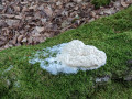
Plenty of mushrooms, some impressive anthills...

(S/E) Sully Oak.

Reviews and comments

4.1 / 5
Based on 4 reviews

Reliability of the description
4.3 / 5
Ease of following the route
4 / 5
Route interest
4 / 5
User 30896879

Overall rating : 4.7 / 5

Date of your route : Aug 28, 2026
Reliability of the description : ★★★★★ Very good
Ease of following the route : ★★★★★ Very good
Route interest : ★★★★☆ Good
Very busy route : No

A walk I did a few years ago and have recently done again. Unfortunately, a great deal of clear-cutting has changed the route, and it’s now much less shaded. It’s still pleasant, though, as long as it’s not too hot! The signposting and directional signs are excellent.

Machine-translated

Zayu
Zayu

Overall rating : 4 / 5

Date of your route : Apr 13, 2026
Reliability of the description : ★★★★☆ Good
Ease of following the route : ★★★★☆ Good
Route interest : ★★★★☆ Good
Very busy route : Yes

First part of the hike: large-scale tree felling
Second part: we walk through a magnificent forest
An easy hike, perfect for the whole family

Machine-translated

jefdetulle
jefdetulle

Overall rating : 4 / 5

Date of your route : Oct 18, 2021
Reliability of the description : ★★★★☆ Good
Ease of following the route : ★★★★☆ Good
Route interest : ★★★★☆ Good
Very busy route : No

A easy and pleasant route. Beautiful deciduous woodland and magnificent beech forests. I didn’t do the short extension to the pond before Marcouyeux. JFS

Machine-translated

Other walks in the area

For more walks, use our search engine .

The GPS track and description are the property of this route's author. Please do not copy them without permission.