


CH/MY

 Visorando Member
 Premium user
 Sign up:
Published route(s)
 The hills of Montbrun-Bocage via Les Cabanères
 9.22 mi
 +1,529 ft
 -1,519 ft
 5h 30
5h 30
 Average
 Departure from Montbrun-Bocage (Haute-Garonne)
This walk will allow you to explore the open countryside around Montbrun-Bocage and take you to the Plantaurel ridge via old paths and forest tracks. You will come across numerous springs and streams. A GPS will be essential as signposting is virtually non-existent.
Loop around Montfa
 6.83 mi
+1,332 ft
-1,332 ft
4h 20
Average
Departure from Montfa (Ariège)
6.83 mi
+1,332 ft
-1,332 ft
4h 20
Average
Departure from Montfa (Ariège)
A beautiful hike on the Plantaurel massif which, from the village of Monfa, will take you on well-marked trails with beautiful climbs to discover surprising local habitats, beautiful views, the Roc du Cor, the Les Moulis Ecomuseum, the hamlet of Camarde, and the Couminge dolmen. You may see herds of geese, sheep, goats, donkeys and horses.
Col de la Mothe from Montgaillard-de-Salies
5.51 mi
+443 ft
-436 ft
2h 55
 Easy
Departure from Montgaillard-de-Salies (Haute-Garonne)
Easy
Departure from Montgaillard-de-Salies (Haute-Garonne)
A pleasant walk on quiet roads, mainly on the heights, offering beautiful views of the Cornudère ridge and the Cagire, after passing through a beautiful forest. Then, the descent along the Arbas, to the sound of running water, should charm walkers. Please respect the gates.
Bout de la Forêt trail in Contrazy
5.18 mi
+1,053 ft
-1,066 ft
3h 20
Average
Departure from Contrazy (Ariège)
This hike takes place mainly on agricultural and forest tracks with beautiful views of the Pyrenean foothills. Contrazy is a hamlet that you will only discover when you see the sign, as it is nestled in its green surroundings. Beautiful renovated farms, a remarkable church, a street decorated with flowers. On the way back, don't miss the unusual Notre-Dame de la Goutte chapel in Montardit.
Circular Sentier des Goutères
5.06 mi
+554 ft
-535 ft
2h 50
Easy
Departure from Palaminy (Haute-Garonne)
Discover the local area in the heart of nature. Departure from the commune of Palaminy, on the right bank of the Garonne, at the hamlet of Les Pesquès on the D62. Stay alert, as you will be walking on tarmac roads for much of the route, although there is not much traffic; I only came across one vehicle. However, beautiful paths and tracks await you, and the Ruisseau des Goutères stream is a sight to behold. The route is very well signposted, even if some points are hidden by dense vegetation. Thanks to the Department.
Circular route around Montardit
3.77 mi
+830 ft
-830 ft
2h 25
Easy
Departure from Montardit (Ariège)
This pleasant, short walk takes you along good paths through pretty hamlets and beautiful forests of chestnut, beech and oak trees. There are a few lovely views. It can be done in all seasons.
Circular route around Castelnau-Picampeau
5.33 mi
+515 ft
-541 ft
2h 55
Easy
Departure from Castelnau-Picampeau (Haute-Garonne)
This hike, mainly on quiet asphalt roads and farm tracks, can be done after rain. Do not follow the signpost at the start indicating a left turn; you must turn right. The signposting is somewhat unclear as it crosses several routes, so follow the app and the description. There are some beautiful views as the route follows a ridge line.
Circular Bège ridges from Vicdessos
6.81 mi
+1,811 ft
-1,801 ft
4h 45
 Difficult
Departure from Vicdessos (Ariège)
Difficult
Departure from Vicdessos (Ariège)
This hike is for experienced hikers who are comfortable using the app, as it takes place on unmarked roads and trails until the junction with the GR® Tour des Trois Seigneurs at the highest point of the Crêtes de Bège. The trails are old but still easily identifiable and easy to follow. However, you will need to be in good physical condition as there is a significant elevation gain over a relatively short distance. You will also need to be able to identify the best routes when you reach the rocky part of the ridge. From there, you will discover exceptional 360° panoramic views. The return journey, which is not particularly difficult, follows the GR® trail.
Circular Pré Carré and Artigues from Saleich
8.01 mi
+2,064 ft
-2,054 ft
5h 30
Average
Departure from Saleich (Haute-Garonne)
This hike takes place on good tracks and forest roads, through beautiful forests of beech, ash, chestnut, boxwood and other trees. The descent is mainly on less comfortable paths, which require a little more attention as they are less well-trodden. The yellow markings are good, but seem to have been scratched and partially erased between points (8) and (9). The route, which is mostly in the shade, can be done in any season. However, avoid periods of fog due to the reported problem of poor markings on part of the route.
La Soulane de Vicdessos
7.99 mi
+1,457 ft
-1,447 ft
4h 55
Average
Departure from Vicdessos (Ariège)
As its name suggests, the hike takes place on the southern slope and on the heights of Vicdessos. You will take an old, entirely paved road to reach the village of Illier with its interesting narrow streets, then follow a balcony path through a forest of boxwood, cherry, oak, acacia and hazelnut trees to the village of Orus. From there, the landscape opens up onto a safe path built on the mountainside, offering beautiful views as you reach the village of Sentenac, from where you will return partly via the D18. All these roads and paths are built on foundations that bear witness to civil engineering skills in terms of their volume and position.
La Table des Quatre Seigneurs via the Crêtes trail from Ouerdes
8.92 mi
+1,982 ft
-1,972 ft
5h 50
Difficult
Departure from Eycheil (Ariège)
A very pleasant walk through beautiful forests along forest tracks and a few well-marked paths. A fairly difficult section that is fully roped off (to be avoided with dogs, otherwise you’ll have to carry them), with numerous short detours to see the entrances to chasms or viewpoints that are not to be missed. Beautiful beech woods and the regrowth of boxwood give this path a touch of magic. The app will be useful as numerous paths cross at various points.
Circular route from the watchtower via Moux
7.58 mi
+2,064 ft
-2,083 ft
5h 15
Average
Departure from Moux (Aude)
A challenging hike, with no major difficulties, apart from the total lack of signposting or, frequently, numerous signs that contradict this route. The route follows deeply rutted paths, with loose gravel underfoot. The start crosses a pine forest devastated by fire, but after that it’s pure joy through dense vegetation, consisting of pines, holm oaks, boxwoods, junipers, kade trees, and the full range of Mediterranean plants – a feast of scents. Avoid doing this in summer or after a storm.
The Rochers de Péne Blanque as seen from Baderque
5.36 mi
+1,348 ft
-1,322 ft
3h 40
Average
Departure from Herran (Haute-Garonne)
From the hamlet of Baderque, looking south-west, you’ll notice a white limestone outcrop – the destination of this short walk – which is accessible to all, except for the summit itself, where you’ll need to use your hands for both the ascent and descent (no equipment required), with a sheer drop of over 100 m on the western side. The first section follows a track suitable for vehicles, then a forest track and well-marked footpaths. The yellow markings are sometimes faint, as some of the markers on the outward journey have been scraped off, but the return journey is straightforward. A large part of the route passes through the Campas woods, where the abundance of moss makes you feel as though you’re in the Amazon. Return via the same route.
Crête d’Esplas – Crête de la Calvière from Goulier
8.83 mi
+2,822 ft
-2,828 ft
6h 30
Difficult
Departure from Goulier (Ariège)
This hike is suitable for walkers who know how to use the app and are observant of their surroundings. Most of the route follows paths marked on the map, but these are often difficult to spot. There are no signposts from the Col de Grail onwards; however, some sections remain clearly visible and provide reassurance regarding the route. Do not attempt this hike if there is a risk of fog or after rain, as the descent into the gispet could prove very difficult. Otherwise, there are remarkable views of the Pique d’Endron, Vicdessos, the Pic des Trois Seigneur, Montcalm and others...
Circular loops around Martres-Tolosane
6.02 mi
+102 ft
-102 ft
2h 50
Easy
Departure from Martres-Tolosane (Haute-Garonne)
A short, easy walk suitable for families, offering the chance to explore the village of Martres-Tolosane and its surroundings, with a variety of landscapes and atmospheres. There are many quiet roads and a few tracks, but Lake Saint-Vidian and its park are a lovely spot for a picnic break. Best avoided in hot weather.
Circular route around the Tignalbu reed beds from Mounicou
7.53 mi
+2,264 ft
-2,274 ft
5h 25
Average
Departure from Auzat (Ariège)
A pleasant walk through forests of beech, hazel and pine trees along well-marked trails to the drystone shelters and orris of Tignalbu. Views of the Montcalm massif and the Pique Rouge de Bassiès. You can also catch a glimpse of the Étang de Soulcem, the Pic de la Madelon and other landmarks. The return journey along a pleasant track offers a chance to see the flora regenerating after a fire. Don’t set off too quickly – the first hour is quite tough. The final stretch is lulled by the sound of the torrent, with a few small pools along the way.
Étang Sourd circular loop, returning via the Waterfall d’Artigue
 6.78 mi
+2,815 ft
-2,789 ft
5h 35
Difficult
Departure from Auzat (Ariège)
6.78 mi
+2,815 ft
-2,789 ft
5h 35
Difficult
Departure from Auzat (Ariège)
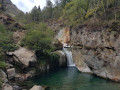
A hike suitable for people in good physical condition, for which a navigation app may be useful. The first section follows good paths which are actually shortcuts, so it’s short but steep as it climbs through the Montcalm State Forest. After a very scenic traverse through the forest, we rejoin the GR®T60 and begin the ascent along a path in poor condition. The Orri de Pla de Nouzère is of no particular interest. It’s better to take the path leading uphill to the left, which is rocky and easier (marked in yellow). The Étang Sourd, set in its picturesque surroundings, makes the effort well worth it. The return journey follows the GR®T60 for part of the way; this section is tough and you’ll sometimes need to use your hands. The Artigue Waterfall is well worth a look.