Vineyards and woodland above Baroville

A route exploring the vineyards and hills, as well as the Bois des Dames, Le Pimeux and La Grand-Côte above Baroville. It follows part ofthe GRP® – Gaston Bachelard (a philosopher born in Bar-sur-Aube) and theGR®145– Via Francigena (the route taken by pilgrims travelling to Rome).

Details

16165228
Creation:
Last update:
Last review:
  • Walking
    Activity: Walking
  • ↔
    Distance: 5.97 mi
  • ◔
    Average duration: 3h 35 
  • ▲
    Difficulty: Moderate

  • ⚐
    Back to start: Yes
  • ↗
    Ascent: + 951 ft
  • ↘
    Descent: - 935 ft

  • ▲
    Highest point: 1,161 ft
  • ▼
    Lowest point: 666 ft
  • ⚐ Country: France
  • ⚐ City: Baroville (10200)
  • ⚑
    Start/End: N 48.192634° / E 4.721918°
  • ❏
    IGN map(s): Ref. 2918SB, 3018SB
  • Hour-by-hour weather

Description of the walk

Park in front of Baroville Town Hall.

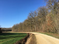
(S/E) Take Rue de Fontaine, heading north. On leaving Baroville, continue uphill along this path, still heading in the same direction, through the vineyards. After a short descent, the path climbs again.
Carry on straight ahead, cross the Grandes Valottes valley and continue along the hillside, still heading in the same direction, until you reach the crossroads.

(1) Turn sharply left at the junction with thePR® (just after passing the crossroads marked with a cross). The Voie des Dames is a fairly steep path.

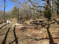
(2) After 300 m, leave thePR® by taking the path on the left. Continue uphill initially, then walk through the Bois des Dames on almost level ground for 1 km.

(3) Then take the small forest path on the right. Be careful, as it is difficult to spot. After 200 m, at the junction with theGR®145, turn left.

(4) After 180 m, leave this path—which forms part of theGR®145and theGRP® Gaston Bachelard—by turning right. Descend through the forest along a path that will soon become clearly marked by the ruts left by forestry machinery. Near the edge of the wood, pass by a hut and then leave the forest. At the bottom of the valley, turn left and head uphill for 500 m.

(5) At the junction with theGR®, turn right to enter the woodland.

(6) At the junction, leave theGR® by turning left. Please note that the path does not follow the one shown on the map. At the top of the grassy gully, at around 350 m, turn left, at a 90° angle, towards the Fond du Pimeux

(7) Turn left, at a 90° angle, and after 100 m, turn right. The path is quite steep.

(8) At the top, at the junction with the forest track, turn left then immediately right.

(9) At the second junction, take the path on the left. The start of the path is obscured by a tree. This path descends then veers slightly to the left to join a wider path. Head off to the left to continue downhill.

(10) The path leaves the woods and runs alongside the vineyards, descending towards the village. Take the Chemin de l’Étape, walk alongside the sports ground, then turn right into Rue de Couvignon to reach the town hall (S/E).

Waypoints

  1. S/E : mi 0 - alt. 719 ft - Town Hall
  2. 1 : mi 1.23 - alt. 679 ft - Junction between Route de Fontaine and the PR
  3. 2 : mi 1.43 - alt. 807 ft - Turn left at the fork
  4. 3 : mi 2.35 - alt. 1,086 ft - Junction with a small forest track
  5. 4 : mi 2.61 - alt. 1,115 ft - Unmarked junction
  6. 5 : mi 3.46 - alt. 915 ft - Junction with the GR
  7. 6 : mi 3.62 - alt. 978 ft - Unmarked junction
  8. 7 : mi 4.32 - alt. 1,060 ft - The Fond du Pimeux
  9. 8 : mi 4.57 - alt. 1,099 ft - Forest track junction
  10. 9 : mi 4.85 - alt. 1,138 ft - Junction
  11. 10 : mi 5.41 - alt. 886 ft - The edge of the woods / The vineyards
  12. S/E : mi 5.97 - alt. 719 ft - Town Hall

Always be cautious and plan ahead when you're outdoors. Visorando and the author of this route cannot be held responsible for any accidents occurring on this route.

The GR® and PR® markings are the intellectual property of the Fédération Française de Randonnée Pédestre.

Reviews and comments

3.5 / 5
Based on 4 reviews

Reliability of the description
3.8 / 5
Ease of following the route
3.3 / 5
Route interest
3.5 / 5
vairelles franck
vairelles franck

Overall rating : 4 / 5

Date of your route : Jul 15, 2024
Reliability of the description : ★★★★☆ Good
Ease of following the route : ★★★☆☆ Average
Route interest : ★★★★★ Very good
Very busy route : No

Without GPS, you do get a bit lost, especially at junctions in the woods where you’re not sure which way to go.
A lovely walk with some good elevation changes.

Machine-translated

shapiro
shapiro
• Edited:

A few comments on the route.

From the start to the waypoint (1), you’ll be on a narrow tarmac road, which fortunately isn’t very busy.

200m before reaching the point (1), the route takes a first turn left then right along the tarmac road. It’s best to stick to the dirt track that continues straight ahead, to avoid a bit of tarmac.

At the waypoint (1), there are no PR signposts (if you look carefully, you can find remnants of yellow-and-blue markings that have been deliberately removed).

At point (2), the tarmac ends and the road becomes a track suitable for vehicles. Here, the written description states “After 300 m, leave the PR route by taking the path on the left”, yet there are no PR markings, nor is there a proper path as such. Several farm tracks branch off diagonally to the left, but you must not take them. Instead, you should head right, climbing towards a woodland. It is only after 300 m through the woodland, on a gentle climb, that there is a Fork in the road to the left.

The point (3) is not easy to find without a GPS. The path to the right is very poorly marked. It starts opposite a hunters’ sign marked ‘Poste 3’, but this is unlikely to remain in place permanently.

(4) Sign for plot no. 17.

200m past the point (4) you come to a T-junction. Turn left, heading slightly downhill.

At the point (5), as trees have been felled, there are no PR markings. It is only 150 metres further on that you will find yellow-and-red markings.

Point (6): turn left at the sign for plot no. 29.

Between (6) and (7), 400 metres after the 90° left-hand bend: at the signs for plot nos. 33–35, continue straight ahead, slightly downhill.

(7) Plot sign no. 34.

(8) Plot no. 33E. On the right, a steep but short climb.

Machine-translated

shapiro
shapiro
• Edited:

Overall rating : 3.7 / 5

Date of your route : May 01, 2023
Reliability of the description : ★★★★☆ Good
Ease of following the route : ★★★★☆ Good
Route interest : ★★★☆☆ Average
Very busy route : No

A pleasant walk through open countryside, with gentle hills, amongst vineyards and woodland. The village of Baroville is charming. The church is open to visitors. There is an old fountain and washhouse – interesting but unfortunately dry – to one side of the church.

The route was very quiet on Monday 1 May. Lots of flat terrain along wide forest tracks; a few steep but short ascents and descents. The advertised duration of 3 h 30 mins seems overestimated to me: it took me 3 h at a leisurely pace, including a visit to the village and numerous stops.

Between (2) and (3), the route overlooks the valley from the edge of the plateau; you’d expect some lovely views, but all you can see is the foliage. Perhaps best attempted in autumn or winter?

This route would no doubt be great for a jog or a mountain bike ride.

The GPS track is spot on. Without GPS, you’ll get a bit lost around point (2) (the written description doesn’t match the terrain) and point (3) is easy to miss. I’ll provide more detailed comments on the route in a separate review.

Machine-translated

virgule
virgule
• Edited:

It’s a beautiful region. I’d love to visit one of these days.

We’re in the Champagne vineyards. Wine lovers can enjoy a glass or two on arrival, or buy a few bottles.

Machine-translated

titibof
titibof

Overall rating : 3 / 5

Date of your route : Feb 14, 2023
Reliability of the description : ★★★★☆ Good
Ease of following the route : ★★★☆☆ Average
Route interest : ★★☆☆☆ Disappointing
Very busy route : No

This route is best done in summer as most of the walk takes place in the forest. Which is a bit of a shame, as you don’t get to enjoy the view of Baroville and its vineyards. The paths are badly damaged by machinery and, on the final stretch, the path is nothing but mud. (Fortunately, when we walked it, the mud had hardened due to a lack of rain.)

Machine-translated

Fabrice79
Fabrice79

Overall rating : 3.3 / 5

Date of your route : Nov 14, 2022
Reliability of the description : ★★★☆☆ Average
Ease of following the route : ★★★☆☆ Average
Route interest : ★★★★☆ Good
Very busy route : No

Hello
The route between points 2 and 4 in the forest isn’t very clear. The path isn’t visible
Make sure you have a 1:25,000 map. A GPS is a bonus for sections without signposting.
Beautiful views; an enjoyable route

Machine-translated

Other walks in the area

For more walks, use our search engine .

The GPS track and description are the property of this route's author. Please do not copy them without permission.