


 Country:
 City:
City:


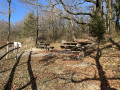
Starting point: Sainte-Germaine Chapel.
(S/E) Head down towards Bar-sur-Aube, leaving the chapel behind you (blue and white markings).
(1) After 250m, take the hairpin bend to the left (yellow and white markings). Pass a path on your left and continue until you reach a Fork in the road. Take the most clearly marked path on the left until you reach the small road.
(2) At the crossroads, do not take theGR® but take the path on the right towards the mobile phone masts.
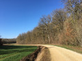
(3) At the end of the fence around the last mobile phone mast, turn left onto the narrow path. Continue along this path, always taking the most clearly marked track furthest to the right at each junction. As you emerge from the woods, turn left along the edge of the forest.
(4) At the corner of the woodland, take the narrow path that runs alongside the forest on your right. A lovely shaded stretch.
(5) Just before leaving the woods, take the path on the left which runs alongside a dry ditch.
(6) 40 metres before leaving the woodland, pass a wide path leading downhill on your left. The footpath is 5 metres before the edge of the woodland, which it follows down to the bottom of the valley. If the ground is very wet, take the wide path down instead. It’s safer but less pleasant.
(7) At the edge of the woods, turn right just at the end of the fence. Two landmarks to help you:
A sign marked ‘Tranche 11’ and a railway crossing at the corner of the fence.
(8) Cross the road and take the path 10 metres further up on your right. Follow this path (GRP®) to the entrance to Bergères. In Bergères, take Rue Gaston Cheq on your left, then the first path leading out of the village on the right. Leave the GRP®.
(9) Enter the woods before the bend in the white track that runs alongside the forest. Follow the yellow and redGRP® markings again.
(10) Continue along theGRP® (yellow and red) to the edge of the woodland. Leave the main track and take the path leading uphill on your left (yellow and red markings). At the junction with theGR® (red and white), turn left.
(11) At the fork in the road, leave the main path and follow the one leading down towards the bottom of the valley (an alternative is to follow theGR® Gaston Bachelard).
(12) At the bottom of the valley, turn left for about 200 metres. Before you reach the large fir trees on your left, turn right onto the faintly marked path that leads into the forest. If you see any hunting hides, turn back 100 metres.
Turn left onto the short, steep slope, then take the narrow path that runs along the edge of the woodland.
(13) As you emerge from the woods, turn right and follow the path alongside the woods to join the GR®. Follow it to the left to reach the chapel (S/E).


 Visorando Member
 Easy
Easy 
 AONB
AONB
 Difficult
