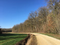
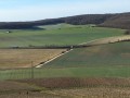
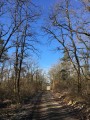
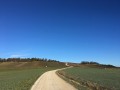
Vineyards and woodland around Champignol-lez-Mondeville

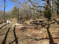
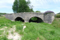
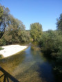
Vineyards, fields and woods around Champignol-lez-Mondeville.

Details

972206
Creation:
Last update:
Last review:
  • Walking
    Activity: Walking
  • ↔
    Distance: 7.85 mi
  • ◔
    Average duration: 4h 10 
  • ▲
    Difficulty: Moderate

  • ⚐
    Back to start: Yes
  • ↗
    Ascent: + 630 ft
  • ↘
    Descent: - 646 ft

  • ▲
    Highest point: 1,125 ft
  • ▼
    Lowest point: 764 ft

Photos

Description of the walk

(S/E) Leaving the town hall, take Rue de Mondeville on the left for fifty metres.
Turn left onto Rue de Bar-sur-Aube until you reach the right-angled bend.

(1) Leave this road and continue in the same direction along the footpath.
Carry on to the left along the footpath, cross Rue de la Lochère (D70), then continue uphill.

(2) Turn right at the junction and continue north-west.

(3) Go round the motocross track on the right. When you reach the three-way junction, near the edge of the woods, turn left for a few metres, then right onto the path that leads into the woods. This path then joins the edge of the woods. Follow the vineyards for about a hundred metres.

(4) Head downhill to the left between the vineyards towards the D12, passing under a power line. Do not take that bridge.

(5) Just before the ditch, turn left and walk along the edge of the field to the small bridge. Cross it to reach the road. Cross the road and take the path leading towards the underpass beneath the motorway.

(6) Go under the motorway, then walk uphill for 800 m.

(7) Turn right onto the forest track, then turn left onto the Ronde des Moines forest road

(8) When you reach the D70, turn left. Walk alongside the D70 for 1.5 km.
Caution: motor traffic.

(9) As soon as the road starts to climb, turn right onto the dirt track at the foot of the hill and continue to follow the Val Roussel until you reach the junction

(10) Turn left to head up towards the underpass beneath the motorway. Then head down towards Champignol.

(11) At the entrance to Champignol, turn right towards the stadium, then turn left twice to reach the town hall (S/E).

Waypoints

  1. S/E : mi 0 - alt. 853 ft - Town Hall - Landion (rivière) - Affluent del'Aube
  2. 1 : mi 0.21 - alt. 876 ft - Right-angle bend
  3. 2 : mi 0.61 - alt. 928 ft - Crossroads
  4. 3 : mi 1.02 - alt. 1,093 ft - Entrance to the motocross track
  5. 4 : mi 2.04 - alt. 978 ft - Start of the descent through the vineyards
  6. 5 : mi 2.38 - alt. 764 ft - Ditch running alongside the D12
  7. 6 : mi 2.86 - alt. 807 ft - Underpass beneath the motorway
  8. 7 : mi 3.36 - alt. 935 ft - Junction with a forest track
  9. 8 : mi 4.89 - alt. 978 ft - Junction of Route Forestière and the D70
  10. 9 : mi 5.8 - alt. 860 ft - Entrance to the white track
  11. 10 : mi 6.49 - alt. 889 ft - Crossroads
  12. 11 : mi 7.31 - alt. 876 ft - Road junction
  13. S/E : mi 7.85 - alt. 853 ft - Town Hall

Notes

There is a car park at the back of the town hall.

Reviews and comments

4.7 / 5
Based on 2 reviews

Reliability of the description
5 / 5
Ease of following the route
4 / 5
Route interest
5 / 5
henri57
henri57 ★

Hello,

Thank you both for your active participation.

Kind regards

Machine-translated

Citron10
Citron10

Thank you for pointing that out.
I’ve corrected that mistake.
I’m going to post a new walk around Mondeville which is even more beautiful than this one. It allows you to enjoy the magnificent view behind the hill.

Machine-translated

gillot54
gillot54

Overall rating : 4.7 / 5

Date of your route : Apr 22, 2019
Reliability of the description : ★★★★★ Very good
Ease of following the route : ★★★★☆ Good
Route interest : ★★★★★ Very good

Actually, I wanted to talk about point 6.

Machine-translated

gillot54
gillot54

Overall rating : 4.7 / 5

Date of your route : Apr 19, 2019
Reliability of the description : ★★★★★ Very good
Ease of following the route : ★★★★☆ Good
Route interest : ★★★★★ Very good

A lovely walk, though it’s worth noting that at point 7 there’s no way to cross the ditch running alongside the road; you’ll need to cross it a little before that to get to point 8. Otherwise, everything’s perfect.

Machine-translated

Other walks in the area

For more walks, use our search engine .

The GPS track and description are the property of this route's author. Please do not copy them without permission.