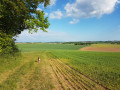
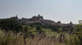
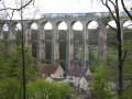
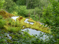
The Sueurre Valley, between coppiced woodland and open plains

A walk through woods, meadows and the Millières plain to Longchamp via the Sueurre Valley.

Details

n°1863585
Creation:
Last update:
Last review:
  • Walking
    Activity: Walking
  • ↔
    Distance: 4.25 mi
  • ◔
    Average duration: 2h 15 
  • ▲
    Difficulty: Easy

  • ⚐
    Back to start: Yes
  • ↗
    Ascent: + 292 ft
  • ↘
    Descent: - 292 ft

  • ▲
    Highest point: 1,427 ft
  • ▼
    Lowest point: 1,217 ft

Photos

Description of the walk

Start from the car park next to the Millières washhouse.

(S/E) After 50 metres, you’ll reach the Fontaine Saint-Gengoul before heading up Rue des Tilleuls to the Mission Cross.

(1) Take the road branching off to the right of the cross and running alongside the Place des Tilleuls. Cross the D33 road and continue along the path opposite until you reach the hunting lodge.

(2) Continue along the path and, at the three-way junction, take the path on the right. Immediately ignore a farm track branching off to the right (dead end). At a small clearing used as a turning area for farm machinery, enter the woods via the path directly in front of you.

(3) At the far end of the Vallon de la Sueurre, turn right, following a well-trodden, sunken path that marks the boundary between the communes of Millières and Longchamp.
At the end of this sunken path, carefully pass through the park fence and enter the meadow. Be careful, there may be cows! If you prefer, you can follow the fence through the undergrowth to avoid entering the meadow.

(4) At the end of the pasture, turn left onto the grassy path (if you open the gate to leave the pasture, take great care to close it properly behind you!).
Take the first path on the right, which climbs between two cultivated fields. Reach the road and follow it to the left. You’ll come to the Longchamp War Memorial.

(5) Walk past this monument and follow the road to the right towards Millières. Take thefirst path on the left.

(6) Walk between the fields and enter the Bois de la Voivre. Take the first unpaved track on the right and continue to the end of this track. First turn right then left, and follow the path to the edge of the woodland. Walk along the edge, keeping to the right, and head back down towards the village.

(7) Follow Rue d’Ageville, then Rue de Fontaine, which takes you back to the washhouse (S/E).

Waypoints

  1. S/E : mi 0 - alt. 1,293 ft - Car park near the Millières washhouse
  2. 1 : mi 0.25 - alt. 1,368 ft - Mission Cross
  3. 2 : mi 0.58 - alt. 1,411 ft - Hunting Lodge (Au Vieux Soldat)
  4. 3 : mi 1.49 - alt. 1,217 ft - To the right, the valley of the - Sueurre (rivière) - Affluent du Rognon
  5. 4 : mi 2.12 - alt. 1,302 ft - Grassy path to the left
  6. 5 : mi 2.79 - alt. 1,417 ft - Longchamps-les-Millières War Memorial
  7. 6 : mi 3.13 - alt. 1,398 ft - Path on the left
  8. 7 : mi 4.14 - alt. 1,273 ft - Rue d’Ageville
  9. S/E : mi 4.25 - alt. 1,289 ft - Car park near the Millières washhouse

Notes

(1) The Mission Cross:
Erected here in 2011 to replace an identical cross put up during a mission that had enlivened the village for a few weeks in the 1960s.

Worth a visit

Don’t miss the Georges Decorse distillery, where you’ll discover all manner of brandies and liqueurs produced on site using traditional methods.

Reviews and comments

4.7 / 5
Based on 1 review

Reliability of the description
5 / 5
Ease of following the route
5 / 5
Route interest
4 / 5
Azimut71
Azimut71

Overall rating : 4.7 / 5

Date of your route : Sep 04, 2021
Reliability of the description : ★★★★★ Very good
Ease of following the route : ★★★★★ Very good
Route interest : ★★★★☆ Good
Very busy route : No

Just before the bottom of the descent, don’t miss the inconspicuous path on the right, which leads to point 3.
If you have a dog, it will love the fountain beneath the village wash house.

Machine-translated

Other walks in the area

For more walks, use our search engine .

The GPS track and description are the property of this route's author. Please do not copy them without permission.