Circular walk starting from Dammartin-sur-Meuse

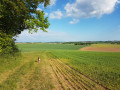
A pleasant little walk with a quiet stretch of road, a walk through the forest, and virtually no change in elevation.
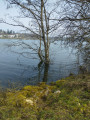
The ponds are on private land but you may pass through provided you do not leave any litter behind.
You’ll often spot roe deer in the forest and on the plains.

Details

n°18880993
Creation:
Last update:
Last review:
  • Walking
    Activity: Walking
  • ↔
    Distance: 4.75 mi
  • ◔
    Average duration: 2h 20 
  • ▲
    Difficulty: Easy

  • ⚐
    Back to start: Yes
  • ↗
    Ascent: + 138 ft
  • ↘
    Descent: - 157 ft

  • ▲
    Highest point: 1,293 ft
  • ▼
    Lowest point: 1,194 ft

Description of the walk

Park towards the end of Rue de la Chapelle, at the junction with Rue du Moulin.

(S/E) Continue due north along the quiet little road and leave the village. You’ll reach a bridge over the Meuse.

(1) Cross the bridge, then quickly turn right onto the ‘Chemin Blanc’ and head into the forest.
Walk along the path, straight ahead, keeping to the main path the whole way. At one point, turn left and then immediately right onto a path that runs alongside a park. Walk down to a small private cottage.

(2) Cross the embankment between the two ponds. At the end of the embankment, continue along the main path until it ends, leading onto the D236 road at the entrance to the village of Malroy.

(3) Turn right onto it, then, about a hundred metres further on, turn onto the path on the left, immediately after crossing the Meuse. Carry on until, after a long straight stretch, you reach a right-angled bend.

(4) Keep to the right on this wide track. Further on, you’ll come to the Fontaine du Pré Coué. Then cross the D236, pass through the hamlet of Les Sillons and you’ll reach the car park on Rue de la Chapelle (S/E).

Waypoints

  1. S/E : mi 0 - alt. 1,260 ft - Rue de la Chapelle car park
  2. 1 : mi 0.63 - alt. 1,207 ft - Crossing the - Meuse (fleuve)
  3. 2 : mi 1.76 - alt. 1,266 ft - The ponds
  4. 3 : mi 2.69 - alt. 1,207 ft - D236, entrance to Malroy
  5. 4 : mi 3.49 - alt. 1,293 ft - Right-angled bend
  6. S/E : mi 4.75 - alt. 1,260 ft - Rue de la Chapelle car park

Notes

No special equipment required.

Worth a visit

(2) Enjoy the wildlife when you reach the ponds.

Reviews and comments

3.7 / 5
Based on 2 reviews

Reliability of the description
4 / 5
Ease of following the route
3 / 5
Route interest
4 / 5
leoderynck
leoderynck

Overall rating : 4 / 5

Date of your route : Mar 17, 2026
Reliability of the description : ★★★★★ Very good
Ease of following the route : ★★★☆☆ Average
Route interest : ★★★★☆ Good
Very busy route : Yes

Tip: do this walk in the opposite direction to the suggested route. The tricky bit is crossing the woods before the two ponds and leaving the woods after the two ponds. It’s hard to find the path and make sure you’re on the right one. But if you walk in the opposite direction, you shouldn’t have any trouble. We met a group of walkers who were doing this route for the fifth time – and in the opposite direction!

Machine-translated

randonneur 70
randonneur 70

Overall rating : 3.3 / 5

Date of your route : Jun 03, 2024
Reliability of the description : ★★★☆☆ Average
Ease of following the route : ★★★☆☆ Average
Route interest : ★★★★☆ Good
Very busy route : Yes

A really lovely walk, especially at point 2 by the ponds; the section of the route between point 3 and the finish can be a bit monotonous with those endless straight stretches on gravel paths and may prove unpleasant in hot weather.
To sum up, one half is very good and the other half not so good; nevertheless, it remains an easy walk with no difficulties whatsoever.

Machine-translated

Other walks in the area

For more walks, use our search engine .

The GPS track and description are the property of this route's author. Please do not copy them without permission.